


ZenaDrone Mining Solutions: Boosting Safety & Efficiency
Transform Your Mining Operations
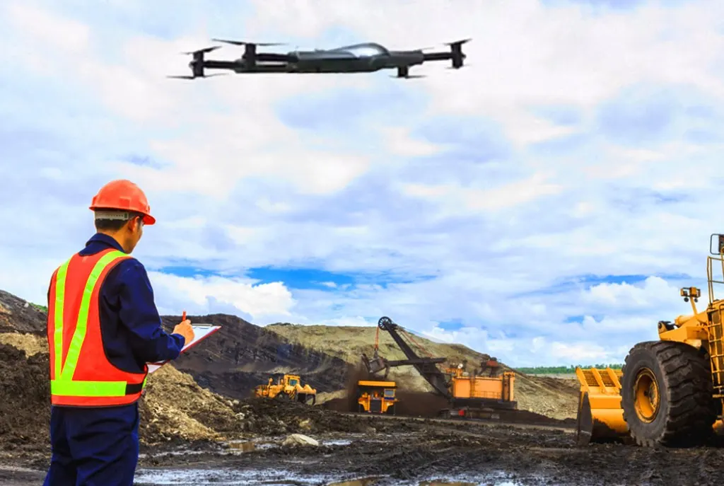
At ZenaDrone, we’re pioneering advanced drone solutions specifically engineered for the mining sector. Our flagship ZenaDrone 1000 delivers unparalleled capabilities that enhance safety, efficiency, and data collection across all mining operations.
The mining drone market, valued at USD 131.3 million last year and projected to reach USD 1.01 billion by 2030, is experiencing explosive growth—and ZenaDrone is at the forefront of this revolution.
Key Capabilities
Real-Time Surveillance
Monitor mining locations continuously to identify problems before they escalate. Our advanced imaging systems capture high-resolution footage, enabling proactive management and minimizing costly downtime.
Precision 3D Modeling
Create accurate terrain models to determine mineral quantities and optimize extraction strategies. These detailed models are invaluable for determining mineral quantities and planning optimal extraction strategies, giving your operation a competitive edge.
Risk-Free Assessment Inspect
Inspect ground conditions, tunnel walls, and blasting sites without putting employees at risk. Our remote capabilities significantly reduce human exposure to hazardous environments, protecting your most valuable asset—your people.
Safety Challenges Solved
Traditional mining operations present numerous health and safety hazards that our technology helps mitigate:
- Ventilation Issues: Reduce employee exposure to harmful gases, heat, and dust
- Noise Hazards: Minimize time spent near equipment that can cause permanent hearing loss
- Gas Ignition Risks: Inspect areas with methane gas presence without human risk
- Heat and Dust Exposure: Lower the risk of heat stroke and chronic lung conditions through remote monitoring
Industry Applications
Exploration & Development
ZenaDrone 1000 redefines mine exploration, transforming potentially life-threatening operations into efficient, cost-effective procedures. Our high-quality data collection saves time, money, and lives while providing insights previously impossible to obtain.
Infrastructure Optimization
Our drones capture comprehensive aerial data about haul road networks—critical infrastructure in your mining operations—providing essential information about length, slopes, and turning angles regularly to optimize traffic flow and road maintenance schedules.
Surveying & Mapping
Traditional surveying methods are time-consuming yet require regular implementation. ZenaDrone surveys deliver higher-quality data at a fraction of the cost compared to conventional methods, with greater accuracy and less environmental impact.
Tailings Dam Monitoring
ZenaDrone provides regular aerial imagery that enables your planners and operators to monitor tailings dams effectively, preventing asset damage and operational interruptions caused by uncontrolled sediment flow. Our detection systems can identify subtle changes before they become critical issues.
The ZenaDrone Advantage
Choosing ZenaDrone for your mining operations delivers multiple competitive advantages:
- Exceptional efficiency in managing large mine sites
- Significantly lower operational costs
- Data-driven decision-making capabilities
- Comprehensive quarry management solutions
- Industry-leading safety improvements
Frequently Asked Questions (FAQs)
What industries benefit the most from using drones in mining?
Nearly every industry in the mining sector can take advantage of the benefits drones can offer. However, certain industries, like coal, gold, and rare earth metals in particular, benefit greatly from the use of drones.
What are the biggest challenges of using drones in mining?
There are quite a few hurdles when it comes to using drones for mining. These include, but are not limited to, regulatory issues, weather dependence, and especially data processing.
How much do drones for mining cost?
While drones are becoming more accessible as technology improves, they still remain a significant investment. Basic drones can set companies back about $1-5,000, while industrial drones with advanced software cost about $20-100,000.
How do drones ensure accuracy on maps and models?
In addition to drones’ onboard RTK (real-time kinematic)/PPK (post-processed kinematic) technology, surveyors also use additional methods to “ground-truth” data.
How do drone solutions integrate with existing workflows?
While many worksites operate based on their own “local grid”, surveyors and software can convert and export drone data accordingly. By doing so, less time is spent simply moving data into other existing applications.
Book a Live Demo Today!
Experience how ZenaDrone 1000 can revolutionize your mining operations. Contact us now to schedule your personalized demonstration and take the first step toward safer, more efficient mining operations.
Thank you for your message. It has been sent.