



AI Construction Drones for Site Inspection and Progress Monitoring
AI-powered construction drones are transforming how architects, engineers, and contractors plan, inspect, and manage construction site projects. From site surveying and 3D mapping to progress monitoring and infrastructure inspections. Autonomous drones help Construction teams collect accurate data faster, improve worker safety, and reduce project costs.
ZenaDrone autonomous drone solutions are designed for the architecture and construction industry, delivering real-time aerial intelligence for site inspections, progress tracking, asset monitoring, and high-precision mapping. By automating data collection and providing actionable insights, ZenaDrone helps construction professionals improve project efficiency, reduce risks, and make informed decisions throughout every stage of a project.
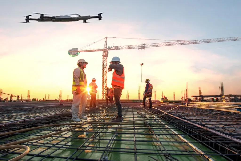
Transform Construction Projects with AI Powered Drone Technology
Technology introduces changes in all kinds of processes in architecture and construction. The introduction of construction drone monitoring has played a pivotal role in building design, maintenance, and completion. These are the ways construction drones are revolutionizing building design and architecture:
3D Building Modeling with AI Construction Drones
AI-powered construction drones enable architects, engineers, and construction professionals to create highly accurate 3D building models using high-resolution aerial imagery and mapping technology. These digital models improve project planning, design validation, stakeholder collaboration, and construction accuracy while reducing the time and cost associated with traditional surveying methods.
Key Benefits of Drone-Based 3D Building Modeling
- Improve project visualization: Generate realistic 3D models and digital twins that help architects, engineers, and clients visualize projects before construction begins.
- Enhance stakeholder collaboration: Share interactive aerial models and site data with project teams, investors, and clients to improve communication and reduce misunderstandings.
- Support faster decision-making: Access accurate aerial data to evaluate design changes, monitor site conditions, and make informed project decisions.
- Improve Design Accuracy: Capture precise measurements and detailed terrain information for planning, design, and construction workflows.
- Reduce project costs and delays: Automate site documentation and minimize the need for repeated manual surveys, helping projects stay on schedule.
Site Planning and Layout with AI Construction Drones
AI-powered construction drones provide architects, engineers, and project managers with accurate aerial imagery and real-time site data to improve planning before construction begins. High-resolution aerial maps help teams evaluate terrain, identify site constraints, optimize building placement, and verify that project layouts match design plans. This reduces planning errors, minimizes costly rework, and improves collaboration throughout the construction process.
Benefits of Drone-Based Site Planning
- Accurate Site Mapping: Capture detailed aerial imagery and topographic data to support precise site planning and land development.
- Optimize Building Layouts: Evaluate building placement, access roads, utilities, and surrounding infrastructure using current site conditions.
- Early Risk Identification: Detect drainage issues, elevation changes, obstacles, and environmental constraints before construction begins.
- Improve Survey Accuracy: Replace time-consuming manual site measurements with fast, high-precision aerial surveys.
- Support Better Project Coordination: Share up-to-date site maps and aerial data with architects, engineers, contractors, and stakeholders to improve planning and communication.
Assess Construction Site Conditions with AI Drone Inspections
Before construction begins, project teams must evaluate existing site conditions to identify risks that could affect safety, schedules, and project costs. AI-powered construction drones provide real-time aerial inspections and detailed site intelligence, allowing architects, engineers, and contractors to assess terrain, environmental conditions, access routes, drainage patterns, and existing structures without lengthy manual surveys.
- Detect Potential Site Risks: Identify unstable ground, erosion, drainage issues, vegetation, and physical obstacles before construction begins, helping reduce unexpected delays.
- Monitor Environmental Conditions: Capture up-to-date aerial imagery to evaluate changing site conditions caused by weather, flooding, or nearby construction activities.
- Improve Safety Assessments: Inspect difficult-to-access or hazardous areas without exposing survey crews to unnecessary risks, improving worker safety during pre-construction inspections.
- Support Data-Driven Decisions: Provide project managers with accurate visual documentation and inspection data to prioritize site preparation activities and reduce project uncertainty.
- Reduce Inspection Time: Complete comprehensive site assessments in hours instead of days, accelerating project planning and reducing operational costs.
Building Maintenance & Structural Damage Assessment with AI Drones
AI-powered construction drones help construction teams inspect buildings, monitor structural health, and detect maintenance issues throughout the project lifecycle. Using high-resolution visual cameras and thermal imaging, drones can safely inspect roofs, façades, bridges, and other hard-to-reach areas while reducing inspection time, improving worker safety, and minimizing maintenance costs.
- Detect Hidden Structural Issues: Use high-resolution visual and thermal imaging to identify cracks, water intrusion, insulation failures, corrosion, and other structural defects before they become major problems.
- Perform Safe Remote Inspections: Inspect roofs, high-rise buildings, bridges, towers, and hazardous locations without exposing maintenance teams to unnecessary risks.
- Support Predictive Maintenance: Monitor assets over time to identify deterioration trends and schedule maintenance before failures occur, reducing unexpected downtime and repair costs.
- Improve Structural Health Monitoring: Capture consistent inspection data throughout the building lifecycle to help engineers evaluate structural integrity and support long-term asset management.
- Accelerate Maintenance Decisions: Provide real-time aerial imagery and inspection reports that enable maintenance teams to prioritize repairs and respond quickly to potential issues.
Construction Progress Monitoring with AI Drones
Construction progress monitoring helps project managers track work completed on-site and compare actual progress against project schedules. AI-powered construction drones capture recurring aerial imagery and site data, enabling teams to identify delays, verify contractor performance, monitor material placement, and maintain accurate project documentation throughout construction.
- Track Project Milestones: Capture scheduled aerial inspections to compare construction progress against project timelines.
- Identify Delays Early: Detect workflow bottlenecks and construction delays before they impact project completion.
- Improve Contractor Coordination: Share updated site visuals with contractors, architects, engineers, and stakeholders for better collaboration.
- Document Construction Activities: Maintain an accurate visual record of every construction phase for reporting and compliance.
- Support Remote Project Management: Monitor multiple construction sites without requiring constant on-site visits.
Drone Mapping & Surveying for Construction Projects
Construction drone mapping enables professionals to collect accurate geospatial data for surveying, land measurement, and engineering analysis. AI-powered drones quickly generate orthomosaic maps, topographic surveys, 3D land mapping, digital terrain models, and elevation data, providing highly accurate information for construction planning and documentation.
- Generate Orthomosaic Maps: Produce high-resolution aerial maps for construction documentation and planning.
- Create Topographic Surveys: Capture accurate terrain and elevation data to support engineering projects.
- Measure Stockpiles and Earthworks: Calculate excavation volumes and material quantities with greater accuracy.
- Support GIS and CAD Workflows: Export mapping data into engineering and design software.
- Improve Survey Productivity: Complete surveys significantly faster than traditional land surveying methods.
Contact Us at ZenaDrone 1000 Today
Ready to improve construction site inspections, surveying, and project monitoring? Contact ZenaDrone today to schedule a live demonstration and discover how our AI-powered drone solutions can help reduce costs, improve safety, and accelerate project delivery.
Frequently Asked Questions (FAQs)
Companies can easily fall behind industry standards since drones do so many things at all stages of the building cycle. That said, there are always more things you can learn to make the most out of your drone. Here are five frequently asked questions about drone architecture:
How are Drones used in Construction Projects?
Construction drones are used for site inspections, surveying, mapping, progress monitoring, safety assessments, and building maintenance. They provide accurate aerial data that helps architects, engineers, and contractors improve project planning and reduce operational costs.
What are the Benefits of AI Construction Drones?
AI-powered construction drones automate data collection, improve worker safety, reduce manual inspections, accelerate project monitoring, and provide real-time insights for better decision-making.
How Accurate are Drone Surveys for Construction?
Construction drones equipped with RTK GPS, LiDAR, or photogrammetry can produce highly accurate survey data suitable for mapping, engineering, and site planning applications.
Can Drones Monitor Construction Progress?
Yes. Construction drones capture recurring aerial imagery that allows project managers to compare site progress over time, identify delays, and document every stage of construction.
What Construction Projects Benefit from Drone Technology?
Construction drones are widely used for commercial buildings, residential developments, civil infrastructure, industrial facilities, transportation projects, utilities, and public works.
Experience ZenaDrone in action! Fill out the form below and our team will be in touch to set up a demo schedule.
Thank you for your message. It has been sent.