Fixed-Wing Drones: Revolutionizing Aerial Mapping

The civil and earthworks industries now inspect job locations using drone technology. Unmanned aerial vehicles (UAVs) make surveys quicker and less expensive without compromising quality. Drones are easy to operate, require little specific training, and allow electronic data collection without endangering workers.
Obtaining frequent and precise site data is more straightforward with autonomous long-range drones. UAVs with high-definition cameras are now easier to get and operate. Thanks to affordable equipment, aerial surveillance, and mapping are now possible without expenses. Up-to-date site data also makes it possible to identify issues before they escalate in cost or necessitate more work. It entails more stringent budgeting, planning, and contractor monitoring. Data from drone-captured surveys can improve team collaboration, communication, and accountability when adequately analyzed.
Drone Survey: Defining Today's Aerial Surveillance And Mapping
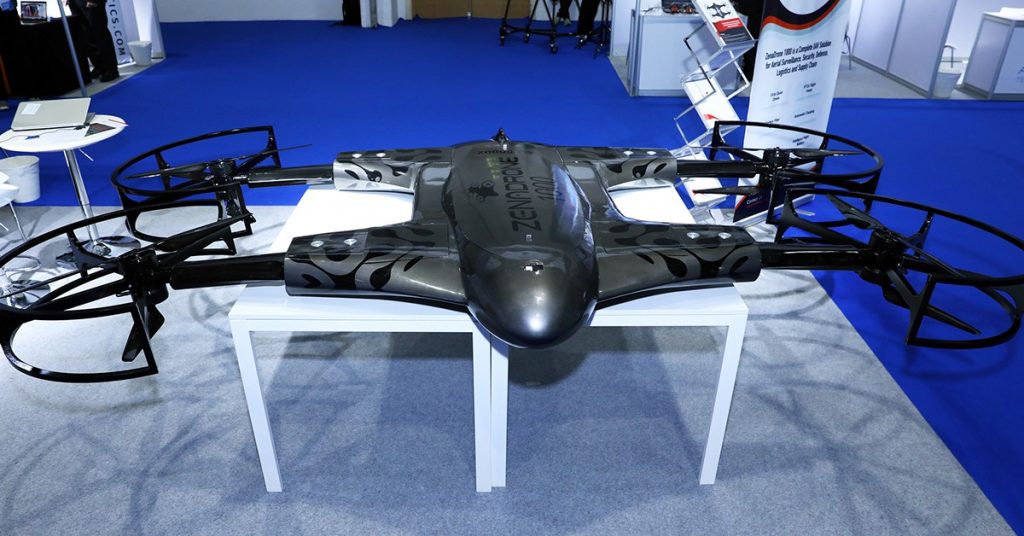
Drones in surveys collect airborne data with sensors such as RGB or multispectral cameras and LiDAR payloads. The ground is photographed numerous times from various angles during a drone survey with an RGB camera. Each image has tagged coordinates. Autonomous long-range drones can fly at lower altitudes than piloted aircraft of satellite imaging. These drones can capture numerous high-resolution and accurate data faster, without the costs. Unlike satellite and aircraft imaging, environmental factors like clouds don’t hinder drone imaging.
Each project saves time and funds with every straightforward check and balance made possible by regular, accurate drone survey reporting. The more people pay attention, the quicker problems can be identified and fixed. Crew acquiring access to precise, comprehensive, and insightful reports make wise decisions and adopt a proactive approach. Drone helps visualize locations with straightforward methods and as realistic as possible with accurate 3D drone survey data and technologies. Drone technology allows data sharing across the enterprise.
Three Benefits Of Surveying And Mapping
The significant benefit of autonomous long-range drones for surveillance and mapping is the ability to swiftly and effectively record visuals. The benefits of drone surveying and mapping are as follows:
1.Precise And Thorough Information
Total stations only take individual point measurements. A drone flight generates tens of thousands of measures, shown in various formats. The generated map’s or 3D model’s points’ pixels or topics include 3D geo-data.
2.Inaccessible Areas Are Now Revealable
Nearly anywhere can be used as a launchpad for an aerial mapping drone. Inaccessible regions with dangerous slopes or rough terrain are no longer an issue with drones. Conventional measuring tools and hardware usually require roads and tracks to acquire images and videos. Fixed-wing, long-range drones can collect data without being hindered by inaccessible or dangerous geography. Before, workers needed to close roads to make way for heavy machinery to do surveys and mapping. Now, drones make it possible to collect data without close areas.
3.Reduce Survey Expenses And Fieldwork Time
Drones can collect topographic data faster and with less labor than traditional methods. Geo-tagging saves time since installing several GCPs is no longer essential. Drones deliver survey data more quickly for less money.
Photogrammetry: Drone Imagery And 3D Survey
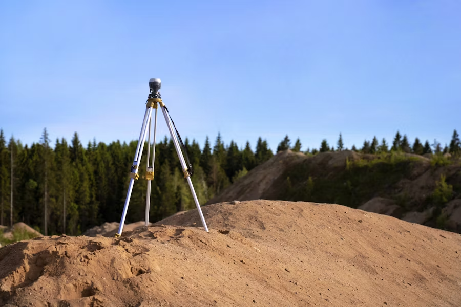
Drones utilize photogrammetry to assess geography and landscapes. Photogrammetry analyzes and processes hundreds or thousands of overlapping aerial photographs a drone acquires. Photogrammetry software produces 3D images of topographic surfaces and features when combined with enough overlapping photographs of the same features. Positioning, evaluating, and rectifying each drone image throughout every survey is necessary. Photogrammetry methods such as post-processing kinematic (PPK) and real-time kinematic (RTK) processing provide survey-grade accuracy. PPK and RTK processing operate in distinct ways, each with its advantages and disadvantages:
PPK Advantages:
- PPK requires fewer ground control points for drone mapping. PPK also dramatically reduces the amount of time needed for field operation. It allows fixed-wing, long-range drones to operate in broader, more challenging areas.
- More dependable and straightforward workflow.
- The GNSS base and rover don’t require to be connected all the time.
- PPK permits longer baselines.
- It’s possible to execute processing several times with various settings.
Disadvantages:
- Processing position data takes more time.
- There are chances of poor precision in the final output.
- Correction occurs after takeoff.
RTK Advantages:
- RTK provides the drone’s precise position in real-time.
- RTK eliminates or reduces the number of ground control points.
- RTK is perfect for geo-tagging with 100% accuracy during real-time flights.
- If the RTK connection breaks mid-flight, its software can increase survey accuracy after the mission.
- Real-time correction eliminates the need for GNSS post-processing.
Disadvantages:
- A prolonged re-initialization process and severe data loss are the effects of a short-term lock loss.
- Signal strength limits the maximum flight range due to undocumented post-flight corrective data.
- Base station placement mistakes need correction after a flight, which reduces real-time advantage.
The Four Vital Benefits Of Drone Surveying: Data Utilized By Businesses
The benefits of employing drones for surveying are swift and adequate records and accurate visual representations of a job site. There are also additional benefits of autonomous long-range drones for surveying and mapping:
Boost Office-To-Site Communications
Drone-based survey data collection and processing improve collaboration between surveyors, engineers, foremen, and site managers while centralizing project documentation. Information and relay of information are vital for contractors and stakeholders. Each stakeholder has access to the information required to determine whether the project is progressing according to plan.
Avert Any Conflicts
A strategy for clear communication and documentation is necessary for dispute resolution. Contractors can immediately identify and address project faults or concerns thanks to accurate records created with drone data. In a disagreement, contractors can refer to the pertinent site survey to address any issues. Survey drones can provide transparent, accurate, unbiased, and simple-to-understand documentation of each project stage.
Reduce Time And Costs
It requires time, energy, and frequently a full-time devoted individual to measure amounts and progress manually. Projects run more smoothly with less rework, additional expenditure, and overhead with survey data collected in hours. Additionally, using cloud-based processing is far more scalable and eliminates the need for server and computer costs.
Decreased Workplace Hazards
Surveyors utilizing drones can securely navigate hazardous terrain and slopes to avoid coming into proximity to congested freeways. Drone surveying keeps employees on site for a shorter period, lowering the possibility of an accident. Easy flight path and control provide precision and decrease hazards.
Contact Us
Thank you for your message. It has been sent.
Latest Posts
Social Profiles


