


The Vital Role of Technology in Drone Flight Planning
Collecting aerial information and capturing footage from above are the known advantages of drone technology. All these years, drone manufacturers have continuously upgraded and improved it to support different industries. For that, one of the sectors that receive significant impact from technology is the aviation industry, especially in drone flight planning. This critical procedure implies meticulous route calculation, weather analysis, and safety assessments.
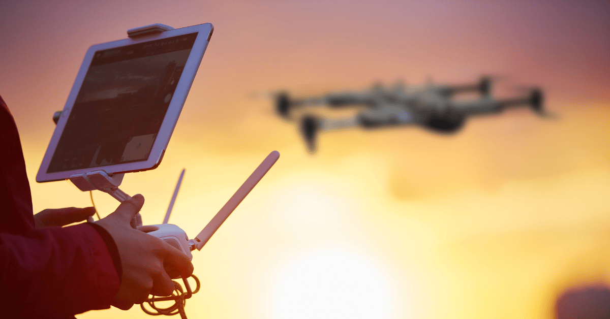
Drones and drone navigation software have become commendable tools in accelerating this crucial aspect of aviation. Learn more about how drone supports the planning of flights and how it helps the industry.
What is Flight Planning?
In the aviation industry, flight planning is one of the core operations. Every flight begins with this procedure, which deals with planning and preparing before an aircraft flies.
This systematic procedure determines the optimal route, altitude, and other essential l parameters for any aircraft’s journey. This process will involve considering factors like the weather conditions, required fuel, the different airspace regulations, and ensuring the aircraft’s performance. It can secure safety, efficiency, and on-time flight operations.
How Does Technology Assist in Drone Flight Planning?
Drone flight planning technology has various functionalities, allowing the aviation industry to streamline operations. Here are some of the benefits of having navigational tools for drone pilots:
1. Aerial Surveillance and Data Gathering
As drones are known as navigational tools for drone pilots, they can capture high-resolution footage with depth details. Its aerial imagery can present valuable imagery data backed by sensor information and precise mapping direction. This capability can aid the initial stages of flight planning.
A drone can support flight path mapping through aerial surveys of airports, runways, and other areas necessary for the operation. It can distinguish any potential obstacles and hazards which the team can immediately address. The drone data can also guide sound decisions regarding route selection and airport suitability.
2. Checking of Weather Conditions
For drone flight planning, considering weather conditions is crucial. Advanced drone navigation software have weather monitoring tools to present real-time weather information at different altitudes.
Usually, the data from drone flight path mapping equipment includes details regarding wind speed and direction, the outside temperature, humidity, and precipitation. The gathered data will support the flight planners in making safe and sound flights with accurate and appropriate decisions.
3. Ground and Terrain Mapping
Technology is efficient for drone flight path mapping as it supports comprehensive data by capturing aerial footage of the ground. Besides physical inspection, aerial surveillance is necessary for safe and efficient flights.
Advanced drones can help produce 3D maps of the terrain or the environment. The data can serve as a guide for flight planners on what are the most suitable routes for the pilot. Also, it can ensure safety as they can identify the possible obstacles they can encounter ahead of time. In addition, terrain mapping is essential for aviation as it aids in precise altitude calculations and estimation of efficient fuel use.
4. Assessment of Environmental Impact
A successful flight begins with considering different impacts on the environment the aircraft will pass by. Drones, as navigational tools for drone pilots, help in environmental evaluation, as this is a prominent concern in the aviation industry.
Understanding and making the best choice of flight routes are crucial. Most aviation companies use drones to conduct aerial surveillance and data gathering of different local ecosystems. It helps flight planners identify the areas and make sound decisions and considerations to avoid ecological disruptions.
5. Emergency Rescue and Response
The GPS navigation for drones is one of the commendable features that organizations for search and rescue utilize the most. The aviation industry can also take advantage of this function. For instance, an unexpected event happens during any flight operations. The team can immediately send the drone to evaluate the situation. It also gives the idea of their route to get there.
Impacts from different obstacles such as natural catastrophes, obstruction on runways, or any aircraft incidents, the drone can send immediate real-time situational awareness to guide flight planners on handling or rerouting the flight plans, ensuring the safety of everyone inside the aircraft.
Choosing the Suitable Drone Technology for Flight Planners
Getting the gist of how drone technology is an essential tool for flight planning operations, here is a quick guide on what to consider in choosing the suitable one.
1 Purpose of Purchase
Like any product, it is essential to identify the purpose of purchase as drone technology can be pricey and also a long-run investment tool. Consider how the management plans to use it for flight planning and identify the primary applications needed. Narrow the purpose and see for drone products that fit the company’s needs without compromising the allocated budget.
2 Flight Range and Time
Drones’ capacity to fly and operate varies. It is a must to consider how long the usual flight planning takes. If the management plans to use the drone for other purposes, view it and see the ideal drone range and time it can last that suitable for the work operation.
3 Payload Capacity and Features
See the drone attachments, such as high-quality cameras, multispectral sensors, and other essential accessories for the operation. Also, understanding the payload capacity of drones is a must to avoid overloading and helps decide what payloads and features are necessary.
4 Camera Quality
The camera is the drone’s core; the higher the quality, the more vivid it can present data. Choose a 4k quality camera with stabilized gimbals and adjustable settings for better footage. It is also a plus if the camera uses sensors that help gather comprehensive image data.
5 GPS Navigation for Drones
A stable flight comes with a reliable navigation system. Capture smooth footage with precise operations through it. Besides the GPS navigation for drones, choosing drones that highlight obstacle avoidance, altitude hold, and auto-return features in their system is commendable.
6 App Compatibility and Controller
It is also crucial to see the drone navigation software app to see if it is user-friendly and compatible with the existing management system. See if the software supports mobile devices and other essential electronics. Also, besides the compatibility, see if the drone comes with a software app dedicated to navigation, flight planning, monitoring, and more.
7 Warranty and Reviews
Always consider the manufacturing warranty and reviews to make the purchase and investment worthwhile. It will help the management avoid any struggles in the long run, and in case of issues, they can immediately address them to the drone provider.
Takeaway
Drone technology is a commendable equipment that guides industries with aerial inspection and surveillance. Drone flight planning is one of the many work operations that benefit from its capability. Hence, with a better understanding and drone manufacturers upgrading their ability, it is no wonder this tool will continue to aid and support the aviation industry.
Contact Us
Thank you for your message. It has been sent.