


Drones for a Greener Future: Innovations in Environmental Monitoring
Scientists are turning to technological innovations for solutions, with the world continuously struggling with climate change and dwindling biodiversity. One such innovative technology is drones. Using aerial monitoring for environmental conservation can collect a wide range of ecological data more affordably and efficiently than ever. This blog post explores how drones can help create a greener future through environmental monitoring and conservation. It will discuss how essential this equipment is in conserving the ecology. Learn more about this ground-breaking technology.
The Importance of Aerial Monitoring for Environmental Conservation
Aerial monitoring is increasingly important for environmental conservation. It is an ideal method to observe the land, water, and air from a bird’s eye view. It can help detect changes in land cover, analyze biodiversity, and monitor protected areas. Aerial monitoring provides data essential to inform decisions about protecting and preserving resources. It identifies potential threats such as contamination, illegal dumping, or unauthorized development. It can provide information on the health of watersheds and soils.
Aerial monitoring for environmental conservation is also incredibly cost-effective. It allows researchers to cover more areas in less time, minimizing resources spent collecting data. By incorporating aerial monitoring into conservation efforts, researchers can better track environmental changes and develop strategies promoting sustainability
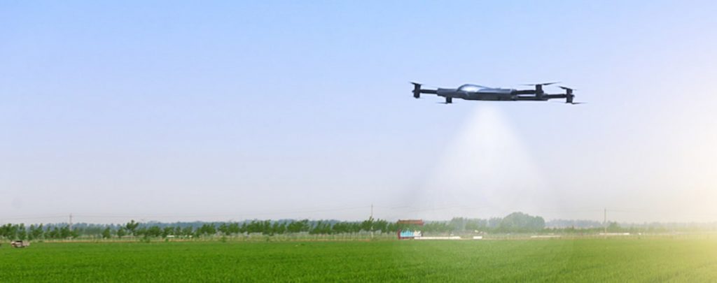
Drone Technology for Aerial Monitoring and Surveillance
This technological innovation has increasingly become famous for environmental monitoring. Drones can provide an efficient and cost-effective way of collecting data, allowing us to better understand our environment and track changes over time. Drone technology for environmental monitoring can support various purposes, such as tracking wildlife populations, mapping landscapes, detecting pollutants in water bodies, measuring land cover types, or even monitoring air quality. Also, they can operate in difficult-to-access areas that are traditionally difficult to study.
Drones also offer a variety of sensors and cameras that allow us to get detailed information on the environment. For instance, they can capture high-resolution images or videos with optical cameras and infrared technology, allowing scientists to track changes in vegetation cover and water quality. Multispectral cameras can even help detect pollutant plumes or track the health of coral reefs. In addition, advanced drone technology for environmental monitoring can carry other sensors, such as gas detectors, radiation detectors, and air quality monitors, to measure different ecological data.
Top 6 Comprehensive Drone Benefits for Ecological Conservation
1. Increased Efficiency
Doing conservation with drone applications can help increase the efficiency of ecological surveys, enabling teams to cover more ground in a shorter period. It could be especially beneficial in remote or difficult-to-access areas.
2. Cost-Effective
Compared to traditional survey methods, drone-based ecological surveys can be more cost-effective as they require fewer resources and personnel to achieve the same results. It makes them ideal for use in conservation efforts that may have a limited budget.
3. Accurate Data Collection
Drone-based ecological surveys can collect precise data essential for environmental research and conservation. With the help of advanced sensors and imaging technologies, conservation drones can capture accurate insights into the environment.
4. Increased Safety
The use of drone technology can aid researchers in reducing the risk of injury or harm to personnel while conducting surveys in remote or dangerous locations.
5. Enhanced Visualization
Making conservation procedure drone applications can guarantee a 3D view of the environment. It is a commendable aid for data visualization and a guide for conservation efforts.
6. Improved Decision Making
Using drone-based surveys, researchers can collect real-time data to help make informed decisions on managing and protecting their surroundings.
These are just some of the beneficial uses of the said tool. It will continuously grow as technology advances; more applications for drones in conservation will exist.
Drone Technology for Solving Environmental Problems
1. It Helps in Monitoring Wildlife
Drones can monitor endangered species in their natural habitats. By studying animal behavior and movement patterns using drones, researchers can gain valuable insights into the health of a particular population. This data can also help inform conservation efforts by better understanding the animals’ needs and habitat requirements.
2. It Aids in Monitoring Land Degradatio
Drones can also monitor land degradation and illegal logging activities in remote areas. The detailed aerial imagery allows conservationists to see how forests change over time. It can also identify potential threats that humans or other environmental factors may pose.
3. It Assists in Collecting Water Samples
Drones can collect water samples from lakes, rivers, and other bodies of water for research purposes. This data will help environmental groups understand the consequences of pollution and climate change on aquatic ecosystems.
4. It Supports Mapping Climate Change
Drones provide an excellent platform for gathering detailed information on areas affected by climate change. By mapping the region, researchers can identify temperature, vegetation, and soil composition changes that may impact local ecosystems. These are just a few ways drone technology can help everyone better understand and manage our environment.
Brief Tips Before Getting a Drone Solution for Environmental Procedures
1: Evaluate Environmental Needs and Research Appropriate Drone Solutions
Analyze the environmental needs and research the most appropriate drone solutions available. Consider traditional fixed-wing drones and newer VTOL, or Vertical Takeoff and Landing, models that may be more suitable for specific tasks.
2: Understand Data Capture Requirements
Ensure that the team understands the data capture requirements of the project and what type of needed data to collect. Decide which drone type best suits the data collection procedure.
3: Investigate Sensor Types and Software Solutions
Investigate the various types of sensors available for drones and the type of software suitable for the procedure. See the expected results and other reviews to understand the target drone solution capability.
4: Consider Operational Requirements and Safety Regulations
Consider the operational requirements and safety regulations when selecting a drone solution for environmental monitoring. Ensure the team understands the local drone technology laws and any insurance considerations required by industry standards.
5: Consider the Cost of Drone Solution and Data Processing
Consider the cost of the drone solution and the associated data processing. Research any warranties or maintenance contracts that come with the purchase of a drone
6: Employ Experienced Drone Pilots or Services
Finally, hire experienced pilots or get a drone service to fly drones safely and effectively in an environmentally-friendly manner. It will ensure the drone’s safety and obtain high-quality data and results.
Takeaway
Using drones in aerial monitoring for environmental conservation is becoming popular these days. This innovative technology provides e a range of benefits, such as increased efficiency, cost-effectiveness, accurate data collection, and improved decision-making capabilities. And with enough knowledge and utilization of it, environmental groups and conservationists can make their jobs much more manageable than ever.
Contact Us
Thank you for your message. It has been sent.