


ZenaDrone IQ Quad Drone
The Future of Drone Surveying
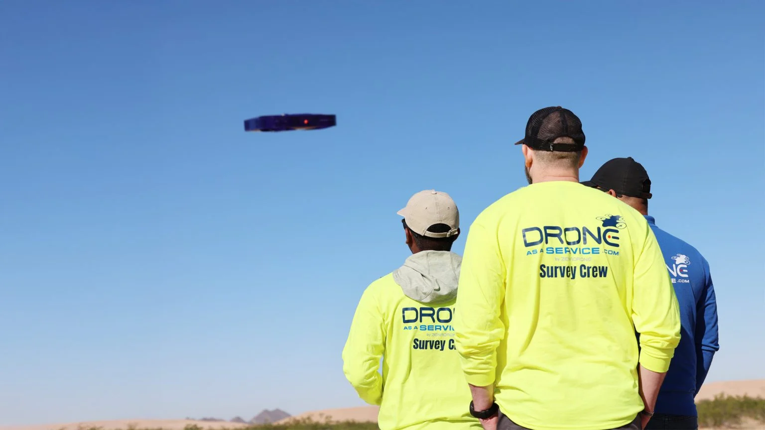
The ZenaDrone IQ Quad is a reliable VTOL quadcopter that makes accurate surveying faster and easier for commercial and industrial users.
Flexibility + Accuracy = Insight
Designed for land surveying, the IQ Quad Drone supports 4K cameras, LiDAR, and multispectral and thermal sensors. It delivers clear, detailed aerial data in complex environments.
The platform includes smart safety features like obstacle detection, terrain-following, and 360° awareness cameras to support confident operation. The IQ Quad delivers reliable, survey-grade results with efficient performance.
Get a Sharper Perspective
Take to the skies with the next-generation IQ Quad.
A Wealth of Data
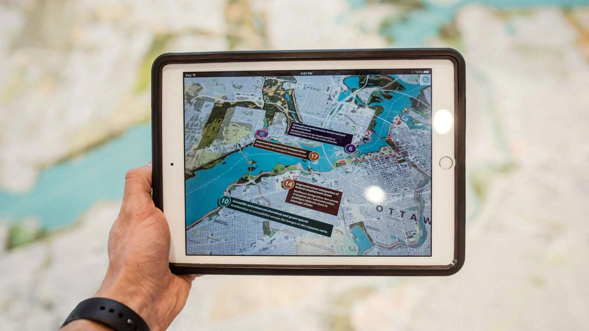
The IQ Quad Drone is capable of capturing high-precision, geospatial data for a range of outputs.
Geo-tagged, orthomosaic maps
Cadastral/boundary maps
3D Digital Elevation Models (DEMs) Digital Terrain Models (DTMs) Digital Surface Models (DSMs)
High-resolution video and photographs
Textured 3D mesh models
IQ Quad Drone Key Features
Stability
Quad Rotor Drone configuration provides excellent stability during flight to capture precise geospatial or topographic data.
Obstacle Avoidance
Real-time GPS enables the IQ Quad to avoid any site obstacles.
Retractable Landing Gear
Improves aerodynamics when retracted and provides unobstructed views for cameras and sensors.
Payload
Possesses 2 to 3 kg payload capacity, ensuring it can meet all survey project requirements.
Folding Arms
Increases use versatility while enhancing portability and simplifying storage.
Endurance
Capable of up to 45 minutes of flight time with maximum operational range of 5 km before recharging is required.
Autonomous Recharging
Automatically lands on a charging station to recharge its batteries.
Durable
Weather resistant, carbon-fiber airframe ensures performance in diverse conditions.
Data Security
Features an integrated, cellular-based transmission system for secure, enterprise-level, real-time data transfer.
Ideal Across Industries
The IQ Quad drone leading-edge survey capabilities are applicable across diverse industries.
Acquire comprehensive site data to conceptualize, design, and develop any type of terrain.

Assess site features, including volumetrics, to design and develop landscapes, buildings, and operations.
Assess landscape features and usage, infrastructure design and condition, traffic patterns, emergency response plans, pollution levels, and more.
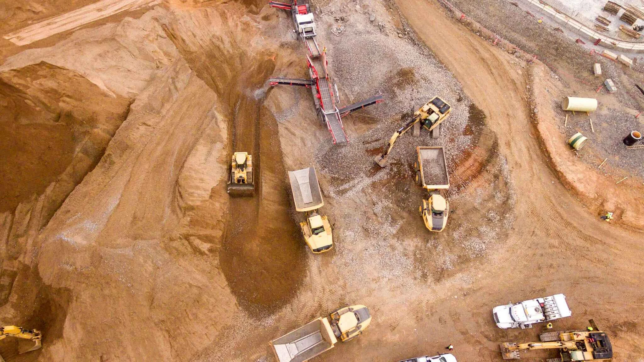
Explore potential sites, develop mine operations, accurately assess volumetrics, plan drilling and blasting, and identify hazards.

Obtain insights into course design and renovations, turf health, water management, and operations.
Contact Us
Achieve new heights for your survey project with the ZenaDrone IQ Quad. Fill out the form below and our team will be in touch to schedule a demo.
Thank you for your message. It has been sent.