


What Farmers Need to Know About Inspecting Crops Using Drones
Crop production is one of the most important parts of agriculture. Farmers and growers are responsible for supplying food, livestock feed, and other materials. For example, fabrics like cotton and flax come from plant fibers and are in high demand.
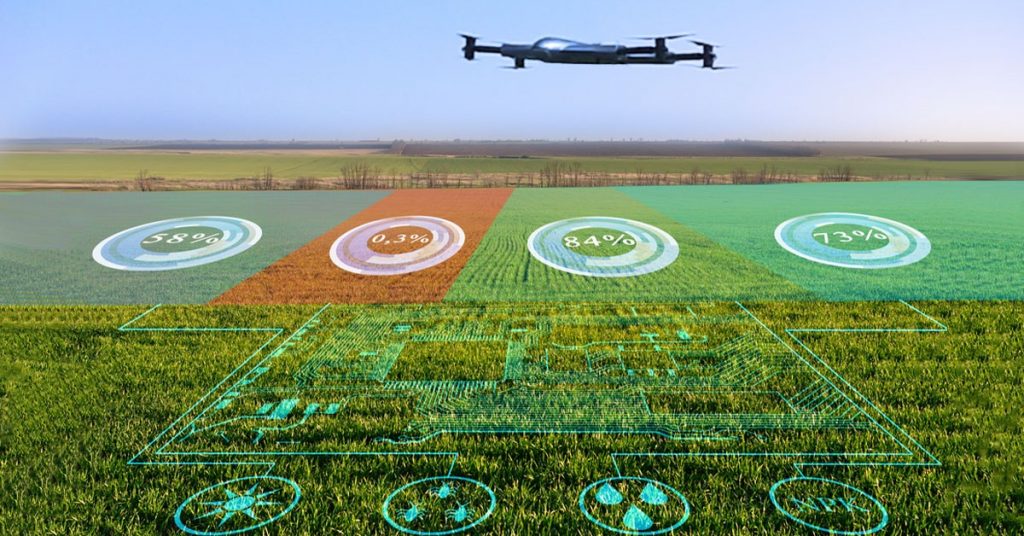
To ensure a steady supply of these consumer goods and raw materials, farmers and growers need to optimize every process from planting to harvesting. They also need to optimize the water, fertilizer, or pesticides they use to maximize their crop yield. Drones are a great way tool for optimizing yield. Because of their capabilities and versatility, they play a huge role in crop production, especially for crop production services.
The Role of Drones in Crop Production
While drone technology isn’t a one-size-fits-all solution, drones have multiple uses across different industries. Drones have become more prevalent in agriculture and agribusiness since they became commercially available. On top of this, various models can be used to assist different processes. However, drones are often used in the following ways:
Surveying crops and livestock
For ranchers raising livestock like cattle or sheep, drones with high-resolution cameras are essential for regular monitoring. A farmer or a crop production service can also use drones to monitor crops from seed to harvest.
Plant and animal tracking
With the addition of multispectral sensors in drones, plant and animal tracking has become much easier for farmers and ranchers. Meanwhile, movement tracking and GPS tags allow ranchers to locate missing livestock and monitor their health.
3D mapping
Drones can create detailed maps that include essential topographic attributes and land measurements. Farmers, growers, and crop production services can use this data to create the best environment for crops.
Seeding and spraying
Drones come in different sizes. Certain drones used by farmers and crop production services can carry payloads and custom attachments. These attachments allow for remote-controlled or even automatic seeding and spraying.
What Farmers Need to Know About Inspecting Crops Using Drones
Crop inspecting and scouting are made possible using the latest advancements in drone technology. Farmers and growers can identify crop stress, diseases, pests, and overall plant health with them. However, it’s not always easy to do so. Farmers and crop production services often contend with variability and plant health algorithms. Additionally, there aren’t any rules on the best way to gather and compile this kind of data. To get the most out of their data, here’s what farmers need to know about crop inspection using drones:
Altitude
Flying drones at higher altitudes allows drone operators to cover more ground in less time. However, the resulting footage will also be less detailed as a result. To optimize the balance between image resolution and ground covered, operators should consider how they want to use their maps. Low-resolution images can work for mature crops, while emerging plants may require lower altitudes.
Overlap
Whether they have their drone or hire a crop production service, the overlap is the next thing farmers should consider. In a nutshell, it refers to the amount that photos overlap with each other when stitching images together.
The overlap makes it easier for drones identify features and generate a higher-quality map. However, higher overlap also means it has more points on its flight path, which will consume more battery life.
Flight planning
Mapping large areas can be tricky since they are in areas with poor Wi-fi connection or cell service. Fortunately, drones don’t rely on either to transmit real-time data.
With the help of special software, operators can sync their drones to apps on their mobile devices. Drones can proceed on their flight paths via remote control or pre-programmed routes.
Battery Life
Crop production services also have to consider battery life depending on the area. Regular operations can take up much battery power for drones and limit their area coverage. For areas larger than 100 acres (about 4047 square meters), it’s generally good to bring an extra battery or a charger. This goes for both drones and their remote controllers.
Imaging
Imaging is the primary way that drones provide data for farmers. NDVI (Normalized Difference Vegetation Index) is one of the most popular ways of assessing plant health via imaging.
However, it’s not the only one. For example, VARI (Visible Atmospheric Resistant Index) and multispectral imaging can also be used outside traditional high-resolution imagery.
What are the Different Types of Imaging
When hiring a crop production service to assist your farming operations, you will most likely come across different maps. Depending on their equipped sensors, drones can also provide other maps, which can yield valuable data.
However, it’s important to remember that data is just one part of monitoring overall plant health. Combining practical knowledge with data gives farmers insight into making the right decisions.With all that stated, here are the different types of imaging used to get plant health data:
NDVI imaging
Healthy plants reflect plenty of near-infrared (NIR) and green light while absorbing plenty of red light. This is the most popular method used by drone services or other agricultural providers like Crop Production Services, Inc.
Multispectral imaging
Many drones come with multispectral cameras that capture red, green, and NIR light. They can be calibrated with incident light sensors to compare plant health data.
VARI
VARI stands for visible atmospherically resistant index, an imaging method designed to be compatible with RGB sensors. In a nutshell, VARI measures how green an image is and is used in detecting possible areas of crop stress.
False NDVI
False NDVI is a term used to refer to the NDVI algorithm used in RGB imagery. While it can sometimes be helpful, crop production services don’t use it since it’s more likely to yield inaccurate data.
The Bottom Line
The widespread success of drones in streamlining agricultural and agribusiness operations in recent years means they’re here to stay. However, farmers and crop production services now must deal with plant health algorithms and variability.
The good news is that collecting and processing this data doesn’t have to be complicated. Combining practical knowledge with data gives farmers insight into making the right decisions
Contact Us
Thank you for your message. It has been sent.