


Boundary Survey Guide for Property Owners
Buying land or a home is exciting, but it can also be confusing. Many people think fences, hedges and old promises show where their property ends, but these are often wrong. Depending on them can cause problems with neighbors and even legal trouble. A boundary survey shows the true property lines and helps you know exactly what you own. It is important for anyone who owns land and plans to build something on it.
What is a Boundary Survey?
Let’s start with the foundational question: what is boundary survey work actually about? A boundary survey is a professional service performed by a licensed surveyor to accurately locate, confirm, and mark the legal property lines of a piece of land. By analyzing historical records and conducting precise on-site measurements, the surveyor creates a detailed map of the property. This process helps prevent boundary disputes, verifies ownership, and is essential for construction, property sales, and land development.
When you ask, what a property boundary survey is, you are asking for a forensic investigation. It isn’t just a map; it is a legal document signed and stamped by a licensed professional that says, “Here is the limit of your dominion.”
The Components of the Survey
To understand what is on a boundary survey? you have to look past the pretty lines. A comprehensive legal boundary survey typically includes:
- The Boundary Lines: The perimeter of the property is defined by specific bearings (directions) and distances recorded in the legal deed.
- Monuments: These are the physical markers such as iron rods, concrete pillars, or chiseled marks that are set into the ground to denote the exact corners of the property.
- Improvements: This component refers to man-made structures (like the house, garage, or driveway) and shows their precise position in relation to the property’s boundary lines.
- Easements: An easement is a legal right that allows another party, such as a utility company, to use a specific portion of your land for a defined purpose.
- Encroachments: This identifies instances where a neighbor’s structure (like a fence or garage overhang) illegally crosses the boundary line onto your property, or vice versa.
Why it’s More Than Just Measuring
A boundary identification survey is not simply measuring existing fences. Fences move. They rot, fall down, and get rebuilt by people who didn’t measure correctly. A survey ignores the fence and looks for the invisible legal lines created when the land was originally subdivided. It is the gold standard of property ownership verification.
Why Are Boundary Surveys Important?
You might be thinking, the fence has been there for 20 years; isn’t that good enough? Unfortunately, in the world of property law, the answer is often no. While there are legal concepts like “adverse possession” (squatter’s rights), proving them is expensive and difficult. It is much better to know the truth upfront. Here is why property boundary surveys are non-negotiable in many contexts.
Real Estate Transactions and Lender Requirements
A bank requires a boundary land survey when you apply for a mortgage because they need assurance that the asset is legally sound; for instance, if a survey reveals a neighbor’s encroachment (like a driveway crossing the line), it signals a title defect, and thus the bank needs the survey to confirm the house is properly situated and follows all zoning rules.
Avoiding and Settling Disputes
The old saying “Good fences make good neighbors” only holds true if that fence is correctly placed on the property line. Disputes over property lines are emotional and can quickly turn friendly neighbors into bitter enemies.
Consider a neighbor cutting down an oak tree you claim is yours. Without surveying property boundaries, this argument is just noise. A survey provides the definitive answer: if the trunk is on your side, it’s your tree.
Construction Preparation and Zoning
If you are planning to build an addition, a detached garage, or even a swimming pool, you must proceed carefully. You cannot just build wherever you want because every municipality has “setback” rules: invisible buffers inside your property lines where you cannot build structures.
The risk is significant: if you build, for example, a garage 5 feet from the line when the law requires 10 feet, the city can legally force you to tear it down at your own expense. Therefore, a land survey property boundaries report is the essential blueprint that keeps your construction project legal.
How Boundary Surveys Determine Property Lines
The process of how to determine property boundaries is a fascinating mix of history, law, and high-tech geometry. It is not as simple as finding a starting point and walking 100 feet.
The Hierarchy of Evidence
When a surveyor conducts a boundaries survey, they follow a legal hierarchy of evidence to determine where the line is. It usually goes like this:
- Natural Monuments: Rivers, massive boulders, or specific geographic features mentioned in the original deed.
- Artificial Monuments: Iron pins, concrete markers, or stone piles set by previous surveyors.
- Adjoiners: The legal description of the neighbors’ land (you can’t own what your neighbor already owns).
- Courses and Distances: The specific measurements (e.g., “North 30 degrees East, 200 feet”) written in the deed.
Interestingly, the measurements written in the deed are often the least important factor if physical markers (monuments) exist. If a deed says “200 feet to the iron pipe,” but the iron pipe is found at 202 feet, the pipe usually controls the corner, not the math.
Tools of the Trade
To perform a boundary identification survey, professionals use advanced gear:
- Total Stations: These are the optical instruments you see on tripods. They use lasers to measure distances and angles with millimeter precision.
- GPS/GNSS Rovers: These look like white discs on top of poles. They communicate with satellites to pinpoint a location on the globe to within a centimeter.
- Metal Detectors: Magnetic locators are used to find iron rods buried inches (or feet) under the soil.
Boundary Markers
A survey boundary isn’t always obvious. In older areas, the original markers may be gone, plowed over by farmers or paved over by road crews. In these cases, the surveyor has to become a detective.
They might measure the entire block, finding markers four houses down, and calculate backwards to figure out where your corners should be based on the logic of the neighborhood’s creation.

Who Performs a Boundary Survey?
This brings us to a critical safety warning: can I survey my own property? The short, hard answer is No.
While you can measure your yard for gardening or curiosity, you cannot create a legal boundary survey yourself. In the US and most other jurisdictions, surveying is a regulated profession, just like medicine or engineering.
The Professional Land Surveyor (PLS)
A boundary survey for property must be signed and sealed by a Professional Land Surveyor (PLS).
- Education: Most states require a four-year degree in Geomatics, Civil Engineering, or Surveying Technology.
- Experience: After college, they must work under a licensed surveyor for roughly four years.
- Exams: They must pass rigorous national and state-specific exams that cover math, legal principles, and history.
Liability and Legality
The reason homeowners cannot perform this work themselves comes down to liability. A licensed surveyor carries professional liability insurance. If they incorrectly locate a property line, causing you to build a costly structure (like a $50,000 garage) in the wrong place, their insurance pays for the resulting damages. In contrast, if you measure it yourself and are wrong, you are personally liable for all costs, including removing the encroachment and paying your neighbor for damages.
Furthermore, any DIY drawing has no standing in court. If you end up in a boundary dispute, the judge will only look at the legal boundary survey stamped by a licensed Professional Land Surveyor (PLS).
The Boundary Survey Process
If you’ve never hired a surveyor before, the process can feel a bit like a black box. You pay money, a truck shows up, and weeks later you get a piece of paper. Let’s break down the workflow of surveying property boundaries so you know what you’re paying for.
Step 1: Research (Office Work)
The process starts before the surveyor ever visits your land; this is the stage where they access public records. Here, they will gather your current deed, the legal descriptions of all neighbors (adjoiners), old maps, and historical surveys. Crucially, this comprehensive research is vital because an accurate boundary land survey requires understanding the legal history of the entire area.
Step 2: Fieldwork (Data Collection)
Next, the crew arrives on site. They first hunt for existing iron pins, rods, and other original markers using metal detectors. Once these markers and other physical evidence (like fences and walls) are located, they use high-tech equipment (like Total Stations and GPS) to run a traverse.
This is a series of precise measurements taken around the property to link all found evidence and existing structures into a single geometric “cloud” of data.
Step 3: Boundary Analysis and Marking
This is the phase where expertise matters most. The surveyor integrates the new field measurements with the old legal research. Because the data rarely matches the deed perfectly (e.g., the deed says 100 feet but the pins are at 99.8 feet), the surveyor must use legal principles to resolve the discrepancies.
After the final decision is made, the crew returns to the site to set new, official markers at any missing corners.
Step 4: Final Report (Drafting the Survey Boundary)
Finally, the official map, or survey boundary, is drafted in the office. This final plat clearly shows the legally determined boundary lines, the location of your house and other structures (improvements), and any necessary legal notes regarding easements or encroachments.
This stamped document is now the authoritative record of your property limits.
How Long Does a Boundary Survey Take?
We live in an age of instant gratification, but how long does a land survey take? It is rarely an overnight process. For a standard residential lot (under half an acre) in a modern subdivision, the turnaround time is typically one to two weeks.
Here are the factors that can drag that timeline out:
1. Research Complexity
If your property has been bought and sold routinely over the last 50 years, the research goes quickly. However, if the land has remained in one family for a century without a proper survey, the surveyor may need to dig through old, handwritten archives from the 1800s. This necessary “forensic research” naturally requires much more time.
2. Physical Terrain
A flat, grassy suburban yard takes a few hours to measure. A land boundary survey on 50 acres of steep, snake-infested woodlands with dense briars takes days or weeks of chopping line-of-sight paths just to get measurements.
3. Weather
Surveying relies on optics and electronics. Rain, heavy snow, and extreme heat can halt fieldwork. If you need a survey in the middle of a rainy spring, expect delays.
4. Adjoiner Trouble
Sometimes, to survey your land, the crew needs to enter the neighbor’s land to find their corners. If the neighbor is hostile or has a locked gate, this can stall the project.
How Much Does a Boundary Survey Cost?
This is the most common question, and the hardest to answer with a single number. The cost of surveying land varies wildly based on location, size, and complexity.
General Price Ranges
- Small Residential Lot (Suburbs): $500 – $1,000.
- Large Residential Lot (1-5 Acres): $1,200 – $2,500.
- Large Rural Tracts (10+ Acres): $3,000 and up, often priced by the linear foot of the perimeter.
What Drives the Cost Up?
When budgeting for a boundary survey for property, keep these cost factors in mind:
- Foliage: As mentioned, brush cutting is labor-intensive. Winter surveys (when leaves are down) can sometimes be cheaper or faster in wooded areas.
- Age of Subdivision: Newer subdivisions (post-1980s) usually have better existing records and markers, making them cheaper to survey. Old “metes and bounds” descriptions from the 1920s are harder to decipher.
- Missing Corners: If the surveyor has to reset every single corner because they were dug up by landscaping, it takes more time and materials.
- Technology: While technology speeds things up, the equipment is expensive. However, using advanced tech like drones (which we will discuss later) can actually stabilize costs on large tracts by reducing field hours.
A land survey property boundaries quote is usually a fixed fee, but for very complex jobs, surveyors might charge an hourly rate.
How to Measure Property Boundaries (Non-Legal DIY)
Okay, we’ve established that you cannot do a legal survey. But what if you just want to find your pins to mow the lawn correctly? Here is a guide on how to measure property boundaries for your own information.
Step 1: Get the Plat
You cannot start without a map. Go to your county recorder’s office (or look online) and get the subdivision plat or the previous survey of your lot. This will tell you the shape of the land and roughly where the corners are.
Step 2: Understand the Geometry
Look at the map. It might show that your front corner is 15 feet back from the curb and 10 feet from the fire hydrant. Use these physical clues as starting points.
Step 3: Rent a Magnetic Locator
Do not use a standard “treasure hunting” metal detector; they aren’t deep enough. Rent a magnetic locator (often called a “dip needle” or “pin finder”) from a tool rental shop. These are designed to find iron specifically.
Step 4: The Search
Go to the area where you think the corner is. Turn the sensitivity up. Sweep the device. When it screams at you, dig a small plug of grass. You are looking for an iron pipe, a rebar rod, or a concrete monument with a metal disk.
Step 5: Verify with Tape
Once you find one corner, use a 100-foot tape measure to see if the next corner is exactly where the map says it should be.
The Limitations
How to determine property boundaries using this method is prone to error.
- The “Neighbor’s Pipe” Problem: Sometimes, you might find a pipe that looks like a corner but is actually a fence post anchor or a grounding rod.
- Disturbed Markers: Property corners get bent, moved by lawnmowers, or shifted by frost heave.
- GPS Apps: Do not trust phone apps that overlay property lines on a camera view. Phone GPS is accurate to within 15 feet. That is huge in terms of property lines.
Note: that always treat your DIY findings as estimates, not facts.

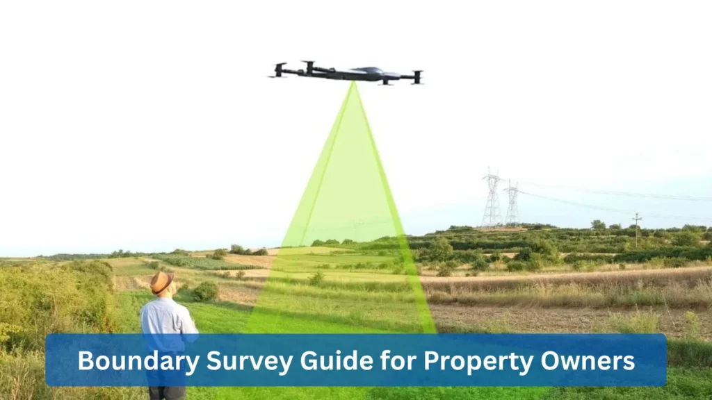
How the Zenadrone 1000 Helps in Boundary Surveys
The traditional image of a land surveyor often involves someone manually cutting through brush with a machete. However, the industry is experiencing a massive technological shift, largely due to tools like the Zenadrone 1000.
This industrial-grade drone is dramatically changing how we approach surveying property boundaries, especially for large, hazardous, or difficult-to-access sites, integrating advanced aerial technology into the modern land boundary survey.
Accessing Hazardous Terrain
One of the biggest obstacles in completing a survey boundary project is often the safety risk. Locations like cliffs, deep ravines, swamps, or unstable quarries pose serious nightmares for human crews. Fortunately, the Zenadrone 1000 eliminates this danger entirely. It can safely fly over these hazardous areas, capturing all necessary data without requiring a surveyor to ever set foot on dangerous ground.
Photogrammetry and Visual Evidence
Safety is a major challenge in a boundary land survey project, as cliffs, ravines, swamps, and quarries are nightmares for human crews. Yet, the Zenadrone 1000 eliminates this risk by flying over hazardous areas and capturing data without a surveyor having to set foot on dangerous ground.
LiDAR: Seeing Through the Trees
For heavily wooded properties, standard GPS is unreliable because the trees block the satellite signals. The Zenadrone 1000 solves this by being equipped with LiDAR (Light Detection and Ranging). LiDAR technology shoots laser pulses that can penetrate the canopy, allowing it to accurately map the ground below. This provides precise topographic and boundary evidence in forests that would otherwise require weeks of manual clearing.
Efficiency and Cost Savings
Time is money. On a 100-acre farm, a traditional crew might take two weeks to map the improvements and topography, but the Zenadrone 1000 can complete the site flight in a matter of hours. This dramatic speed reduces the labor hours required for the project, potentially lowering the cost of surveying land for the client while simultaneously delivering a much richer dataset.
Furthermore, by integrating GIS (Geographic Information Systems) with the drone data, surveyors can overlay deed lines onto high-definition aerial maps, giving property owners a visual understanding of their land that a black-and-white paper drawing simply cannot match.
Conclusion
Your property is likely your most valuable asset. Protecting it requires more than just a security system; it requires knowing exactly where it begins and ends. A boundary survey provides the peace of mind that comes with certainty.
Whether you are settling a dispute, planning a dream home, or just want to know what you own, hiring a licensed professional is the only way to go. And with advancements like the Zenadrone 1000, the process is becoming faster, safer, and more detailed than ever before. Ready to experience the future of accurate land measurement? Ask your surveyor about the Zenadrone 1000 today to get a faster, safer, and more detailed boundary survey for your complex property.
FAQ - Frequently Asked Questions
Are Boundary Surveys Public Record?
Generally, yes. If a survey is filed to aid in a property transaction, it becomes a public record accessible at the courthouse. However, private informational surveys may remain confidential depending on local state laws.
How Long Does a Boundary Survey Take?
Expect 1 to 2 weeks for a standard residential job. Complex historical research or adverse weather conditions can easily extend the timeline to a month or more.
Do I Need a Boundary Survey to Build a Fence?
Yes. Building a fence, even a foot onto your neighbor’s land risks legal action and the high cost of removal. A survey is much cheaper than legal fees.
How Accurate is a Boundary Survey?
Modern surveying is incredibly precise. Using robotic total stations and calibrated GPS, a survey can locate corners to within a fraction of an inch (less than 0.05 feet).
How Often Should a Boundary Survey Be Conducted?
Surveys do not expire, but you should get a new one when buying a property or building a new structure. It is also recommended if markers are missing or you suspect neighbor encroachment.
Can I Survey My Own Property?
No, not legally. You can measure your property for personal curiosity, but only a licensed Professional Land Surveyor (PLS) can produce a survey accepted in court or by a bank.
Who Pays for a Boundary Survey?
In a real estate transaction, this is negotiable between the buyer and seller. For existing homeowners needing a survey for construction or dispute resolution, the homeowner pays the cost.
Boundary Survey vs ALTA Survey
A standard boundary survey locates lines and corners, while an ALTA survey is a comprehensive version used primarily for high-value commercial properties and title insurance. Homeowners typically only need the standard boundary survey.
Land Survey vs Boundary Survey
A Land Survey is the umbrella term for the entire profession. On the other hand, a Boundary Survey is a specific type of land survey that exclusively defines the perimeter and limits of ownership.
Boundary Survey vs Topographic Survey
A boundary survey is 2D and defines the legal perimeter and ownership limits, while a topographic survey is 3D, mapping elevation, contours, and drainage for architectural design purposes.
Contact Us
Thank you for your message. It has been sent.