


5 Ways Drones are Changing the Real Estate Industry
More opportunities emerge with drone technology in marketing property and the real estate industry. Aside from more affordability and more straightforward data processing, drones offer much more for real estate companies and agents. The industry can use drones to meet customer expectations better when searching for their dream home. Additionally, drones can do more than offer 2D and 3D images. They also bring essential capabilities like topography and soil type analysis on land sites, making them essential for commercial projects.
5 Ways Drones are changing the Real Estate Industry
When it comes to marketing, both companies and agents need to catch customers’ attention. While the locations and the properties themselves might be lucrative, it’s also important to highlight the properties’ other features. As a result, more real estate professionals are turning to drones to capture more compelling aerial videos and photography. Here are the biggest ways drones in real estate are changing the industry:
Budget-friendly Drone Photography and Video
Before drones, aerial photography was limited to satellite images, helicopters, or low-flying planes. These options made birds’-eye view footage and pictures inaccessible to small real estate firms and agents. With drones, high-resolution photos and videos are more accessible than ever. Agents or firms can choose to invest in their drones for long-term use. Alternatively, they can also hire a drone photographer for one-time packages. Additionally, the best drones for real estate mean more affordable 3D mapping. Full scans of commercial properties can be completed much faster thanks to their onboard AI and machine learning software.
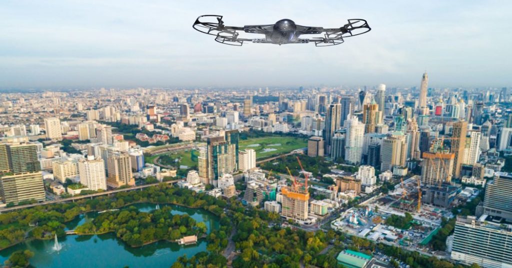
Birds’-Eye View of Property Locations
Using aerial photography for real estate marketing is necessary to get a bird’s-eye view of property locations. They are a great way to showcase the property and highlight features potential buyers might easily miss on the ground. That said, it’s important to note that drone photography isn’t always the best solution. For example, smaller lots in residential areas surrounded by neighbors’ houses aren’t ideal since they can cause privacy concerns. Another example would be high-rise units in downtown areas. The best way to use drone photography for selling real estate is for expansive properties. It’s better suited for taking footage of second dwellings, additional buildings, or stables on a piece of land.
Remote Viewings
Aerial photography for real estate isn’t quite viable for residential properties. This is because most drone cameras tend to have fisheye lenses. As a result, they won’t always show a home’s best features. Store buildings and more significant commercial properties, meanwhile, are quite different. Drones have more room to roam because commercial real estate tends to be several times larger than residential properties. Aside from their size, commercial properties easily lend themselves to remote viewings due to their location. Real estate agents and firms can showcase a commercial property’s proximity to other areas, especially in downtown locations.
Increased Safety for Taking Promotional Footage
While it’s less known, photography in the real estate industry can pose many safety hazards. These are mostly related to appraisal inspections, from accessing tight spots to making roof checks. Clients looking to sell property, home appraisers, and real estate agents can rest easy knowing a house’s complete condition. Drones can help them find cases like water pooling, excess debris, and more without risking their safety.
Increased Sales and Savings
Drones for real estate are a recent trend that can raise an agent’s or firm’s profile. However, they are expected to become an industry standard since they make marketing material look more professional. Ultimately, drones offer a more accessible and affordable way to shoot professional-looking aerial photos and footage. They give a higher chance of landing a sale with a client while still being cost-efficient.
What Makes ZenaDrone 1000 the Top Drone Solution for Real Estate?
Drone technology provides much-needed perspectives for different kinds of listings. Aside from downsides like privacy concerns and possible crashes, their benefits make them essential for the real estate industry. ZenaDrone is one of the most advanced drones currently in the real estate and property management market. With a combination of top-of-the-line hardware and software, it offers significant improvements in the following:
Geo-tagging and marking
ZenaDrone allows users to capture high-resolution aerial images and integrate them into data, complete with coordinates and other terrain features. Identifying specific points from aerial images is also much more manageable.
3D Rendering and Property Tours
ZenaDrone can easily make 3D maps with accurate aerial data on demand with multispectral sensors and machine learning software. These features make it an asset for high-paced construction management industries.
Precise Surveying and Measurement
Many real estate firms greatly benefit from ZenaDrone 1000’s accurate and authentic data. Its ability to cover large distances over more prolonged periods allows for more high-quality images in a shorter time.
The Bottom Line
How are drones used in real estate marketing?
Drone technology is becoming more widespread and critical to more industries. The real estate industry benefits not just from easily accessible 2D and 3D images, but also from its other features. Drones make everything from remote virtual tours to appraisal inspections much more effortless. Additionally, with the right model, they can be equipped with more specialized sensors for more accurate survey data. If you’re still looking for the best aerial photography solution, look no further. Book your first service at zenadrone.com today – we’d love to hear from you!
FAQs
How are drones used in real estate marketing?
Precise Surveying and Measurement
Drones capture high-quality images and sweeping video tours of properties. They showcase home exteriors, rooflines, and surrounding landscapes in one shot. This adds depth and dimension traditional photography can’t provide.
Are drone videos effective for selling homes?
Yes, drone videos create immersive listings that grab buyer attention instantly. Properties with aerial footage often receive more views and engagement online. It helps buyers visualize space and layout before an in-person visit.
Can drones be used for commercial real estate?
Absolutely—drones are ideal for capturing large commercial lots, buildings, and development zones. They offer a bird’s-eye view of access points, traffic flow, and nearby infrastructure. This supports better decision-making for investors and tenants.
Do real estate agents need a license to fly drones?
Yes, for commercial use in the U.S., drone pilots must hold a Part 107 certification from the FAA. This ensures safety, legal compliance, and professionalism during aerial shoots. Many agents hire certified drone operators to stay compliant.
Contact Us
Thank you for your message. It has been sent.