


How Are Drones Used in Construction
Commercial drones are operated for business and industrial purposes. Some individuals even use hobby drones professionally for construction, surveying, inspection, etc.
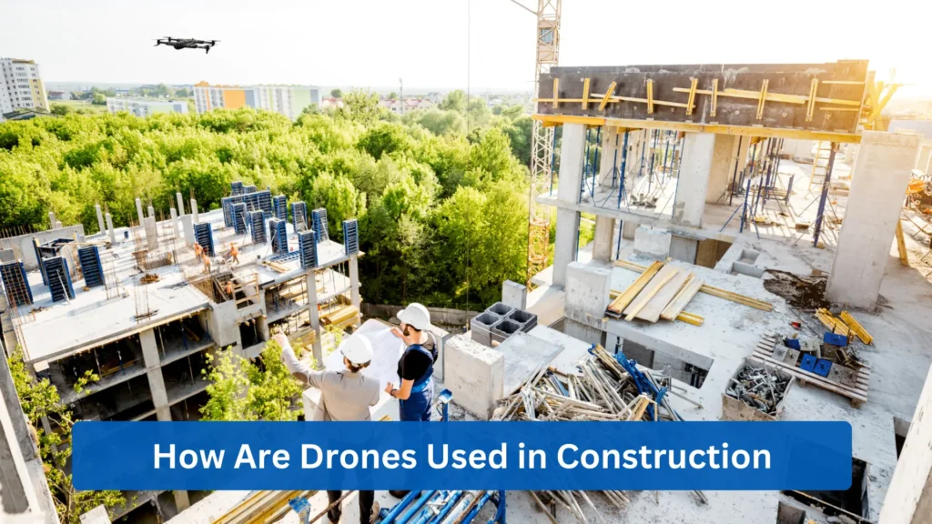
More and more construction companies experience tighter timelines and higher safety standards while maintaining precision with complex projects. It’s essential for construction companies to learn more about UAVs and how drones in construction have become one of the most reliable technologies to utilize on-site.
This Complete 2026 guide breaks down how construction drones can support your company workflows and why these UAVs are regarded as essential tools, and not optional add-ons.
What Are Drones in Construction and Why Are They Used?
Starting with construction drones, these UAVs provide workers with quick and accurate site surveys, mapping, and work progress tracking. Drones in construction are equipped with high-resolution cameras and Light Detection and Ranging (LiDAR) sensors, which help collect accurate site data faster and more safely. Project managers can use these drones to deliver real-time visuals and precise measurements and withstand project demands and diverse site conditions.
In 2026, these particular UAVs are being utilised for drone construction monitoring, drone surveying, and even drone mapping. The construction industry highly regards drones in construction as they are consistently operated throughout all phases of construction projects.
Multiple construction companies have been adopting these construction drones to monitor work, detect issues early, and ensure safety, as they ease the workload of all engineers and project managers. Workers are able to see more and monitor progress better with construction drones.
Unlike traditional methods for site monitoring, modern drone construction monitoring is able to capture detailed aerial images to create three-dimensional (3D) models and take measurements of such. This commercial drone technology offers real-time oversight, supports remote decision-making, and provides consistent documentation. These drones in construction make work faster, safer, and more cost-effective. Construction firms and project managers can ease their workload when drones are utilised for complex and time-consuming projects.

How Are Drones Used for Site Surveying and Mapping?
This digital age has led to drone surveying and drone mapping becoming better methods for creating topographic maps. This advanced UAV technology is built to capture high-resolution aerial data across large sites, instead of total stations and Global Positioning System (GPS) poles. With that, drone mapping in construction enables teams to make informed decisions earlier, which reduces revisions for costly designs.
By using drone mapping, teams can improve photogrammetry workflows. Drones are significant with the specialised software that captures overlapping images and designs them into precise 2D maps and 3D models. Moreover, Real-Time Kinematic (RTK) and Post-Processed Kinematic (PPK) drones can enhance the positional accuracy of data. This can correct errors during and after processing data.
These efficient solutions for site surveying and mapping produce construction deliverables from 3D models to volume measurements. All these drone services for architecture and construction outperform traditional survey equipment. Automated drones in construction can perform site surveys and mapping faster while improving safety, accuracy, and overall project efficiency. It also provides the construction firm’s stakeholders with unprecedented visibility of ongoing projects.
How Do Drones Support Construction Progress Monitoring?
When it comes to site captures, drone construction monitoring enables teams to capture aerial visuals daily and weekly. This progress monitoring is highly regarded, as it showcases the current status of projects and what has been completed. Construction teams can rely on this consistent process to help them in day-to-day project operations that involve a real-time view of ongoing and finished site activities.
The industry can utilise modern drones to generate accurate 3D models based on data from recurring construction drone flights. It allows construction managers to track information regarding job site conditions, including a comparison of planned versus actual progress.
Information gathered from drones can also help individuals gain an understanding of where delays to projects may be forming. By using both aerial progress tracking and drone construction monitoring, progress comparison is done more easily, instead of detecting deviations and adjusting schedules proactively.
Finally, drones are able to support construction progress monitoring with reports for clients and stakeholders. UAVs provide clarity and credibility, which are important features of a credible report. Drones that provide progress monitoring can also help project managers and workers act faster and reduce costly reworks across construction projects.
How Do Drones Improve Safety and Site Inspections?
Safety and site inspections are critical for the construction industry. It signifies that teams are solemn with their tasks by assessing the dangers and risks of construction projects. Intelligent drone technology enables monitoring with real-time actionable insights. With that, drones help workers reduce exposure to hazardous areas as stated above.
Drone safety inspections allow remote inspections, minimal fall risks, and fewer equipment accidents. As a result, workers will not be assigned to work in dangerous areas. These site risk assessments prove how proactive managers and workers can experience better workflow while being safe inside and outside construction sites.
Furthermore, construction drones are engineered to provide fast, high-resolution inspections of scaffolding systems, rooftops, etc. Inspections and assessment programs enable construction teams to improve compliance, maintain structural integrity, and enhance overall job site safety. When drones are used by project managers, construction sites are safer while inspections become faster and more reliable.
How Are Drones Used for Equipment and Asset Tracking?
Tracking equipment and assets can be troublesome, but it can be done with the proper drone equipment tracking. It’s engineered to have a fast, aerial view of equipment and asset locations across construction sites. Construction companies use this advanced technology to verify equipment location, identify company assets, and optimise equipment utilisation. Project managers can quickly access where materials are, even idle equipment.
Other than that, construction asset monitoring helps with the ongoing movement of construction materials. From concrete forms to steel components, project managers can track their locations. This ensures that equipment and assets arrive at the right location at the right time. Drone equipment tracking also reduces theft and operational delays. Not only can it strengthen site security, but drones can also prevent operational delays for all company materials.
How Do Drones Measure Stockpiles and Earthwork Volumes?
Stockpiles and earthwork volumes refer to calculating quantities of materials such as soil, gravel, etc. Measuring these helps construction teams gain an understanding of the current supply and encourages efficient management of materials. Aerial intelligence has led construction companies to create volume calculation, monitor earthworks, and reduce survey time and human error
Drone stockpile measurement uses aerial imagery and 3D surface modelling to calculate precise material volumes for soil, gravel, etc. Construction teams can rely on this more efficient method than outdated ground-based ones.
Moreover, volumetric analysis monitors earthworks as routine drone flights are engineered to monitor excavation, grading, and backfilling activities. These are accurate for individuals to take note of for inventory management and construction planning. These drones also reduce survey time and human error as they outperform traditional earthwork surveys. By using drones, construction companies improve consistency with active machinery.
How Are Drones Used for Quality Control on Construction Sites?
Quality control involves verifying that products and services meet predetermined standards. These standards are established to ensure that other components and systems are suitable for long-term use. When drones have a feature of construction defect detection, it’s faster to identify structural issues, detect construction deviations, and check the materials. Drones provide consistent aerial inspections, which help in identifying structural issues. It is equipped with high-resolution cameras and zoom sensors so inspectors can efficiently check the quality of materials.
Construction teams can use drones to capture data relating to errors, elevation mismatches, and installation inconsistencies so corrections can be made sooner. Drone quality assurance allows project managers to detect construction deviations and correct these accordingly. Formed concrete, steel frameworks, and roof membranes are familiar materials to any construction worker. Hence, inspecting these is essential for every construction company. Routine inspections with drone quality assurance can check concrete, steel, and roofing work more efficiently.
How Do Drones Help With Environmental Monitoring?
While companies use drones daily for site mapping and material inspection, environmental monitoring is a matter of great importance. It involves regular environmental monitoring, forest preservation and reforestation. Drone environmental compliance has companies monitor land conditions, specifically the soil erosion, sediment runoff, drainage patterns, and water flow in construction sites.
Tracking such can help workers be aware of their environment – the risks, corrective measures, and ways to prevent violations of land and water management. Equipped with environmental monitoring and photogrammetry capabilities, drones enable construction teams to collect high-quality data.
Furthermore, drones also offer site sustainability monitoring, which includes tracking dust dispersion, stockpile emissions, and air quality impacts in ongoing construction sites. Utilising drones for this enables construction teams to adhere to environmental standards. Lastly, construction drones can also produce reports with aerial evidence, site maps, and compliance reports. It’s accurate and reinforces corporate environmental responsibility. Discover more about how drones help with environmental monitoring and why choosing a drone is necessary for this specific activity through this blog.
How Are Drones Used for Construction Site Security?
Construction site security is just as important for the construction industry. With drones, project managers are able to do real-time patrolling, remote video monitoring and theft prevention. The drone site surveillance offers real-time patrolling of your construction sites. UAVs help security teams in surveying areas and responding to suspicious activities.
It also provides rapid response and advanced monitoring for various security needs.
Remote video monitoring is possible by construction site monitoring, in which drones provide remote visibility of site operations. Your project managers and security personnel can access these videos at any time, adding another layer of security. These drones are significant when it comes to theft prevention, as UAVs are built to reduce blind spots and have a consistent aerial view of ongoing activity in construction sites.
Security teams have real-time patrolling and remove video monitoring, which ensures that everything happening within project sites is taken into account. All drones are implemented with enterprise-grade protection for data collection and regulatory compliance with all relevant regulations in the country.
Explore how advanced security surveillance drones can enhance protection within your construction sites through this blog.
How Do Construction Teams Use Drones for Client Communication and Marketing?
Communicating and messaging with clients is significant when maintaining a good business relationship. Drones can improve communication and marketing by creating aerial updates, visual progress reports, and client engagement videos. Having a reliable and secure communication system between drones and teams is vital in discussing, even in defence and remote operations.
Clients are able to learn about site conditions, progress milestones, and overall development from aerial updates provided by drones. These are offered consistently and give clients an idea that the construction company values transparency with them. Captured data from drones creates visual progress reports that can leave a good impression on your clients and target audience.
When drones provide footage of maps, time-lapse videos, and side-by-side progress comparisons, individuals acknowledge the honest work that is put into your construction firm. Construction marketing can be taken to the next level with high-quality construction drones. It helps construction firms create client engagement videos that showcase expertise, scale, and execution quality. Moreover, public relations and investor communications can be improved with what drones have provided.
What Are the Best Drones Used in Construction?
Different drones deliver different purposes. There is drone construction monitoring, drone surveying, and drone mapping. From project managers to the workers themselves, from one construction site to another, it is important for firms to know which drones are best used for a certain flight mission.
The table below discusses construction drone models: maximum flight time, payload capacity, key features, and the primary purpose for which they’re best used. Six drone models are listed below with the necessary details. Here are the best construction drones as of 2026:
Drone Model | Max Flight Time* | Payload Capacity | Key Features | Best For (Construction Use) |
Skydio X10 | ~40 min | Light payloads | Autonomous AI flight, 360° obstacle avoidance, RGB + thermal sensors | Inspections, safety checks, confined-area mapping |
Freefly Astro Max | ~37 min | Medium payloads | High-accuracy RTK, photogrammetry-grade camera, stable for mapping | Surveying, high-precision mapping, infrastructure inspection |
Parrot ANAFI USA | ~32 min | Light payloads | Thermal + RGB, compact & quiet, NDAA compliant | Security, inspections, thermal checks |
DJI Mavic 3E | ~45 min | Light payloads | Mechanical shutter, RTK module support, excellent for mapping | Surveying, progress monitoring, documentation |
DJI Matrice 350 RTK | ~55 min | Heavy payloads | Weather-resistant, supports LiDAR, thermal, zoom cameras | Large projects, LiDAR mapping, advanced inspections |
ZenaDrone 1000 | ~50+ min (varies with payload) | Heavy payloads (up to ~40 kg) | Heavy-lift octocopter, AI-powered navigation, multisensor platform, long endurance | Large-site surveying, object transport, heavy sensor payloads, environmental monitoring |
What Use Cases Could ZenaDrone 1000 Serve in Construction?
With the ZenaDrone 1000, construction jobs can be done more efficiently as it is engineered for autonomous flight. Enhance your flight missions on construction sites with features such as:
- Large-site Surveying & Mapping
ZenaDrone 1000 can better handle big infrastructure, earthworks, or construction projects with volumetric measurement. As stated above, the extended flight time of 50+ minutes can endure the long mission, and its advanced sensor compatibility can capture high-resolution data even in large areas. Being able to scan a large site helps your engineers to calculate more accurately. It allows earthworks to begin sooner and minimises manual surveying. - Heavy-lift Tasks
A heavy payload capacity is also supported by the ZenaDrone 1000, as it can transport equipment and supplies across large sites and carry advanced sensor payloads for inspection and monitoring. The advanced UAV supports heavy-lift operations where regulations permit. Using this drone will encourage your workers more, as these have less travel time for them, speed up daily inspections, and minimise exposure to dangerous ground conditions. - Progress Monitoring & Inspections
The ZenaDrone 1000 can be operated during progress monitoring and site inspections as it has high-resolution imaging and multi-sensor features. It can also support site audits, environmental monitoring, and structural quality. Your project managers can compare footage to confirm milestones, and safety teams can use the drone data to check roof work, scaffolding, and environmental compliance.
What Are the Benefits of Using Drones in Construction?
After knowing more about construction drones, it is also important for companies and firms to understand their advantages. Check out the benefits of construction drones and how drone cost savings:
Efficiency: By using drones, construction firms are able to improve operational efficiency. Drones are built to successfully conduct surveys, do inspections, and perform progress tracking faster.
Your construction firm can be even more efficient with drones, as it completes a site survey within a few hours in comparison to ground crews, who may take days to even a week. This rapid data collection encourages teams to maintain a steady workflow and keep projects moving.
Safety: Drones minimise workers’ exposure to dangerous areas; hence, job site safety is even more feasible. Safety improvements are critical for construction firms as they lower accident risk and encourage project managers and workers to be proactive in safety management.
When working with high-rise building projects, drones can inspect scaffolding and rooftop edges. Your workers are no longer being sent to do such tasks that can possibly endanger them.
Accuracy: The ZenaDrone 1000 is suited for exceptional measurement precision. Built with high-resolution imaging, LiDAR, photogrammetry, and RTK-enabled positioning, the ZenaDrone 1000 can provide accurate surveying, mapping, and monitoring for construction tasks.
Your contractors can feel at ease when drones are used for large excavation projects to measure volumes. With its accurate calculations, over-excavation can be avoided, and costly disputes can be prevented.
Cost Reduction: When construction teams reduce labour requirements and have better resource utilisation, they can have drone cost savings. Drones lower costs to inspections, surveys, and monitoring through accurate volumetrics.
Your stockpiles and supplies can be monitored with drones, which avoids overordering all materials for construction projects. By reducing material waste, your construction firm is able to save on unnecessary purchasing and storage costs.
Better Communication: For communication, the ZenaDrone 1000 is best as it provides clear, visual, and data-driven project updates. From aerial images to 3D models, it will impress fellow workers and clients, which improves overall work and collaboration among teams.
With drones, project managers are able to share construction progress with other individuals and even overseas investors. Communicating with visuals has helped construction firms to impress stakeholders and let them understand the project progress faster without delay.
Frequently Asked Questions (FAQ)
What tasks can drones perform on a construction site?
Drones can help in numerous construction tasks, such as drone surveying for construction sites, drone mapping that can create topographic maps, drone monitoring of areas and materials, quality control, environmental monitoring, security surveillance, and client reporting.
Are drones accurate enough for surveying?
Yes. Advanced drones engineered with RTK/PPK technology, high-resolution cameras, and LiDAR, like the ZenaDrone 1000, can deliver accurate surveys. Drone data is accurate when operated correctly, not only for surveying, but also for grading, volume calculations, and site planning.
Do you need a license to use drones in construction?
In most countries, you need a license to operate drones. All modern commercial drones require a certified remote pilot license and compliance with aviation regulations in order to be operated within construction sites.
Are drones replacing surveyors?
No. These two technologies have different purposes – drones automate data collection, whereas a licensed surveyor interprets results, sets control points, and ensures legal accuracy.
How much do construction drones cost?
Drones in construction cost differently based on capability and use case. While entry-level drones may range from a few thousand dollars, industrial-grade platforms with LiDAR, RTK, and heavy-lift capacity can reach six figures.
Contact Us
Thank you for your message. It has been sent.