


How Does Topographic Mapping Help in Environmental Conservation?
Much of topography has changed with the advancement of technology. Survey techniques, instrumentation, and design and printing technologies have vastly improved survey accuracy. Additionally, devices like drones have made mapping much more straightforward. Surveyors and inspectors no longer need to rely on tedious traditional processes or survey entire areas on foot. Because of this, drones are instrumental in environmental conservation. They can make highly detailed maps with more detail and accuracy with ease. They also take up less time and allow users to take advantage of their other features to track wildlife.
What is Topographic Mapping?
Topographic maps are accurate graphic representations of features on the Earth’s surface. It depicts all natural and man-made features and elevations, from roads and buildings to lakes, mountains, and forests. These maps are used for many purposes. In conservation planning and management, users often need to combine data with spatial analytical techniques to make habitat maps or forest cover maps.
These maps are often the products of topographic mapping and surveys. They are performed on a large scale and often use the following equipment:
- Total Station Theodolite (TST): A TST combines electronic distance measurement (EDM) with a standard theodolite. It can read slope distances and is used in surveying multiple points and elevations.
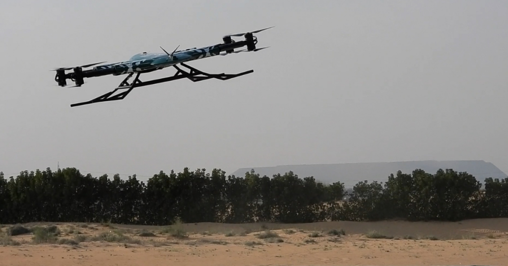
- Drones: Drones are increasingly used when surveying large areas, roofs, and other inaccessible areas. They also provide photos and point cloud records for ground laser scanning.
- Transit Level: Transit levels are used in topographic mapping for surveying and building. It measures relative levels for horizontal lines and points and can measure heights accurately over time.
How Does Topographic Mapping Help in Environmental Conservation?
Many organizations utilize advanced technologies today to create comprehensive topographic maps. Rail, mining, and construction industries rely on these maps’ accurate data. Organizations specializing in environmental conservation and management rely on topographic maps, especially for this reason. New devices, such as drones, can provide real-time geospatial data, making this possible and more convenient.
Topographic maps and surveys are invaluable, whether the area in question is a marine habitat or on land. Here’s how topographic mapping helps in environmental conservation:
1. Soil Conservation
Soil is one of the world’s most critical environmental and natural resources. As such, soil maps give crucial data for sustainable land and forest management. Today, geographic information systems and spatial statistics give powerful tools for soil mapping. The rise in digital soil mapping has provided more detailed and accurate information compared to traditional methods. Topographic maps offer geospatial data that can help accurately assess the extent of land use, conversion, and degradation. Additionally, topographic maps can also help with the following:
- Identify areas vulnerable to land degradation
- Provide data for long-term food, water, and fuel security planning
- Promote awareness for sustainable land use, especially in the context of climate change
2. Marine Conservation
Techniques used in topographic mapping are also essential in marine conservation, even though the equipment may differ. Spatial data and analytical methods often go hand-in-hand to create marine habitat maps. The marine habitat maps created as a result are essential in monitoring and predicting several factors, such as:
- Impact assessment of anthropogenic disturbance
- Identifying marine protected areas
- Monitoring and predicting the particular distribution of organisms and ecological underwater features
3. Wildlife/Vegetation Monitoring
In agriculture, LiDAR mapping is used to monitor crops. Regarding wildlife management, conservationists, biologists, and scientists also use data from LiDAR maps to study vegetation. This is because conventional satellite imagery can only quantify the two-dimensional features of any given canopy surface. As a result, the three-dimensional attributes of the forest floor and the middle strata are inaccessible.
LiDAR is often used for mapping and quantifying forest structure as a result. It can outperform other kinds of remote sensing metrics. Additionally, it can help perform different tasks with ease:
- Estimate carbon stocks, flood risk, and habitat suitability for wildlife
- Assess the severity and impact of forest degradation
- Provide comprehensive datasets of existing forest cover
Why is Topography Important?
Topography matters in many industries and fields. For example, farmers need to determine the best methods of conserving soil health and water in agriculture. Scientists need geospatial data to know how to minimize soil erosion best. Other fields, like weather forecasting, rely on topographic maps to analyze weather conditions from different areas. Meanwhile, military departments use these maps to study and analyze terrain.
There are two ways to gather information in topography:
- Direct Survey: For direct surveys, surveyors use equipment like levels and theodolites to determine the elevations of different points. Direct surveys combine techniques from indirect surveys for more accurate imaging.
- Indirect Survey: Indirect surveys utilize satellite images, radar, and other aerial images. Techniques that yield remote sensing and raw survey data, such as LiDAR mapping, make the work of scientists more convenient.
The Bottom Line
Topographic mapping and surveying have existed for a long time. However, with recent technological advances, new techniques have made obtaining more comprehensive maps with more accurate detail easier. The benefits of these new technologies and techniques to environmental conservation are clear and valuable. Aside from the relative safety and convenience, they also save conservationists and scientists valuable time. The data provided by said maps is also essential in decision-making policies and planning. While the highly technical aspect may be an initial barrier, the results ultimately benefit conservation efforts worldwide.
Contact Us
Thank you for your message. It has been sent.