


Hydrographic Survey Guide: Cost, Equipment & Process
When you say what a hydrographic survey is, it is the science as well as the practice of measuring and describing the physical characteristics of oceans, rivers, lakes, and coastal regions. A hydrographic survey is concerned with the measurement of the water depth, the topography underwater, and the seabed conditions to get well-established nautical charts and bathymetry mapping products.
Simply, it is a special underwater survey that provides mapping of what is underneath the water surface.
Marine surveying is incomplete without hydrographic surveying, which serves as the foundation of the safety of navigation, as well as planning offshore construction.
Core objectives of hydrographic surveying
The major objectives of hydrographic surveying are
- The calculation of depth by the method of echo sounding and sonar mapping.
- Developing bathymetric survey models.
- Mapping the topography of the underwater world.
- Detection of hazards like rocks, wreckages, or shoals.
- Propping offshore surveying and seashore mapping.
- Accurate seabed profiling of engineering projects.
The basic data that is applied in marine navigation and in marine geophysical surveys is produced by these surveys.
Purpose of Hydrographic Survey
Measuring water depth and seabed features
A hydrographic survey gives an accurate water depth measurement and seabed mapping data. With the use of SONAR systems just like multibeam survey tools, surveyors can capture detailed 3D models of underwater terrain.
This data supports:
- This data supports:
- Dredging survey planning
- Sediment mapping
- Seabed profiling
- Underwater topography analysis
Supporting marine navigation
Safe navigation is reliant on the current bathymetry mapping. Hydrographic surveys are used to update the nautical charts so that the vessels do not move into the shallow areas and submerged dangers. The International Hydrographic Organization (IHO) established the standards to govern globally on the accuracy requirements of the hydrographic data.
Infrastructure and offshore planning
Hydrographic surveys are essential before building:
- Ports and harbors
- Offshore wind farms
- Oil platforms
- Bridges and dams
- Subsea pipelines and cables
Good mapping of the seabed minimizes the structural threats and ensures accurate placement of the foundation.
Bathymetry and Seabed Mapping Explained
What is a bathymetric survey?
A bathymetric survey is a hydrographic survey that is dedicated to the measurement of the depths of water and the creation of contour maps of the seabed. It is based on the echo sounding technology to identify the distance between the seabed and a sonar transducer.
Multibeam systems of survey are now able to cover extensive areas of the seabed in one pass, making it more efficient and more precise.
Seabed topography mapping
Underwater terrain is mapped in Digital Elevation Models (DEMs). This can assist engineers to know about slopes, layers of sediments, obstructions, and stability of the seabed.
Difference between Marine Survey and Hydrographic Survey
Scope comparison
Marine surveying is a general area that encompasses inspection of vessels, appraisal of offshore assets, and underwater inspection. Hydrographic surveying is a specialized discipline that deals with mapping the underwater features and depth measurements.
Data collection differences
Hydrographic surveys use:
- Echo sounding
- Multibeam survey systems
- Side scan sonar
- GNSS positioning
Marine surveys can be based on structural checks, classification checks, and compliance checks.
Industries That Use Hydrographic Surveys
- Maritime transport: Shipping companies use hydrographic data to be safe in their shipping routes through ports and shipping lanes.
- Oil and gas: In offshore surveying, the drilling foundation and submersible pipelines are properly placed to avoid instability during drilling.
- Renewable energy: The offshore wind projects rely on the seabed mapping prior to the installation of turbines.
- Coastal engineering: Hydrographic survey is used by engineers in monitoring erosion and planning the protection of shorelines.
Why Are Hydrographic Surveys Important?
Maritime Navigation Safety
- Nautical chart updates: The hydrographic surveys update the official nautical charts to the existing seabed scenario so that they can sail with the accurate and latest depth information.
- Hazard detection: They locate diluted rocks, wrecks, shallow beaches, and other underwater obstructions, which can be hazardous to shipping and maritime operations.
Infrastructure Planning and Development
- Port and harbor construction: Surveys in ports and harbors provide valid depth and seabed data to bolster dredging, berth, and suitable maneuverability of vessels in congested terminals.
- Bridge and dam projects: In order to achieve stable bases and prevent the structural risks, the foundations are designed by the engineers based on the accurate data of the underwater topography and the seabed profiling.
Offshore Energy Development
- Wind farm surveys: Offshore wind farms should be thoroughly investigated before turbines are installed regarding the stability of the seabed, cable pathway planning, and bathymetry.
- Oil and gas exploration: The marine geophysical survey techniques allow identifying the safe terrains for drilling, estimating the hazards of the seabed, and determining the position of offshore platforms.
Dredging and Sediment Monitoring
- Pre-dredge surveys: The baseline bathymetric surveys are aimed at defining the current depths and the extent to which the sediment has to be eroded to meet requirements of design.
- Post-dredge volume calculations: After dredging, hydrographic surveys are conducted to determine the new levels of the seafloor to verify the design depths and the appropriate volumes of the materials that are removed.
Environmental Protection and Coastal Management
- Coastal erosion monitoring: The repetitive hydrographic survey is used to monitor shoreline movement, the movement of sediments, and changes of the seafloor over time to assist in the long-term planning of coastal stability.
- Habitat mapping: The marine ecosystem protection is supported by hydrographic data and seabed mapping to determine the sensitive habitat, benthic environment, and conservation management areas.
What Are the Different Types of Hydrographic Surveys?
Bathymetric Survey
Depth measurement techniques
- Single-beam echo sounding
- Multibeam survey
- Airborne LiDAR bathymetry
- Navigation charting
- Dredging surveys
- Reservoir mapping
Geophysical Survey
- Sub-bottom profiling: Sub-bottom profilers are used to investigate objects that are buried in the seabed or embedded in the sediment or geological features and that are not observable by regular bathymetric surveys.
- Seabed structure analysis: Applied in marine geophysical survey projects to observe the thickness of the sediment, faults, and conditions under the sea when building offshore.
Geotechnical Survey
- Soil sampling: Physical samples taken in the seabed to establish soil composition, strength, and load-bearing capacity involve coring and borehole drilling.
- Foundation analysis: Geotechnical data plays a very important role in the design of stable foundations of offshore wind turbines and the oil platform, bridge, and other marine structures.
Environmental Survey
- Water quality monitoring: Environmental surveys are taken to determine turbidity, salinity, temperature, and pollutants to determine the general conditions of water and the regulatory standards.
- Marine ecosystem assessment: They facilitate habitat conservation planning through a study of seabed features and mark ecologically sensitive marine areas.
Offshore Hydrographic Survey
- Deep-water surveys: Deep-water hydrographic surveys involve a high-level positioning system as well as multibeam sonar to map the complex seabed terrain at higher depths.
- Energy infrastructure mapping: Such surveys are used to map pipelines, subsea cables, and offshore installations to make sure that they are appropriately placed and that they are safe to operate in the long run.
Coastal and Inland Water Surveys
- River surveys: The flood risk assessment, analysis of the sediment transfer, and maintenance of the navigable channels are conducted with the help of river hydrographic surveys.
- Reservoir and dam surveys: Surveys on reservoirs and dams are used to assess the sedimentation, water storage capacity, and structural condition of an underwater structure to assist in providing infrastructure safety.
What Is the Difference Between an Underwater Survey and a Hydrographic Survey?
An underwater survey is a broad term that is used to denote inspections and data collection activities that are conducted under the water surface to investigate underwater structures, underwater conditions, and underwater properties using special underwater survey equipment and underwater sonar imaging devices.
- Underwater inspection: In underwater inspection, divers, ROV deployment, or side scan sonar are commonly used to carry out a visual and acoustic inspection of underwater structures, identify structural damage, or aid in maintenance planning in the marine and inland waters.
- Structural assessment: Bridges, dams, vessel hulls, pipelines, and quay walls are inspected using structural assessment surveys, which consist of sonar mapping, video inspection, and limited bathymetric survey methods to assess integrity, scour depth, sediment build-up, and general safety.
Key Differences in Scope and Objectives
- Mapping vs. inspection: A hydrographic survey emphasizes large-scale mapping, bathymetry mapping, and profiling of the seabed, as well as a sound depth measurement that results in charts and underwater topography models, but an underwater survey is oriented to a check-up, structural evaluation, and condition analysis of particular underwater objects.
- Equipment variations: Multibeam survey equipment, echo sounding equipment, sonar mapping technology, and GNSS positioning are generally used in hydrographic systems to have accurate georeferenced data, whereas underwater inspections generally use divers, ROVs, underwater cameras, and targeted underwater survey equipment to have close-range visual and structural information.
When Is Underwater Inspection Required?
- Structural damage checks: Inspections of the underwater area are necessary following storms, vessel hits, collisions, or other flood conditions to determine the damage to the structure, scour, or foundation exposure, and the condition of the underwater infrastructure with underwater survey devices and sonar imaging.
- Maintenance surveys: The ports, offshore platforms, bridges, dams, and pipelines undergo underwater surveys on a regular basis in order to check the wear, corrosion, sediment, and structure stability as a preventive maintenance program.
Role of Divers, ROVs, and Sonar Systems
- Diver-based surveys: The diver-based surveys are normally applied to shallow waters or restricted water bodies where structures need examination by touch, hand measurements, and close observations.
- ROV deployment: ROVs are utilized in challenging or underwater locations to record high-resolution video, sonar mapping information, and structural images and minimize safety risks to humans.
- Sonar imaging: Side scan sonar and other sonar mapping systems identify items, debris in the seabed, and other objects that may cause obstructions on the seabed, without physical interaction, in aid of both underwater inspection and hydrographic survey operations.
What Equipment Is Used in a Hydrographic Survey?
Echo Sounders
- Single Beam Echo Sounder (SBES): The Single Beam Echo Sounder (SBES) is used to determine exact water depth under the survey vessel through the echo sounding technology; hence, it can be categorized as a basic bathymetric survey device, channel check, and other small-scale inland water projects.
- Multibeam Echo Sounder (MBES): A Multibeam Echo Sounder (MBES) measures extensive strips of seabed data in multiple beams at the same time to provide high-resolution bathymetry mapping, detailed seabed profiling, and a precise underwater topography model to support large-scale hydrographic surveys.
Sonar Systems
- Side scan sonar: The side scan sonar is a sonar that provides detailed acoustic images of the objects, debris, pipelines, and wrecks of the seabed to support sonar mapping, hazard detection, and underwater surveys.
- Sub-bottom profiler: A sub-bottom profiler is used to survey the layers of sediment, objects buried in the seabed, and the geological features and is useful in marine geophysical surveying and planning of offshore infrastructure.
GNSS and Positioning Systems
- RTK GPS: RTK GPS offers centimeter positioning accuracy, which also means that data on hydrographic surveys and bathymetry mapping are accurately georeferenced.
- Motion sensors (IMU): Inertial Motion Units (IMU) remove the motion of the vessel, including the pitch, roll, and yaw, and enhance the precision of multibeam surveys and echo sounding.
- Sound velocity profiler (SVP): The Sound Velocity Profiler (SVP) is used to measure the changes in water column density to correct sonar data and ensure the results of the water depth measurement.
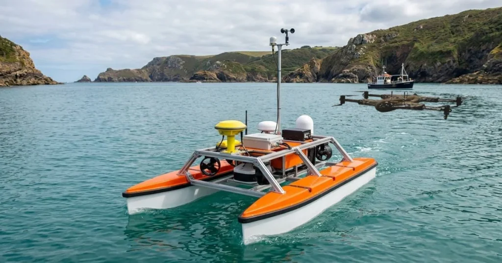
Survey Platforms
- Crewed survey vessels: Offshore surveying projects and large-area hydrographic projects require multibeam equipment and advanced hydrographic systems, which are done using crewed survey vessels.
- ROVs: ROVs are used to conduct controlled underwater surveys, structural surveys, and close-range sonar surveys in inaccessible locations.
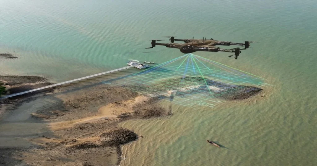
- USVs (Unmanned Surface Vehicles): The USVs are autonomous platforms that are normally deployed in drone hydrographic survey operations and provide an efficient mapping of the bathymetry, less manpower needs, and safe operations in shallow or hazardous waters.
What Are Hydrographic Systems, and How Do They Work?
Integrated Hydrographic Systems
- Sensor integration: In the contemporary hydrographic systems, the sonar, GNSS, IMU, and SVP sensors are all integrated on a single platform so that the precise depth, position, and motion data can be collected simultaneously.
- Data synchronization: All the sensor data are time synchronized to maintain accuracy, minimize inaccuracy, and produce uniform bathymetric and seabed mapping deliverables.
Vessel-Based Hydrographic Systems
- Large survey vessels: The offshore survey, deep-water mapping, and large projects of seabed profiling have advanced hydrographic systems on crewed vessels.
- Offshore deployment: The systems have been designed to work in the rough sea conditions and still have accurate sonar mapping and georeferenced data gathering.
Portable Hydrographic Systems
- Small boat systems: Portable hydrographic systems can be used in inland waterways, rivers, and small lakes where flexible surveys can be deployed where space is limited or shallow.
- Modular configurations: The design of modular systems enables easy installation/upgrades/reconfigurations to suit or adapt to differing project sizes and survey demands.
Drone and USV Hydrographic Systems
- Autonomous navigation: Drones and USV hydrographic systems are operated according to pre-established paths in order to cover survey regions fully and in an identical manner.
- Remote monitoring: The operators can manage the operations of the survey onshore, tracking real-time bathymetry and reducing missions.
- Shallow water capability: Such systems are particularly applicable to unsafe or shallow water zones where traditional vessels will not be safe to navigate.
Hydrographic Data Processing Software
- Data correction: Raw survey data undergoes tidal corrections, sound velocity corrections, and motion compensation by software to provide more accurate data.
- Chart production: The processed information produces digital elevation models, nautical charts, and seabed maps to be utilized in navigation, engineering, and environment.
- GIS integration: GIS can be used to add hydrographic survey outputs to conduct advanced spatial analysis, planning, and reporting.
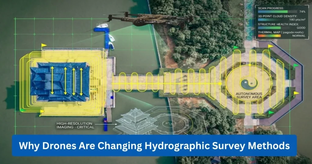
How Does Drone Technology Improve Hydrographic Survey Speed and Accuracy?
Rapid Deployment Compared to Traditional Survey Vessels
- Reduced mobilization time: The drone hydrographic survey systems have minimum setups, and surveys can commence within a short period, in contrast to the traditional survey vessels, which take a long time to prepare.
- Minimal crew requirement: They are run by a few technicians, usually 1-2 technicians, which decreases the labor expenses and eases logistics.
Automated Route Planning and Autonomous Navigation
- Pre-programmed survey grids: The grids of the drones will be preprogrammed. They go through all the surveyed areas evenly in order to increase the trustworthiness of the information gathered.
- Collision avoidance systems: Autonomous navigation plus collision avoidance can be used to increase the safety on crowded waterways and around objects.
Real-Time Data Transmission and Monitoring
- Live bathymetric mapping: Drone hydrographic surveys also offer instant visualization of the water depth changes and can therefore lead to more efficient decision-making in the field.
- Remote quality control: The results of the surveys can be tracked and checked instantly, making it accurate without the need to process the surveys.
High-Resolution Mapping in Shallow and Hazardous Areas
- River and canal surveys: Drone hydrographic systems are most suitable to map limited waterways in which larger water vessels cannot operate safely.
- Dam and reservoir surveys: They collect high-resolution bathymetry and seabed data along with structures reducing occupational hazards.
Cost Reduction Through Drone Hydrographic Systems
- Lower fuel consumption: There is less consumption of fuel by unmanned survey platforms compared to the traditional vessels, which minimizes operational costs.
- Reduced manpower costs: The operators required are few, thus reducing labor costs and still maintaining quality data.
- Faster project completion: Hydrographic surveys with drones can cost 30-50 percent less than the operations involving a vessel, since the entire process is much faster and more efficient without affecting the precision of the outcomes.
What is the Step-by-Step Hydrographic Survey Process?
Project Planning and Scope Definition
- Defining objectives: The project requires identification of the necessary hydrographic survey type together with its required resolution and its specific target objectives, which include bathymetry mapping, seabed profiling, and navigational chart updates.
- Area coverage planning: The survey lines need design, while survey operators must determine their overlap patterns, and the complete area survey needs to be planned according to these requirements for accurate data collection.
Equipment Calibration and System Setup
- Sensor calibration: Each sonar, echo sounder, and GNSS sensor is checked to make sure that the measurements were accurate and within the accuracy level.
- Positioning verification: Check GNSS, RTK, and IMU so as to be georeferenced correctly and to correct ship motion.
Data Acquisition in the Field
- Bathymetric data collection: Record water depth measurements with either a single-beam echo sounder or multibeam echo sounders in order to create a detailed seabed profile.
- Sonar imaging: The seabed and subsurface mapping are done via high-resolution images and data on sediment layers captured by side scan sonar and sub-bottom profilers.
Quality Control and Accuracy Checks
- Cross-line verification: Repeating survey lines in the perpendicular directions would ensure consistency and possible errors are identified.
- Error correction: Implement corrections to motion, tidal variation, and sound velocity to ensure that the data is accurate.
Data Processing and Correction
- Tidal corrections: Modify raw depth measurements to reflect tidal variation and provide standard reference levels.
- Sound velocity correction: Adjust the variations in the density and temperature of water to enhance the accuracy of sonar and the echo sounding.
Chart Production and Reporting
- Digital elevation models: Seabed and underwater topography 3D models are generated out of processed data.
- Final survey deliverables: They can be deliverables in the form of GIS files, contour charts, volume calculations, seabed profiling reports, and navigation or engineering or environmental use bathymetric maps.
How Much Does a Hydrographic Survey Cost?
Survey Area Size and Water Depth
Shallow water vs. deep water cost:
Inland shallow surveys are usually between 5,000 and 25,000 USD, whereas offshore deep-water surveys may be over 100,000 USD and will be more depending on the nature and size of the project.
Equipment and Technology Used
- Multibeam systems: MBES systems with high resolution are costly to procure and give rich and precise bathymetry information.
- Drone-based systems: Drone hydrographic survey platforms save on fuel and manpower costs and still offer high-resolution mapping.
Project Duration and Data Resolution
- High-density surveys: The more data points, the more time and resources it will demand to process surveys.
- Time-based pricing: Other providers pay according to vessel days or the duration of the project.
Location and Logistics Factors
- Offshore mobilization: Offloading vessels and equipment incurs a lot of expenses through fuel, labor, and other support logistics.
- Permits and compliance: Hydrographic survey projects are also accompanied by regulatory approvals and environmental permits that increase the time and costs of the projects.
Traditional vs Drone Hydrographic Survey Cost Comparison
- Crew cost difference: Traditional survey vessels use more manpower, which raises costs of labor and operation.
- Operational savings: Hydrographic systems using drones and USVs will save fuel and manpower requirements and can also cut the overall project costs by 30-50 percent.
What Industries Use Hydrographic Surveys?
- Port and Harbor Development: Channel depths, dredging activities, and safe navigation of vessels in a port or harbor are measured by hydrographic surveys.
- Offshore Wind Farms: They give seabed mapping and water level data to identify suitable locations for turbine foundations and laying cables.
- Oil and Gas Exploration: Hydrographic surveys are useful in the positioning of offshore platforms, pipeline routes, and detection of seabed hazards.
- Pipeline and Cable Route Surveys: They map the underwater terrain and determine the risks to avert risks during the installation of cables and pipelines underwater.
- Dredging Operations: Hydrographic surveys determine the volumes of the sediments and ensure that the design depths are obtained before and after the dredging processes.
- Flood Risk Assessment: They measure riverbeds and reservoirs in order to enhance hydraulic modeling and accuracy of flood prediction.
- Environmental Monitoring: The hydrographic surveys monitor the changes, movement of the sediments, and the marine habitat conditions in the sea.
-
Bridge and Dam Inspection: They measure the scour depth, buildup of sediment, and the structural conditions underwater to ensure that the infrastructure is safe.
What Regulations and Standards Govern Hydrographic Surveys?
International Hydrographic Organization (IHO) Standards
- Accuracy classifications: To stay up to date with the standards of the global survey precision requirements in navigation and seabed mapping, the IHO has come up with the level of accuracy of surveys, which include Special Order, Order 1a, 1b, and Order 2, to be used in hydrographic surveys.
- Survey order requirements: The regions that have greater navigational risk or are more critical infrastructure must have greater survey tolerances and more comprehensive hydrographic data gathering.
Safety and Compliance Requirements
- Maritime safety regulations: In order to protect the crew and equipment, the survey vessels must comply with the laws, navigation regulations, and safety during the observation of hydrographic surveys.
- Data reporting compliance: Hydrographic survey reports should be based on national hydrographic office standards and reporting requirements of official nautical chart updates and regulatory acceptance.
Quality Assurance and Documentation
- Survey documentation standards: Every hydrographic survey has comprehensive records of equipment calibration, survey methodology, and data acquisition to ensure quality assurance.
- Audit and verification: The full documentation will enable the audits and independent control of the survey accuracy, which will provide traceability, reliability, and regulatory compliance.
Common Questions About Hydrographic Survey
What is a hydrographic survey used for?
Its application is in bathymetry mapping, seabed mapping, marine navigation, offshore surveying, dredging survey planning, and infrastructure development.
How much does a hydrographic survey cost?
The prices on cost surveys begin at several thousand dollars for small inland projects and go up to more than $100 thousand for offshore multibeam surveys.
What equipment is used in underwater surveys?
The most common underwater survey instruments are echo sounders, side scan sonar, sub-bottom profilers, GNSS systems, ROVs, and hydrographic systems.
How accurate are hydrographic surveys?
Quality is based on IHO Classification and equipment. The current multibeam survey systems are RTK GPS based and are centimeter accurate.
How long does a hydrographic survey take?
Minor projects within the country can last several days. Mass offshore marine geophysical survey programs can take weeks.
Contact Us
Thank you for your message. It has been sent.