Preserving Our Forests: How Drones are Revolutionizing Conservation Efforts
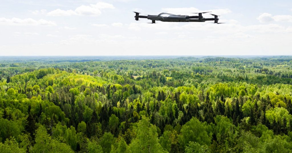
The incredible innovations of drone technology contribute to establishing trust and reliability. These devices can help with various conservation efforts thanks to their sensors, cameras, and data collection capabilities. Drone technology is improving this forest environment in ways that defy the rules of automation and the digital age. In forestry and forest cultivation, the high flame of UAV innovation is burning increasingly more fiercely, despite its infancy.
Optimizing Wildlife Preservation with Drone Technology
1. Observation and Mapping of Forests
Light Detection and Ranging (LiDAR) sensors and on board drones make it possible to create 3D forest maps. The method serves the purpose of observing forest conditions over time, distinguishing between tree species, calculating forest densities, and discovering trends like deforestation and illicit logging. It’s a reliable source of data that helps conservationists and legislators make intelligent choices.
2. Forest Restoration and Seed Sharing
Drone-based Forest restoration activities are quick with the use of drones. They can transport seedpods to far-flung locales and drop them there accurately. Environmentalists can restore ecosystems impacted by deforestation or natural disasters quickly and effectively with the help of this technology.
3. Identifying Unlawful Behavior
Drones with sophisticated surveillance technologies, such as facial and license plate recognition, can help detect and monitor unlawful activities, including forestry, mining, and encroachment on private property. Drones can assist in preventing and lessening the severity of environmental crimes by keeping an eye on high-risk regions.
4. Safeguarding Wildlife
Wildlife preservation and monitoring are two areas where drones have proven invaluable. Use them to keep tabs on endangered animals, their habitats, and any suspicious activity, including poaching or encroachment. Wildlife monitoring with forest drones with thermal imaging cameras can find animals in almost any environment, day or night. Conservationists can use drones to collect data on wildlife populations and behavior, allowing them to develop and implement more effective conservation plans and safeguard biodiversity.
5. Sensitization Programs for the Environment
Sensitizing people for forest preservation is another important use for drones. They may record breathtaking aerial film and stills of woods, showcasing their aesthetic and ecological value. Drones can include images in movies, textbooks, and even social media campaigns to get people thinking about environmental issues that help forest assessment using drones.
Drones in Forestry: Challenges You Need to Consider
Observing forests and woodland can be a time-consuming and resource-intensive activity that requires many people with the right expertise and equipment. Considered a significant problem in the forestry industry, monitoring forests is essential for preventing actions with dire environmental consequences. Since forests cover such vast areas, it is often difficult for forest managers and personnel to respond quickly to emergencies like forest fires, illegal tree cutting, etc. Unmanned Aerial Vehicles (UAVs) provide aid through topography monitoring, aerial photography, thermal imaging, and surveillance from above.
1. Matters of Law and Regulation
Specific laws and regulations govern the operation of drones in the forestry industry. Drone operators may need special permission or even a license to fly in some restricted locations and at specific heights. Meeting these requirements and securing the appropriate authorizations, especially when doing business in more than one country, can take time and effort.
2. Drone Navigation and Obstacle Avoidance
Trees, branches, and uneven ground are just a few hazards in a forest’s dynamic and intricate landscape. Drones need help navigating and avoiding dangers in dense woodlands. The ability to recognize and avoid obstacles requires sophisticated algorithms and sensors.
3. Environment and Climate
Drone activities in forestry are highly susceptible to the elements. Drones’ stability and controllability can be compromised by weather conditions, including strong winds, rain, snow, and fog, increasing the risk of collisions and damage. In addition, bad weather might compromise the precision and reliability of the information gathered by the drone’s LiDAR and cameras.
4. Reduced Flight Duration
Due to their batteries’ limited life, drones can only stay in the air for so long. It presents a difficulty when surveying extensive forests or doing lengthy monitoring activities. Planning and cooperation are essential for maximizing the drone’s flying time and data collection potential.
How can the Forestry Industry Adapt to Drone Technology?
1. Sort out your targets
Determine what it is you hope to accomplish through the use of drones in forestry. You can identify the best and most efficient methods for resolving problems can then be identified with this information.
2. Choose the proper drone and sensors
Select a drone that can handle the elements and has the appropriate sensors for use in the woods. Think about how long it can fly, how much it can carry, and how well it can endure the elements.
3. Take the rules into account
Learn the rules and regulations your area has implemented for using drones in the forestry industry. Obtain any licenses or permits required by law, and use them properly.
4. Map out your objectives
Make a thorough flight plan before taking off. Find the best routes to fly through the regions you wish to check out or keep an eye on. Think about the topography, the number of trees, and any potential hazards.
5. Perform a risk analysis
Analyze the hazards that may arise from using drones for logging. Look for things that could cause problems, including overhead electrical wires or large trees, and prepare to deal with them.
6. Train your team with drone piloting
Be sure your drone pilots and data analysts have received sufficient education. Ensure they have the knowledge and experience to analyze and evaluate the data generated safely and effectively while operating the drones.
The Takeaway
Drones are changing the face of conservation by giving new and better ways to keep an eye on forests, safeguard wildlife, spot fires, help with replanting, stop criminal activities, and educate the public about the environment. Using drones in forest conservation and future sustainability predicts to grow as technology develops.
Contact Us
Thank you for your message. It has been sent.
Latest Posts
Social Profiles


