


Unmanned Aerial Vehicles : Drones Revolutionizing Emergency Response
The rapid pace of technology development in today’s fast-paced, always-evolving environment has far-reaching consequences. Drones’ potential application in rescue operations has received a lot of interest in recent years. These unmanned aerial vehicles are changing how we respond to crises and save lives, from firefighting drones to drones that help with emergency communication. The payload, sensors, and cameras installed on a drone determine the scope of its potential uses.
Journalism, geographic mapping, wildlife monitoring, precision agriculture, shipping, and delivery are just a few of the many uses for drones today. Drones are utilizable in industries where human lives are at risk, such as search and rescue, structural safety inspections, airplane inspections, healthcare, law enforcement, disaster management, and firefighting.
Firefighting Drones: Battling Infernos from the Sky
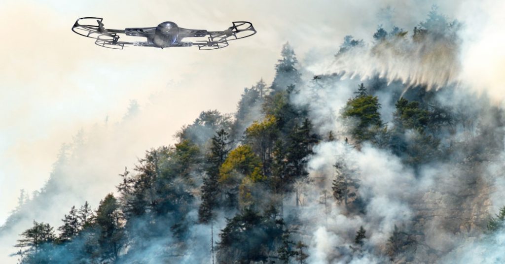
Undeniably, every second matters in the battle against fire. Reaching far-flung or dangerous regions might be difficult with conventional approaches. Drones equipped to tackle fires are, therefore, a game-changing innovation. These drones include thermal imaging sensors and large water tanks to fly quickly over dangerous terrain and provide vital information to firefighters on the ground in real time. Drones explicitly designed for combating fires improve efficiency and safety by pinpointing problem areas, evaluating hazards, and dropping off just the right amount of water or fire suppressants.
Drones are now an integral part of fire emergencies worldwide, helping to reduce reaction times, increase the safety of people, assets, and rescuers, boost the efficiency of suppression operations, and decrease the cost of interventions. For instance, ZenaDrone 1000 has the capability of Thermal Imaging that allows drone pilots to track down life forms in this situation to assess life forms in casualties visually.
Drone-Assisted Emergency Communication: Connecting in Crisis
Due to their various capabilities, drones can conduct unique missions in emergency and disaster response. Drones range in size from palm-sized planes to platforms comparable in weight and power to human aircraft. One of the unique features of these drones is that they include a built-in communication system for use in an emergency. In times of crisis, traditional methods of communication can easily break down due to the sheer volume of calls.
Filling this void with a reliable and adaptable means of communication is the role that drones play in emergencies. These drones can provide live video feeds to emergency response teams or serve as temporary communication relays thanks to their HD cameras, speakers, and mobile connectivity devices. Responders can stay in touch even in far-flung places by constructing a network of interconnected drones, allowing for prompt coordination and support with seamless drone-assisted emergency communication.
Drone Mapping for Disaster Assessment: Enhancing Situational Awareness
Aerial mapping and emergency response Construction, farming, mining, and inspecting infrastructure are just some fields that can benefit from drone mapping. Drones have numerous applications in disaster management, including mapping, monitoring, and damage assessment. Damage assessment, mapping, and 3D modeling have all used drone footage captured at the location of the disaster, like how ZenaDrone 1000 has this feature. Accurate damage assessments and prioritization of needs after a disaster are essential for efficient response and utilization of available resources.
Drone mapping provides a quick and thorough answer to this problem. Drones with sophisticated imaging equipment may take clear pictures from above and use them for mapping disaster zones accurately. Moreover, emergency management teams can use this information for real-time situational awareness, which improves damage assessment, search and rescue operations, and recovery preparation.
Emergency Response Planning with Drones: Proactive Preparedness
AUVs or drones are innovative tools for emergency organizations to manage disaster response and relief operations, thanks to recent technological breakthroughs. You can estimate the flow of the flood using drone footage. As a result, they can determine which areas pose the most threat in advance and which needs evacuation first. Drones are deployable rapidly over disaster zones and are used to build 3D maps, scan for casualties, and evaluate infrastructure damage.
These and other uses have cemented drones’ importance in emergency disaster response. It can serve an essential purpose in the preemptive planning of disaster responses. Drones can help emergency response teams anticipate and assess hazards, test emergency response methods, and pinpoint areas for improvement through simulated catastrophe scenarios. Drones’ bird’s-eye views reveal how factors like geography, buildings, and weather affect crises in otherwise impossible ways.
Using this data-driven strategy will allow first responders to improve their tactics, increase their level of coordination, and save more lives. Drones have numerous applications in public safety and emergency response management, including but not limited to:
- Make information available in near real-time to help shape decisions made on the ground.
- Give people the details they need to understand the situation.
- Perform tasks in dangerous environments without endangering first responders.
- Protect expansive areas, including those that are hard to access, so governments can use public safety resources more effectively.
- Give them access to tools humans lack, such as thermal or infrared scanning.
The Takeaway
Drones are changing how we respond to emergencies by helping firefighters battle fires, connecting people during crises, assessing damage, and planning for the future. They are changing how we plan for and respond to disasters and rebuild after that because of their capacity to reach inaccessible locations, collect data in real time, and improve our awareness of the surrounding environment. Guarantee the safety and well-being of communities by adopting drone technology in emergency responses.
Contact Us
Thank you for your message. It has been sent.