


How Are Drones Used for Disaster Management?
Disaster strikes without warning. During a crisis, conventional methods of rescue might be unable to respond promptly. Here is where modern technology comes to the rescue. Disaster management drones are changing the way in which we respond to an emergency around the world. These remote-controlled machines are not mere flying cameras. They are advanced equipment designed to withstand severe environments.
They are the things that emergency teams go through and see the invisible to tell the decision-makers how much the place has been destroyed in real time. These drones reduce the risks to human responders by incorporating advanced sensors.
Definition of Drones for Disaster Management
Drones for disaster management are specialized unscrewed aerial vehicles (UAVs). Unlike hobbyist drones, these machines are more robust. They are designed to assist in emergency scenarios to support all phases of the disaster lifecycle.
Their primary role is data collection and logistical support. They carry thermal cameras to find body heat. They use LiDAR sensors to map shifting terrain. They can even transport physical goods. These drones bridge the gap between chaos and organized relief. They act as force multipliers for firefighters, police, and medical teams.
Drones are becoming increasingly commonplace in disaster management due to their many applications in search and rescue missions, aiding in strategic planning, and other areas. As a result, using a drone in disaster response is a sensible choice that will facilitate ease and streamline response teams’ efficiency and effectiveness. Check out the factors below on the perks of drones in disaster management.
How Drones Are Used in Disaster Zones
In a disaster zone, information is the most valuable currency. Drones are able to deliver this information in a safe and fast manner.
- Rapid Assessment: Drones fly over the impacted areas as soon as an occurrence takes place.
- Identification of Hazards: Drones detect leaks of gases in the air, live wires, or weak structures.
- Route Planning: Drones detect distinct routes for the ground vehicles to reach victims.
- Infrastructure Inspection: Teams inspect using drones to ensure the bridges and dams are stable.
- Supply Transport: Drones deliver essential supplies to regions that are not accessible by road.
Why Drone-Based Disaster Response Is Increasing
Drones have become increasingly used in disaster recovery and aid missions.
- Speed: Within minutes, drones are put into action and can offer instant eyes on the object.
- Cost-Efficiency: Flying a drone is much lower than using a helicopter.
- Accessibility: Drones access places that are physically inaccessible to human beings.
- Safety: They ensure that the first responders are not exposed to danger on a first scout.
- Data Quality: Drones have larger resolution images than satellites or crewed aircraft.
Key Features Required in Emergency Drones
Not all drones will fit the crisis management. Ideal drones in disaster relief should have specific capabilities.
- Durability: Drones should be resistant to rain, heavy winds, dust, and smoke.
- Long Battery Life: Long flight time is essential in searching extensive areas.
- Payload Versatility: Drones require the ability to replace speakers or drop mechanisms with cameras.
- Intelligence: Thermal and night-vision features should be considered as non-negotiable features.
- Range: Drones must fly far beyond the visual line of sight of the pilot.
How Drones Support Disaster Response and Relief Operations?
Effectiveness in relief operations depends on situational awareness. Drones for disaster response provide a real-time picture of the ground reality. They remove the guesswork from deployment strategies. Commanders can allocate resources exactly where they are needed most.
Rapid Situational Awareness Using Aerial Imagery
Command centers need accurate data to make life-saving decisions.
- Live Streaming: Drones beam high-definition video directly to decision-makers.
- 3D Modeling: They produce computer replicas of the disaster scene.
- Damage Assessment: This approach involves comparing the impact of the disaster through the use of drone maps and pre-disaster data.
- Resource Allocation: Teams are shown precisely where the neighborhoods are in the most need.
- Obstacle Detection: Drones identify congested roads that would impede ambulance staff.
Delivering Emergency Supplies and Medical Kits
Logistics chains often break down during major catastrophes. Drones rebuild these lifelines from the air.
- Medical Deliveries: Drones transport vaccines, blood, and insulin to remote clinics.
- Critical Aid: They drop food and water rations to stranded populations.
- Equipment Transport: Small drones carry radios or phones to restore communication.
- Precision Landing: GPS allows supplies to land in small clearings or on rooftops.
- Contactless Delivery: This prevents disease spread in pandemic scenarios.
Supporting Evacuation Planning
Panic can turn an evacuation into a tragedy. Drones help manage the flow of people safely.
- Traffic Monitoring: Drones identify bottlenecks on evacuation routes in real-time.
- Route Optimization: Police use aerial views to redirect cars to open roads.
- Crowd Safety: They monitor assembly points to prevent dangerous overcrowding.
- Hazard Warning: Drones spot approaching fires or floods near evacuation paths.
- Public Guidance: Aerial speakers broadcast instructions to large groups of people.
Real-Time Communication and Data Transmission
The first infrastructure to fail is usually the communication networks. Disaster management drones facilitate connectivity.
- Signal Relaying: Drones are used as flying cell towers to increase signal bars.
- Wi-Fi Hotspots: Tethered drones deliver the internet to emergency command posts.
- Data Currying: Drones are literally flying data cards to the HQ by flying them to remote teams.
- Interagency Comms: They maintain contact between police, fire, and medical teams.
- Network Repair: Drones are used to check cell towers to direct repair teams.
Case Studies of Drone-Enabled Relief Operations
History proves the value of this technology in real-world crises.
- Flood Response: In 2021, drones surveyed Hurley, Virginia, to simulate the flood path. The officials used this data to anticipate future risks.
- Earthquake Relief: In post-disaster Haiti, drones were used to deliver supplies to the disaster. This circumvented highways that were blocked to access isolated victims.
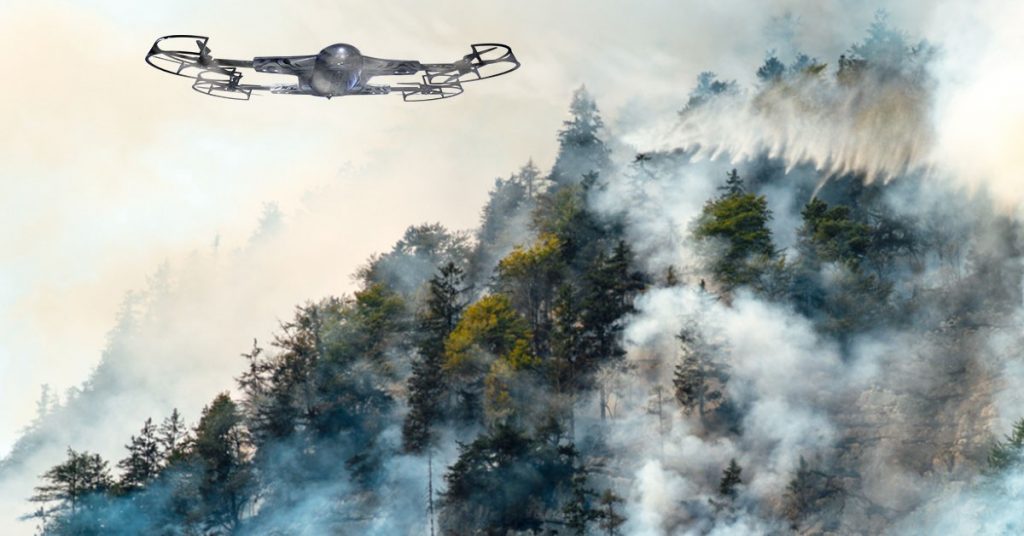
- Wildfire Containment: CAL FIRE deployed thermal drones during the wildfires in California in 2020. They identified concealed hotspots that were overlooked by ground crews.
- Hurricane Recovery: Following Hurricane Irma in 2017, drones inspected roofs in the Caribbean. Insurers used the data to process claims weeks faster.
- Search Missions: A thermal drone found lost hikers on Yonah Mountain, Georgia. It spotted their body heat through the dense forest canopy.
Why Are Drones Effective for Disaster Response?
Effectiveness is measured in speed, accuracy, and safety. Drones excel in all three categories. They transform clumsy, slow responses into surgical, data-driven operations.
Faster Search and Rescue Missions
In search and rescue (SAR), time is the enemy.
- Wide Coverage: Drones scan acres of land in minutes.
- Rapid Deployment: A drone can be airborne while helicopters are still fueling.
- Automated Patterns: Software flies precise grid searches so no spot is missed.
- AI Detection: Onboard computers detect human shapes quicker than human eyes.
- Night Operations: Thermal sensors enable the search to proceed even in complete darkness.
Damage Assessment and Mapping
The recovery funding is essential in understanding the magnitude of damage.
- Structural Safety: Drones examine the safety of buildings to enter.
- Debris Estimation: Drones estimate the volume of rubble on which they are planning to clean up.
- Flood Modelling: Topographic data is used to determine the course of the flood waters.
- Speed Insurance: This is to give evidence of damage to secure quicker payment.
- Historical Record: Drones produce a digital record of the event, which is permanently stored.
Locating Survivors Using Thermal Cameras
The visibility is usually low either as a result of smoke, dust, or darkness.
- Heat Detection: Thermal cameras see body heat through smoke and foliage.
- Living vs. Deceased: Sometimes sensors can differentiate between living and dead bodies.
- Cold Water Rescue: They spot warm bodies against cold ocean water easily.
- Night Vision: Rescue operations do not have to stop at sunset.
- False Alarm Reduction: Zoom cameras verify heat sources before sending crews.
Using Drones to Reach Unsafe or Inaccessible Areas
Some environments are too toxic or unstable for people.
- Nuclear Sites: Drones monitor radiation levels without exposing workers.
- Chemical Spills: They sample air quality over toxic train derailments.
- Unstable Slopes: They map landslide risks without putting geologists on the slope.
- Collapsed Tunnels: Small drones fly into ruins to check for life.
- Volcanic Eruptions: They monitor lava flow paths from a safe distance.
Reducing Risk for First Responders
Every firefighter or medic deployed is a life at risk.
- Advance Scouting: Drones check scenes for active shooters or fire traps.
- Remote Monitoring: Commanders watch operations from a safe distance.
- Fatigue Reduction: Drones do the hard searching, saving human energy for rescue.
- Situational Awareness: Teams know precisely what they are walking into.
- Mental Health: Reducing physical danger lowers the stress on response teams.
How Do Police Drones for Disaster Response Work?
Law enforcement is crucial for maintaining order during chaos. Police drones for disaster response act as eyes in the sky. They allow departments to cover more ground with fewer officers.
Role of Police Drones in Disaster Law Enforcement
Police must secure the disaster zone to prevent further tragedy.
- Perimeter Security: Drones patrol the edges of the disaster zone autonomously.
- Looting Prevention: Aerial surveillance prevents theft in evacuated areas.
- Officer Safety: Overwatch drones keep officers in hostile areas safe.
- Evidence Gathering: They document crime scenes that are difficult to access.
- Resource Management: Commanders see where patrol cars are needed most.
Crowd Monitoring After Disasters
Displaced populations can become panicked or unruly.
- Density Analysis: Drones are used in the determination of the number of people in the crowd to provide sufficient security.
- Behavior Analysis: AI identifies aggressive behavior or stampedes that are being created.
- Safe Distance: The police observe unduly excited crowds without any tension.
- Chokepoint Identification: Drones identify hazardous pedestrian bottlenecks.
- Shelter Security: The Drones patrol the borders of temporary aid camps.
Traffic Control During Evacuations
A gridlock is dangerous during an escape from a fire or a hurricane.
- Real-Time Flow: Drones identify accidents that result in backups in real-time.
- Rerouting: Police reroute drivers on the basis of aerial shots.
- Signal Timing: The data assists engineers in fixing the traffic lights to allow vehicles through.
- Road Blockages: They recognize fallen trees or power lines to escape.
- Accident Reconstruction: Drones survey crash scenes and remove the roads within a shorter time.
Drone Assisted Emergency Communication
Clear instructions save lives.
- Aerial Speakers: Drones broadcast evacuation orders to specific blocks.
- Visual Signaling: Spotlights guide victims to safety at night.
- Message Drops: They can drop leaflets with instructions to isolated areas.
- Two-Way Audio: Certain drones enable the responders to communicate with the survivors directly.
- Language Support: Pre-recorded messages may be played in a variety of languages.
Coordination with Fire, EMS, and Rescue Teams
Disaster response is a joint effort.
- Shared Feed: Police drone video is shared with Fire and EMS chiefs.
- Unified Command: Unites all agencies on the same map to make superior decisions.
- Resource Tracking: Commanders monitor all resources in a single digital dashboard.
- Search Coordination: Drones used in police assistance can be used to search, and Fire teams can carry out rescue operations.
- Safety Overwatch: Police drones watch for hazards while medics treat patients.
What Are the Best Drones for Disaster Relief?
Choosing the right equipment is a matter of life and death. The best drones for disaster relief are robust and intelligent. Consumer-grade toys will fail in these demanding environments.
Key Features of the Best Drones for Disaster Relief
Agencies value consistency, and not glitziness.
- Weather Resistance: An IP rating such as IP45 will be required in rain and dust.
- Transmission Stability: Signals have to penetrate through the interference in cities.
- Data Security: Sensitive footage is not intercepted due to encrypted links.
- Deployment Speed: The drone must go from case to air in seconds.
- Ease of Use: Software should be intuitive for stressed operators.
Battery Life, Payload Capacity, and Flight Range
These specifications define the mission profile.
- Long Endurance: 40+ minutes of flight time is the industry standard.
- Heavy Lift: The drone must carry heavy zoom lenses or drop kits.
- Ready BVLOS: It should have the capability of flying beyond the sight of the pilot.
- Hot-Swap Batteries: Teams must be able to switch batteries without shutting down.
- Quick Charging: This is because the battery needs to charge fast in order to keep the drone in the air.
Autonomous Flight and AI-Based Mapping
Automation helps to reduce pilot fatigue and error.
- Grid Missions: Software employs perfect search patterns, which are flown automatically.
- Obstacle Avoidance: The sensors prevent collision with trees or buildings.
- Subject Tracking: The drone will follow an object or a person that is in motion.
- Smart Return: It is returned home without fear of a loss of signal.
- Terrain Follow: Uneven terrain will make the drone maintain the fixed altitude.
Sensor Types: Thermal, LiDAR, and Multispectral
Various missions have various eyes.
- Thermal Imaging: Essential in detecting heat sources in the rubble or woods.
- LiDAR: Lasers map terrain through dense vegetation or canopy.
- Multispectral: Cameras assess soil stability and vegetation health.
- Zoom Lenses: High-powered optical zoom identifies faces from a distance.
- Night Vision: Low-light sensors provide clarity in darkness.
Comparing Top Drone Models Used in Disaster Relief
Several platforms dominate the market.
- DJI Matrice 300 RTK: The versatile standard for many agencies.
- Skydio X2: Famous for its impossible-to-crash autonomy.
- Brinc Lemur: Designed to break glass and search interiors.
- Parrot Anafi USA: Secure, portable, and thermally equipped.
- Autel Dragonfish: A VTOL fixed-wing for long-range surveillance.
How Does the ZenaDrone 1000 Support in Disaster Management?
The ZenaDrone 1000 represents a specialized tier of disaster technology. It is engineered for industrial strength and multi-role versatility.
Advanced Sensors and Autonomous Navigation
This drone sees the world with machine intelligence.
- AI Integration: Onboard computers analyze terrain data in real-time.
- Precision Navigation: It navigates with accuracy even in GPS-denied settings.
- Risk Detection: This is where hazards such as power lines are detected automatically by the sensors.
- Stabilization: This is done by the gimbal and ensures that cameras remain stable during high winds.
- Intelligent Scanning: It gives priorities to areas of interest without human intervention.
Payload Delivery Capabilities
The ZenaDrone 1000 is a logistical asset.
- Heavy Payload: It carries significant weight for its class.
- Medical Drops: It safely transports fragile medical supplies.
- Custom Attachments: Users can swap tools for different missions.
- Release Mechanism: The drop system is precise and reliable.
- Balance Control: Software adjusts flight dynamics based on load weight.
Real-Time Mapping for Emergency Teams
Data is only helpful if it is timely.
- Instant Streaming: Video reaches the command center with low latency.
- Live Mapping: It builds 2D and 3D maps as it flies.
- Geotagging: Every image is stamped with precise location data.
- Cloud Sync: Data is uploaded for remote teams to analyze.
- Format Flexibility: It outputs data compatible with standard GIS software.
Use Cases of ZenaDrone 1000 in Disaster Scenarios
ZenaDrone 1000’s design fits many emergency profiles.
- Forest Fires: It monitors fire lines to protect ground crews.
- Flood Zones: It surveys levee breaches to predict water flow.
- Search Operations: It goes over large stretches of wilderness in search of lost persons.
- Post-Storm Repair: It examines utility poles to direct linemen.
- Agri-Relief: It determines agricultural damages to food security planning.
Why ZenaDrone 1000 Stands Out in Emergency Operations
ZenaDrone 10000 has distinct characteristics that distinguish it among its rivals.
- VTOL Design: The lack of a runway is called vertical takeoff.
- Flight Time: It has a longer flight time compared to the usual quadcopters.
- Rugged Build: The carbon fiber construction can withstand extreme handling.
- Predictive AI: It helps predict disaster paths using sensor data.
- User Friendly: The interface is designed for rapid field deployment.
What Is the Future of Drones for Disaster Management?
Technology is evolving at a very high rate. The future holds fully autonomous, integrated drone systems.
AI-Powered Disaster Prediction and Monitoring
Prevention will become as important as response.
- Predictive Modeling: AI will use drone data to foresee landslides.
- Early Warning: Drones will detect subtle terrain shifts before collapse.
- Automated Patrols: Drone docks will launch inspections without human pilots.
- Infrastructure Health: AI will spot micro-cracks in dams or bridges.
- Data Synthesis: Systems will combine drone data with weather satellites.
Drone Swarms for Mass-Area Scanning
Quantity has a quality all its own.
- Collaborative Flight: Hundreds of drones will search as a single mind.
- Self-Healing Networks: If one drone fails, others will fill its spot.
- Rapid Mapping: A swarm will map an entire city in minutes.
- Redundancy: Loss of a single unit will not stop the mission.
- Complex Tasks: Swarms will lift heavy debris together.
Integration with Emergency Communication Networks
The drones will form part of the smart city.
- 5G Connectivity: 8K video streaming will be supported with high-speed data.
- FirstNet Compatibility: Drones will be prioritized over responder networks.
- IoT Connection: They will be communicating with traffic lights and ground sensors.
- Centralized Control: City wide drone fleets will be controlled in one room.
- Public Alerts: Drones will be able to send up warnings to smartphones underneath.
Remote Sensing Advancements in Disaster Technology
Sensors will see more than ever before.
- Gas Detection: Sensors will sniff toxic leaks from miles away.
- Ground Penetrating Radar: Drones will see through rubble to find voids.
- Bio-Sensing: Future tech may detect heartbeats from the air.
- Hyper-Spectral: Cameras will identify chemical compositions of spills.
- Acoustic Sensors: Drones will listen for cries for help.
Frequently Asked Questions (FAQs)
How Do Drones Help in Disaster Management?
Drones provide aerial views, map damage, and deliver supplies. They enter dangerous zones so humans do not have to, saving time and lives.
What Types of Drones are Used for Disaster Response?
Agencies use multi-rotors for hovering and fixed-wing drones for range. VTOL hybrids are also popular. Rugged enterprise models are preferred.
How Accurate are Drones in Damage Assessment?
They are highly accurate. RTK GPS allows for centimeter-level precision, which is better than satellite data.
Can Drones Deliver Food, Medicine, and Supplies?
Yes, heavy-lift drones transport critical aid. They are vital when roads are destroyed. They can drop payloads precisely.
Are Police Drones Effective During Major Disasters?
Yes, they are highly effective. They assist with security, traffic, and search operations. They act as a force multiplier.
What Makes a Drone Suitable for Disaster Relief Operations?
It needs durability, long battery life, and thermal cameras. Reliable transmission range is also key. It must withstand the weather.
How do Drones Assist in Search and Rescue Missions?
Drones cover ground faster than foot teams. Thermal sensors find body heat at night. AI helps spot victims automatically.
Do Drones Reduce Risks for First Responders?
Yes, significantly. Drones face the hazards first, keeping humans safe until the situation is clear.
Contact Us
Thank you for your message. It has been sent.