


Enhancing Environmental Monitoring and Conservation Efforts with Drone Technology Drones can provide researchers and scientists with accurate and reliable real-time...

Drones in Forest Preservation: Enhancing Conservation Strategies Forest ecosystems support the vast majority of global biodiversity. It makes forestry one...

Fruit-Picking Drones: Transforming Agriculture with AI-Powered Precision In the rapidly evolving landscape of agriculture, the integration of advanced technologies is...
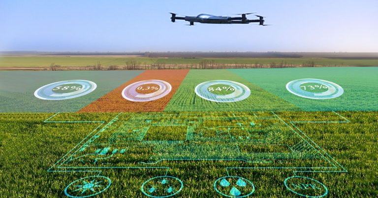
Drone Herbicide Spraying: Companies Prices and Drones for Sale Agriculture and Farm Plantations are becoming technologically optimized with drones as...

Starting a Drone Spraying Business: Tips and Considerations The drone spraying business is a growing market as the use of...
Navigating the Terrain: How Long-Range Drones are Improving Disaster Relief and Rescue Operations Long-range drones have continued to excel as...