


Difference Between GNSS and GPS: Which System Is Better?
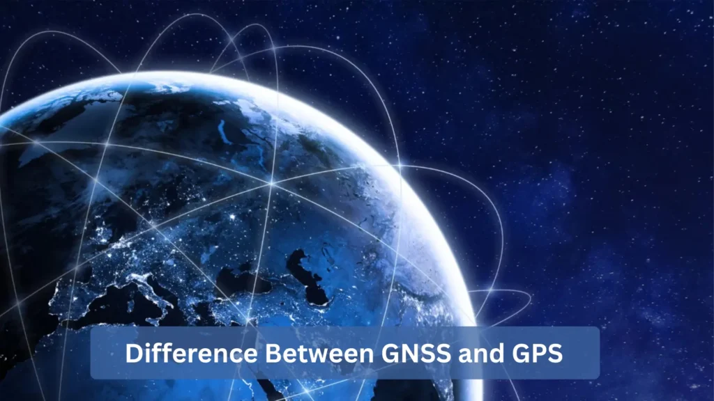
In simple terms, GPS (Global Positioning System) is a satellite navigation network run by the U.S., while GNSS (Global Navigation Satellite System) is a broader concept that covers all such networks worldwide. NASA explains that GNSS provides “autonomous geospatial positioning with global coverage,” and notes that “the U.S. Global Positioning System (GPS) is one type of GNSS”. In other words, GPS is just one member of the GNSS family. GNSS includes GPS plus other constellations like Russia’s GLONASS, Europe’s Galileo, China’s BeiDou, and regional systems like Japan’s QZSS or India’s NavIC. A GNSS receiver can see more than 120 satellites around the world because it uses multiple constellations. A GPS-only unit can only see a few. This means that GNSS usually has better global coverage, reliability, and accuracy than GPS alone.
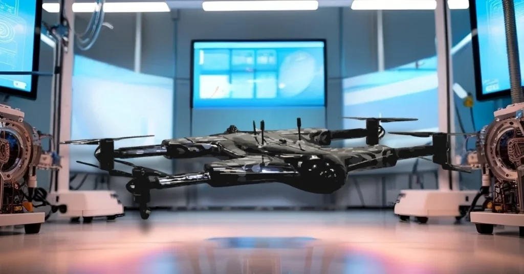
This difference is important for things like drone technology, navigation, and precision farming. For instance, the ZenaDrone 1000 is a modern agricultural drone that uses GNSS-based navigation to get centimeter-level accuracy across a field. These smart drones use GNSS receivers, advanced sensors, and AI to make maps of crops and spray pesticides where they need to go. The ZenaDrone 1000 actually “combines advanced sensors, autonomous flight paths, and AI-driven software” to follow very specific flight plans. This level of accuracy, which is much higher than basic GPS, shows why multi-constellation GNSS is better for important tasks.
What Is a GPS (Global Positioning System)?
The Global Positioning System (GPS) is the American satellite navigation system. It consists of about 31 medium-Earth-orbit satellites (24 active in six orbital planes, plus spares) launched by the U.S. military. Since its initial deployment in the 1970s, GPS has been globally available (for civilian and military use) and is now built into smartphones, cars, ships, and many other devices. When people say “GPS” today, they often mean any satellite-based positioning, but technically GPS refers only to this U.S. satellite network.
- How GPS works: Each GPS satellite continuously transmits a radio signal containing the satellite’s position and a timestamp. A GPS receiver on Earth picks up these signals from at least four satellites and compares the broadcast time to its own clock. By calculating the time delays of each signal, the receiver determines its distance from each satellite. The receiver uses trilateration (solving the geometry of spheres from each satellite) to figure out its 3D position (latitude, longitude, and altitude) and exact time. Most consumer GPS devices only use L1, but civilian GPS usually works on L1 and L2 frequency bands. Dual-frequency receivers (L1, L2, and the newer L5) can fix delays in the ionosphere, which makes them more accurate.
- Accuracy and range: A regular civilian GPS without any extra features usually has an accuracy of about 5 to 10 meters. This is enough for everyday navigation, like getting directions for driving. Augmentation systems, like DGPS, SBAS, or Real-Time Kinematic techniques, are used to make accuracy better to sub-meter or centimeter levels.
- Applications of GPS: GPS is ubiquitous in consumer electronics and transportation. It’s built into nearly every smartphone for mapping and navigation, as well as in car nav units, aircraft avionics, and even wearable fitness trackers. In the context of drones, a standard GPS-controlled UAV can fly predetermined paths or hold position using its GPS fix. For instance, the ZenaDrone 1000 can execute a pre-scheduled automatic flight plan based on GPS waypoints. At a basic level, GPS in such drones enables automated flight routing and geo-tagging, although higher-end drones will augment GPS with additional sensors for greater accuracy.

What Is GNSS (Global Navigation Satellite System)?
The term GNSS stands for Global Navigation Satellite System. It is the collective name for all satellite navigation systems, both global and regional. GNSS includes not only the U.S. GPS constellation, but also other national and international constellations. Each of these constellations has its own set of satellites and control stations, but a GNSS receiver can pick up signals from any or all of them. The benefit is improved positioning: “The advantage to having access to multiple satellites is accuracy, redundancy and availability at all times.”. In practice, a modern GNSS device might use signals from more than one constellation at the same time to get a more accurate position.
Below are the major GNSS constellations in use today:
- GPS (United States): ~31 satellites (Medium Earth Orbit). The global standard system, covering the entire planet.
- GLONASS (Russia): ~24 satellites. Russia’s system, which provides especially good coverage at high latitudes.
- Galileo (Europe): ~30 satellites (currently 24 operational with more launching). A civilian-run system designed for high-precision positioning and timing.
- BeiDou (China): ~35 satellites (currently covering Asia and moving to full global coverage). China’s network, with extra satellites focused on the Asia-Pacific region.
- Regional systems: Japan’s QZSS (4 satellites, focused on Japan/Asia) and India’s NavIC (7 satellites, covering the Indian region).
Each of these GNSS constellations broadcasts signals so that a capable receiver on Earth can calculate its location using any combination of them. For example, by tapping GPS + GLONASS + Galileo + BeiDou, a GNSS receiver effectively uses dozens of satellites, which greatly improves the geometry of positioning and reduces blind spots.
Key Differences Between GNSS and GPS
Despite sounding similar, GNSS and GPS differ in important ways:
- Full Name: GPS stands for Global Positioning System. GNSS stands for Global Navigation Satellite System.
- Satellite Constellations: GPS uses only the U.S. network (~31 satellites). GNSS combines multiple networks (GPS, GLONASS, Galileo, BeiDou, etc.), accessing signals from far more satellites.
- Coverage: Both systems provide global coverage, but GPS is maintained by the U.S. and optimized with its own satellites. GNSS, by definition, is truly global. It pulls in satellites from all participating systems to fill any gaps.
- Accuracy: Civilian GPS accuracy (without corrections) is on the order of 5–10 meters. By leveraging multiple constellations, GNSS can typically achieve around 1–2 meter accuracy with the same hardware. The extra signals improve the position solution. With advanced techniques (RTK, DGPS) GNSS accuracy can be pushed to the centimeter level, which is difficult to do with GPS alone.
- Reliability: GPS is a single constellation. If many GPS signals are blocked (e.g. by mountains, tall buildings, or tree cover) or a satellite is offline, the receiver can lose a fix. In contrast, GNSS uses redundancy: if one satellite system is down, the receiver can fall back on others. This multi-constellation redundancy makes GNSS far more robust in challenging environments.
- Drone Example: For illustration, consider drones. A basic drone using only GPS might have meter-level positioning error. A GNSS-enabled drone like the ZenaDrone 1000, however, uses signals from several systems (plus other sensors) to achieve centimeter-level precision across the field. This is why professional UAVs rely on GNSS for critical tasks.
Overall, GNSS offers broader satellite coverage, higher accuracy, and greater reliability than GPS alone.
Advantages of GNSS over GPS
Using GNSS instead of GPS provides several key benefits.
- More satellites mean better coverage: A GNSS receiver can lock onto satellites from more than one constellation at the same time. This means that it “sees” a lot more satellites in the sky, which makes them more available and lessens the geometric dilution of precision. In real life, receivers that support more than one constellation work much better under trees or in urban canyons than GPS-only receivers.
- Better accuracy: GNSS can get better positioning accuracy because it gets signals from different systems and often on more than one frequency. For instance, GPS is usually accurate to about 5 to 10 meters without any help, but GNSS fixes can be accurate to about 1 to 2 meters in good conditions. Also, GNSS devices can use more advanced methods: Real-Time Kinematic (RTK) and Differential GPS (DGPS) corrections can make GNSS more accurate to within a centimeter or decimeter. (These methods work even better when data comes from more than one constellation.)
- More reliable: GNSS receivers can switch to another satellite or constellation if one goes down. A GNSS receiver can use GLONASS or Galileo signals instead of GPS signals if a GPS satellite is down or blocked. This extra network makes GNSS much more reliable than a GPS solution that only uses one network, especially in places with a lot of interference or obstacles.
- Improved performance under difficult conditions: Because GNSS taps multiple signals, it performs better in challenging environments like dense woods, deep valleys, or built-up cities. GPS signals alone are more prone to dropouts in such areas, whereas multi-constellation GNSS has a higher chance of maintaining a fix.
- Augmentation readiness: Many augmentation systems (WAAS, EGNOS, SBAS) and new services (Galileo HAS, QZSS CLAS, etc.) are designed with multi-constellation GNSS in mind. By using GNSS, a receiver can take full advantage of these corrections and security features as they roll out, further improving accuracy and integrity.
In summary, GNSS receivers deliver GNSS accuracy vs GPS accuracy that is noticeably better for modern precision applications. They combine signals, frequencies, and algorithms to reduce errors, whereas standalone GPS is more limited
Real-World Example: ZenaDrone 1000 with GNSS
To see the difference in practice, consider the ZenaDrone 1000, an advanced UAV used in precision agriculture. This smart drone is integrated with machine learning and AI for highly accurate navigation. It “combines advanced sensors, autonomous flight paths, and AI-driven software” into one platform. In farming use, the ZenaDrone 1000 relies on multi-constellation GNSS receivers to follow centimeter-accurate flight routes over fields.
For instance, the drone can fly pre-defined waypoints automatically, adjusting its route in real time based on GNSS positioning and onboard LiDAR/vision sensors (for obstacle avoidance). While the manufacturer highlights features like GPS tagging and terrain mapping, the underlying navigation uses all available GNSS signals for best precision. This allows the ZenaDrone 1000 to spray crops with extraordinary accuracy, creating uniform coverage and spotting stressed plants early. In short, by integrating GNSS technology, drones like the ZenaDrone 1000 achieve the multi-GNSS precision agriculture that wasn’t possible with GPS alone.
Limitations of GPS
While GPS is immensely useful, it has some inherent drawbacks:
- Single-constellation system: GPS devices can only connect to U.S. satellites. When buildings, mountains, or trees block too many GPS signals, the receiver loses its fix and navigation stops working. This can happen in cities, thick forests, or inside. GNSS receivers don’t have this problem because they switch to other constellations.
- Limited accuracy without support: Basic GPS accuracy is limited (typically 5–10 m). Improving it requires external augmentation. For example, Differential GPS (DGPS) or Satellite-Based Augmentation Systems (like WAAS/EGNOS) are needed to correct errors and reach sub-meter accuracy. Without these, civilian GPS may not meet the demands of precision surveying or high-accuracy mapping.
- Susceptibility to interference: GPS signals are relatively weak by the time they reach Earth. They can be jammed or spoofed more easily than a multi-constellation GNSS signal set. Reflections (multipath) and ionospheric effects also degrade GPS accuracy. GNSS devices often have algorithms to mitigate these errors by using extra data, but standard GPS-only receivers lack that resilience.
- Coverage dropouts: In some places (very high latitudes or very remote areas), the geometry of GPS satellites may not be ideal. A GNSS receiver, on the other hand, gets signals from all the satellites around the world, so it usually has fewer dead zones.
In short, GPS on its own is less reliable and accurate than GNSS. It works fine for everyday navigation (maps, driving), but for demanding applications it needs assistance.
How GNSS and GPS Work Together
Modern navigation devices typically support both GPS and other GNSS signals simultaneously. In other words, nearly all current “GPS” receivers are in fact GNSS receivers:
- Multi-constellation receivers: Most smartphones, car navigators, and drones have chips that track multiple systems. A single receiver can get GPS and GLONASS and/or Galileo/BeiDou signals. This combined fix is more accurate and stable. For example, if a GPS satellite drops out, the receiver can instantly use a Galileo or GLONASS satellite instead. This cooperative approach is inherent – GNSS includes GPS, not excludes it.
- Dual-frequency positioning: Many GNSS receivers use two or more frequencies from each constellation (e.g. L1/L2 or L1/L5). This allows them to correct for ionospheric delay and other errors. With dual-frequency data from GPS and Galileo, an RTK-capable receiver can resolve position to within a few centimeters in real-time.
- Augmentation and corrections: GNSS devices also use augmentation services. A GNSS receiver might apply WAAS/EGNOS corrections for GPS, SBAS for other systems, or get real-time correction data from a local base station (DGPS/RTK). All of these improve precision.
- Integration with new tech: The future of positioning involves blending GNSS with other technologies. For example, 5G cellular signals are now being used to complement GNSS in urban environments, offering additional timing and distance data. In short, GPS and GNSS signals are fused together in advanced navigation solutions, yielding the best of both worlds.
Because of this, devices like the ZenaDrone 1000 use a unified GNSS receiver that simply processes every available signal. The software doesn’t care which satellite network the signal came from, it just computes the optimal position fix.

Applications of GNSS and GPS in Modern Technology
Both GNSS and GPS underpin countless modern applications. Key examples include:
- Agriculture and drone mapping: Precision farming is a big winner. GNSS helps drones and tractors map fields, keep an eye on the health of crops, and only apply inputs where they are needed. For example, drones take NDVI pictures to find crops that are stressed early on. A GNSS-guided drone, like the ZenaDrone 1000, can then fly automated routes over the field and spray the right area, which greatly increases yield and cuts down on waste.
- Surveying and Construction: Land surveyors and builders use GNSS instruments for highly accurate site measurements. Multi-constellation RTK survey receivers can map a construction site with centimeter precision in minutes. This automates tasks that once took weeks with total stations. GNSS drastically speeds up land surveying, boundary mapping, and machine control on sites.
- Tracking transportation and fleets: GPS/GNSS is used by logistics and transit fleets to plan routes and keep track of their vehicles in real time. Delivery trucks, ships, and other vehicles have GNSS trackers that tell dispatchers where they are and when they will arrive. All GNSS constellations work together to make sure that even remote or low-signal areas are covered, which makes global tracking reliable.
- Consumer and Mobile Devices: Nearly every smartphone, tablet, wearable and vehicle navigation system includes GNSS. Apps like Google Maps, ride-sharing, geocaching, and location-based social media all depend on GNSS fixes. Wearables use GPS/GNSS for tracking runs or hikes. Millions of end users leverage this satellite navigation daily. It’s so ingrained that we often just say “turn on GPS” when we mean any satellite positioning.
Each of these sectors benefits from GPS and GNSS technology. In general, GNSS (the multi-system approach) is enabling new capabilities, but for user convenience, we still call it “GPS” in many contexts.
Future of GNSS and GPS
Satellite navigation technology is continually evolving. In the coming years we expect:
- More satellites and signals: Agencies are launching next generation satellites (e.g. GPS III, Galileo 3rd generation) and new frequencies (L5, L6 bands). This will improve precision and availability. For example, Galileo will offer a High Accuracy Service (HAS) down to decimeter accuracy, and QZSS has introduced centimeter-level corrections (CLAS) over Asia.
- Augmentation and integration: Satellite-based augmentation systems (WAAS, EGNOS, etc.) and ground networks are already making accuracy up to 10 times better. Researchers are also combining GNSS with 5G cellular networks and inertial sensors to get around signal problems in cities.
- AI-driven navigation: Just like AI helps ZenaDrone find the best routes, future GNSS apps will use machine learning to find better positions. Self-driving cars and drones will use GNSS with built-in intelligence to get around in complicated places.
- Autonomy and smart infrastructure: GNSS will be a backbone for autonomous cars, unmanned aerial vehicles, and smart-city sensors. Ultra-precise timing from GNSS is also critical for telecommunications and power grids.
In short, the trend is towards multi-frequency, multi-constellation GNSS with integrated corrections – achieving sub-meter and even centimeter accuracy routinely. Systems like the ZenaDrone 1000 already hint at this future, and the technology is only getting more robust. By 2026 and beyond, GNSS will enable faster, safer, and more precise navigation across all domains.
Conclusion
In short, GPS is just one part of the GNSS family. GPS does a good job of positioning on its own (especially with augmentation), but GNSS uses multiple constellations to provide better accuracy, coverage, and reliability. For critical applications – from agriculture to mapping – GNSS’s advantages are clear. The ZenaDrone 1000, for example, shows how a GNSS-enabled drone can navigate fields with centimeter-level precision. As navigation technology advances (new satellites, frequencies, and integration with AI/5G), GNSS will continue to improve. Whether you’re using GPS in your phone or a GNSS module in an autonomous vehicle, remember that GNSS is the broader ecosystem that makes high-precision global positioning possible.
Frequently Asked Questions
Is GNSS more accurate than GPS?
Yes. GNSS receivers usually have better accuracy than GPS alone because they use more than one satellite constellation. For instance, a multi-constellation GNSS fix can be accurate to about 1–2 m (or even better with advanced techniques), while an uncorrected GPS fix can be accurate to about 5–10 m.
Can GPS receivers use GNSS signals?
A GPS-only receiver can only use U.S. GPS satellite signals. However, most modern “GPS” chips are actually multi-GNSS and can pick up additional satellites (GLONASS, Galileo, BeiDou, etc.) without issue. If a device is strictly labeled GPS, it won’t use other constellations. But almost all current smartphones, vehicles, and drones support GNSS signals in practice
Why do drones prefer GNSS over GPS?
Drones rely on stable, accurate positioning. GNSS’s multi-constellation data means more satellites are visible at any time, reducing dropouts and improving geometry. This leads to more reliable location fixes, especially near obstacles or on large farms. In short, GNSS gives drones better accuracy and redundancy, which is critical for autonomous flight and precise operations.
How does the ZenaDrone 1000 use GNSS for navigation?
The ZenaDrone 1000 is equipped with a GNSS receiver that uses signals from multiple constellations. It follows pre-planned waypoints using these satellite fixes. On top of that, it incorporates advanced sensors (like IMUs or LiDAR) and AI to refine its flight path. In essence, it uses GNSS for primary positioning and then adjusts in real time to stay on course with centimeter-level precision.
What are the main GNSS systems in use today?
The four global GNSS constellations are GPS (USA), GLONASS (Russia), Galileo (EU), and BeiDou (China). Together they provide worldwide coverage. In addition, there are regional systems: Japan’s QZSS (4 satellites, covering Asia) and India’s NavIC (7 satellites, covering India).
What does GNSS stand for?
GNSS stands for Global Navigation Satellite System.
Does GNSS work without the internet?
Yes. GNSS relies on satellite signals and does not require an internet connection for positioning. Receivers compute their location from the timing of satellite signals. (Of course, map data or correction services might use the internet, but basic GNSS works independently.)
Can GNSS replace GPS completely?
Not exactly, because GPS is part of GNSS. GNSS is the umbrella term for all systems including GPS. So GNSS doesn’t replace GPS – it includes it. In practice, receivers just use whatever constellation signals are available. Over time, as more constellations come online, users may say “GNSS” more often than “GPS”, but the U.S. GPS satellites will continue to operate as a core component of GNSS.
How many satellites are used in GNSS?
Currently there are over 120 satellites across all GNSS constellations. For example, GPS has ~31, GLONASS 24, Galileo ~30, BeiDou ~35, etc. A GNSS receiver may “see” dozens of these in view, far more than the ~4–12 satellites a GPS-only receiver typically tracks.
Contact Us
Thank you for your message. It has been sent.