


Impact of Drones on Precision Agriculture and Security
Technological advancements allowed for the excellent adaptation of unmanned aerial vehicles for various purposes. One of the best examples of drone use is its advantage of aerial surveillance and data acquisition.
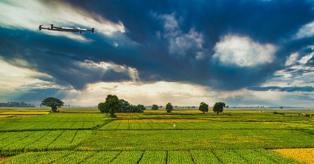
The use of drones in agriculture and farming has spawned a lot of enormous potential. One such application is accurate, and the evidence-based farm produces forecasting using drone spatial data. The best drone for farm security allows farmers to observe their fields from the sky. The use of drones goes back decades. Drones are now integral to most industries, impacting more precision in agriculture. UAVs in military applications include surveillance and neutralizing hostile forces.
Defining Precision Agriculture And The Role Of Drones
Precision agriculture is also known as satellite agriculture and site-specific crop management. The method of precision agriculture requires data gathered from:
- Crop observation
- Measurement
- Response to inter- and intra-field variability
The management uses IT to optimize that crops and soil receive optimal health and productivity requirements. Efficient management ensures profitability, environmental protection, and sustainability. When managing crops, it’s vital to take these factors into account:
- Weather
- Terrain
- Yield data
- Soil chemistry
- Plant growth
- Soil composition
The best drone for farm security assists in improved precision agriculture. Drones provide real-time data on areas that usually take time. Drones help assess data from the abovementioned factors and consider labor costs and equipment availability.
Security Drones: The Role Of Surveillance In Precision Agriculture
Precision agriculture holds a lot of potential for the global farming industry. However, precision agriculture requires a consistent amount of data to be effective. Using drones provides a significant advantage in helping boost the performance of precision farming.
Security drones are moving from military to commercial industries such as agriculture and ranching. The drones’ ability to detect provides an advantage for agriculturists to monitor crops and collect data. Security drones for farms gather valuable information to help farmers navigate the changing environmental conditions and maximize output. AcDrones come in many forms, and the primary purpose of their use is the reduction of required resources. You may also curate data from drones to assist farmers in managing their businesses, which is the most crucial goal of precision agriculture. Agriculture uav drone also aim for lesser negative impact on the environment.
1. Security Drone Application In Farming
Drones have already become essential to large-scale precision farming operations in many areas. Among these, tree planting drones are gaining popularity for their ability to support reforestation and sustainable farming initiatives. The data collected by drones recording fields helps farmers plan their planting and treatments to maximize yields. According to Country Guide, precision farming can increase yields by up to 5%, which is a significant improvement. Tree planting drones not only contribute to higher yields but also promote environmental sustainability by efficiently planting trees over large area
2. Irrigation Design
Crops rely heavily on irrigation to work correctly. As a result, to track effectiveness, farmers must carefully plan irrigation systems and analyze water distribution.The drones provide farmers with new perspectives on irrigation systems. It allows them to monitor effectiveness and make strategic changes to improve water movement.
3. Surveillance And Security
Farmers must closely monitor crops to avoid theft and damage from people and wildlife. However, managing hundreds or thousands of acres of land takes a lot of work. The increasing use of drones in farm security is due to UAVs ‘ ability to cover large areas and fly for extended periods. Drones are capable of capturing detailed aerial footage and approaching unauthorized individuals. They also communicate with security and wildlife deterrence systems to help track down intruders.
4. Seeding
Drones are incredibly effefarctive at gathering data such as land elevation and slope. Farmers can analyze this data over time and use it to determine where to plant before the start of each growing season.
5. Resource Allocation
Crops can be highly complex, and growing requirements can vary due to minor variations in soil, sunlight, and temperature. Farmers can use drones to monitor crop fertility and determine where to apply resources such as fertilizer and pesticides. It is possible to achieve greater consistency and maximize production by using this data.
FAQs On Drones
Undoubtedly, the best drone for farm security contributes to a significant impact on precision farming. However, drone technology is still in development. There are still no strong laws surrounding commercial drone use.
The list below shows some frequently asked questions on drone use:
Q1: How Can A Drone Send Pictures (Real-Time View) To The Controller?
Controllers or drone operators must communicate with the drone through radio waves. Drones usually use 2.4 gigahertz radio waves. A drone must have a 5.8GHz transmitter and monitor on the other end to receive live footage or photographs.
Q2: How Are Military Drones Controlled At Long Distances?
Satellite communication is used by military unmanned aerial vehicles (UAVs) to send control signals and sensor data over great distances to command centers. While experts can do landings and takeoffs locally, remote UAV operation requires satellite communication. This is because the signals take several seconds to travel, even at the speed of light, the 26,000 miles to a geosynchronous orbit and back to the drone.
Q3: Are Military Drones Affected By Jamming?
All radio signals have the possibility of being jammed. However, military drones have their method of avoiding jamming. Military UAVs have a satellite dish that can lose link and run on autopilot for a few seconds. It takes more work to jam on the appropriate frequency.
Q4: Can Military Drones Operate Without GPS/Satellite?
GPS has the probability of failing. Military drones can operate without GPS or satellites. The strength of the GPS signal determines the accuracy of a drone’s navigation. GPS works best with an unobstructed view of the sky, but as the number of use cases increases. It includes the various types of environments UASs must navigate in.
Conclusion
Drones have come a long way from their military origins and are transforming various industries, including agriculture. Their accessibility for commercial use has opened up new opportunities, making precision farming more efficient and data-driven. In agriculture, drones help monitor crop health, manage irrigation, and detect pests early, contributing to higher yields and lower costs. Security drones and UAVs now enhance nearly every facet of farming, playing a key role in the industry’s success.
Contact Us
Thank you for your message. It has been sent.