


 Deutsch
 Português

How Drones Navigate Without GPS: Assured PNT for GPS-Denied Environments
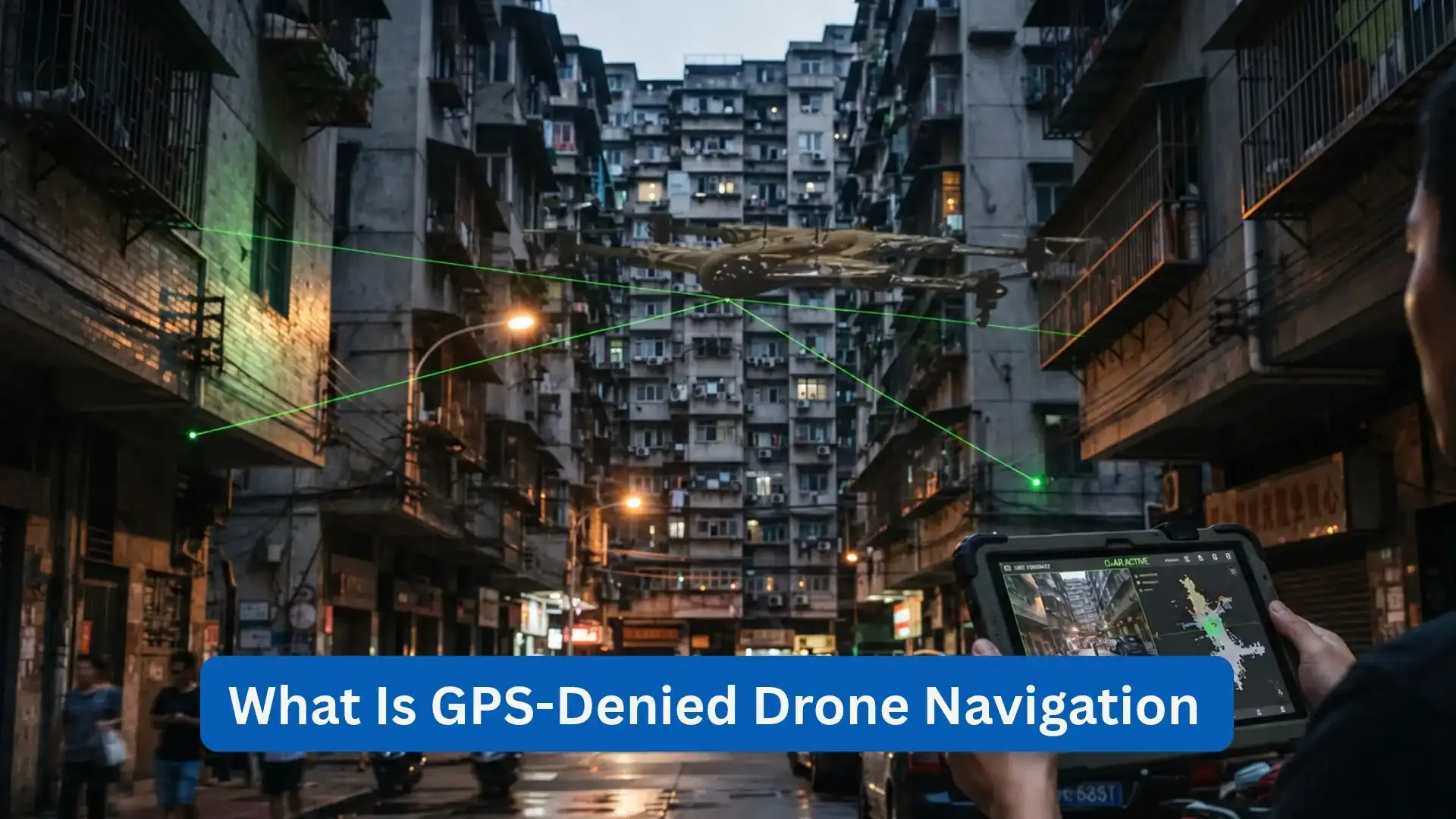
Performing well and safely should be the bare minimum for drones to provide. This is the reason why they need satellite navigation to determine their position and follow flight paths accordingly. Although it’s proven to be useful, it’s still undeniable that these signals can be disrupted by interference, physical obstructions, and electronic attacks. Additionally, GPS-denied drone navigation uses a combination of technologies such as drone inertial navigation systems, cameras, LiDAR, and terrain matching to help the drones retain their positioning when GPS is unreliable.
In this blog, you will gain knowledge about how GPS-denied drone navigation works, along with the role of Assured PNT and the technologies that give support to reliable navigation in defense, infrastructure inspection, mining, and disaster response. Aside from that, this blog also examines how drone sensor fusion helps drones to maintain their confidence in navigation without being dependent on a single positioning source.
What Is GPS-Denied Drone Navigation?
GPS-denied drone navigation refers to the methods that an aircraft uses to make an estimation about its position, movement, and direction when GPS or other Global Navigation Satellite System (GNSS) signals aren’t able to help due to unavailability or are just straight up untrustworthy. GPS is one member of the broader family of GNSS, which includes satellite navigation systems that are operated by other different countries. It’s important to remember that although these systems may have been useful in terms of providing both positioning and essential information, their signals can still be weak the moment it reaches earth, hence making them easy to be interfered with or physically obstructed.
What Is a GPS-Denied Environment?
A GPS-denied environment is an area where satellite navigation signals cannot provide dependable information. This can happen inside buildings, underground facilities, tunnels, dense urban areas, or locations affected by electronic interference. Maintaining an accurate estimate of position without assuming that the signals will always be available is the main challenge for GPS denied drones. Moreover, an aircraft may continue using onboard sensors, but the accuracy of its navigation will still depend on the available measurements, environmental conditions, and, of course, the navigation systems’ quality.
GPS Jamming vs. GPS Spoofing
GPS jamming and spoofing are different forms of interference.
· GPS jamming is an interference that either overwhelms or disrupts a legitimate satellite signal that prevents the receiver from obtaining reliable information.
· GPS spoofing is deemed a false or manipulated signal causing a receiver to calculate both incorrect position and time.
This is important because losing a signal is different from receiving misleading information. A system that can detect a complete signal loss may recognize the problem easily, as opposed to accepting convincing yet inaccurate measurements.
Why Losing GPS Is Different from Receiving False GPS Data
Sensors or cameras are important because they are reliable to drones when GPS fails to work, but their position estimates can drift. False GPS data can also mislead them. It’s important to consider that a navigation that’s reliable must not only verify signal availability, but also how trustworthy it is.
What Is Assured PNT?
PNT consists of three letters that stand for Positioning, Navigation, and Timing. Assured PNT is an approach to maintaining a dependable position, movement, and time information even when a single navigation source is disrupted. Here’s a more specific description of PNT:
· Positioning determines where the aircraft is located.
· Navigation estimates the movement as well as assists the aircraft to follow its intended route.
· Timing provides a time reliable enough to be used as a reference for coordinating measurements, communications, and system operations.
Assured PNT for drones involves combining available sources and evaluating their reliability rather than assuming that any single sensor will always work.
Availability and Integrity
Assured navigation depends on both availability and integrity. Availability means access to navigation data, while integrity means verifying its reliability and detecting errors. Since available data can still be inaccurate, resilient systems must assess the quality of data and respond to the inconsistencies.
Why GPS Alone Is Not Enough for Autonomous Drones
Even though GPS provides valuable information, it still has limitations that become apparent when drones operate in environments that are difficult to navigate in.
Weak Satellite Signals
Satellite signals weaken as they travel to Earth. Buildings, terrain, and other obstacles can become a blockage for them or can reduce their quality. Both indoor and underground environments may prevent a reliable reception altogether.
GNSS Jamming
Jamming can prevent a receiver from obtaining useful satellite information. A drone that depends heavily on GNSS may then need to switch to alternative navigation methods or enter a predefined safe operating mode.
GNSS Spoofing
Instead of just simply removing positioning data, spoofing introduces the possibility of incorrect positioning. The navigation systems must evaluate if the incoming measurements do correlate with independent sensors as well as expected movement.
Urban Canyons, Tunnels, and Indoor Operations
Tall buildings are sometimes a problem since they can obstruct the visibility of satellites and create reflected signals. Tunnels, mines, warehouses, and ship interiors may lack usable satellite coverage. Important cameras, LiDAR, and inertia sensors are capable of providing information in these settings when the satellite can’t be used to navigate.
Contested and Electronic Warfare Environments
Quantum navigation uses advanced sensors to measure motion, rotation, magnetic fields, and gravity, potentially reducing reliance on satellite signals disrupted by jamming or spoofing. However, size, power, cost, and reliability challenges limit its current use.

Technologies That Help Drones Navigate Without GPS
Remember that there’s no single technology that works equally well in every environment. There are some that estimate movement; others recognize surrounding features, and some provide geographic references that help correct the accumulated errors. The most suitable combination depends on the aircraft, its operating environment, and the required accuracy.
1. Inertial Navigation Systems (INS)
Drone Inertial navigation system (INS) uses an inertial measurement unit (IMU), typically containing accelerometers and gyroscopes, to estimate movement as well as orientation through dead reckoning. Drones can use this method in order to track their movement even when GPS signals are lost. But remember that measurement errors accumulate as time flows, causing inertial drift. If INS is combined with other navigation sources, it can be an assistance in correcting these errors and improving positioning accuracy.
2. Visual-Inertial Odometry (VIO)
Visual-inertial odometry (VIO) combines camera images and IMU measurements to estimate a drone’s movement. A visual inertial odometry drone is capable of tracking relative moments without satellite signals, using cameras in order to identify environmental features and inertial sensors to retain its continuity. However, VIO does not necessarily provide a geographic location that’s absolute. Poor lighting, repetitive surfaces, or motion blur can lessen accuracy.
3. Visual Terrain and Map Matching
Visual navigation for drones uses terrain, roads, buildings, and other environmental features to estimate location by matching camera images with stored maps or reference images. Reliable matches can rectify inertial drift and provide absolute position updates. However, the performance is dependent on the quality of a map, the visibility, terrain changes, and the recognizable features.
4. LiDAR and Simultaneous Localization and Mapping (SLAM)
LiDAR makes use of laser pulses to map the surfaces around, while the simultaneous localization and mapping or also known as “SLAM” estimates a drone’s position as it builds or updates a map. These methods are helpful since they support navigation in mines, tunnels, warehouses, and indoor facilities. However, local mapping does not guarantee precise global positioning. ZenaDrone’s IQ Sphere is designed for environments that are deemed confined, including tunnels, mines, and ships’ interiors, but its suitability depends on verified capabilities as well as the operating conditions.
5. Signals of Opportunity
Signals of opportunity use existing transmissions from communications infrastructure and other radio-frequency sources to support positioning and timing. They can provide alternative PNT when suitable signals and processing methods are available. However, we cannot deny the fact that reliability is limited by coverage gaps, infrastructure changes, and interference.
6. Magnetic and Gravity-Based Navigation
Magnetic navigation or MagNav uses variations in the Earth’s magnetic field. On the other hand, gravity-based navigation or known as GravNav uses differences in gravitational measurements to estimate a location. Both of these can support alternative navigation for drones when there are suitable sensors and reference maps that are available. However, remember that the basis of their accuracy depends on the sensor's sensitivity, map resolution, and the conditions of an environment, making complementary methods instead of being universal solutions.
7. Quantum Navigation
Quantum navigation explores how quantum sensors can improve measurements of motion, rotation, magnetic fields, and gravity to reduce reliance on satellite signals. However, size, power requirements, cost, and real-world performance remain challenges.
Why No Single Technology Can Replace GPS
The table below compares how complementary technologies can support GPSdenied drone navigation, along with the main limitations of each. When one source becomes unreliable, another may continue providing useful information.
Technology | Main Contribution | Key Limitation |
INS | Continuous estimation of movement. | Errors accumulate over time. |
VIO | Uses camera and inertial sensors in order to estimate movements. | Depends on the usable visual features. |
Visual Map Matching | Provides updates regarding the position | It needs maps that are both suitable and also |
| Against reference imagery. | Have recognizable features. |
LiDAR and SLAM | Build local maps and estimates position. | Can struggle in feature poor or changing environments. |
Signals of Opportunity | Uses available external transmissions. | It depends on both the availability and reliability of the signal. |
Magnetic and gravity navigation | Uses geographic field variations. | Requires suitable sensors and reference data. |
Quantum sensing | May improve future inertial or field measurements. | Many applications remain under development. |
Always remember that redundancy alone does not guarantee assurance. These multiple sensors can sometimes share weaknesses, produce conflicting measurements, or fail under the same environmental conditions. To have effective navigation, the system evaluates the quality of each input and accounts for uncertainty.
Sensor Fusion: The Real Key to GPS-Independent Navigation
Sensor fusion combines data from multiple sensors to estimate an aircraft’s position, movement, and orientation. For a GPS-denied drone navigation, GNSS may offer positioning, INS may estimate the movement, and cameras or LiDAR may track the features of the environment to navigate in. If these inputs are combined, a GPS independent drone will maintain a navigation estimate when the signals are unavailable for the satellites.
Sensor Fusion and Navigation Integrity
Sensor fusion helps estimate position, while navigation integrity determines whether that estimate is reliable. The sensor can make a comparison regarding the sensor measurements, detect if there are inconsistencies, and lessen the influence of unreliable data. This one’s important since it supports resilient PNT and GNSS denied navigation, where the aircraft must operate without dependable satellite positioning.
The Role of the Autonomous Flight Controller
The flight controller uses navigation estimates to guide movement, maintain heading, and respond to changing conditions. When GPS becomes unreliable pr unavailable, the aircraft may initiate a hold, landing, return procedure, or abort the mission if the navigation confidence drops below acceptable limits. The appropriate response depends on the aircraft, operating environment, and validated safety procedures.
How a Drone Detects GPS Spoofing
Detecting GPS spoofing drones' face is an important part of navigation integrity. A receiver may continue reporting a position even when its satellite measurements are false. The navigation system must therefore look for evidence that the reported position is inconsistent with other available information. Consider a simplified example:
· GNSS reports that the aircraft has moved 500 meters.
· INS estimates the movement of approximately 10 meters.
· VIO estimates the movement of approximately 11 meters.
· A reliable terrain or map reference supports a location close to the expected position.
The system may flag GNSS data as unreliable when it conflicts with other measurements. Aside from that, it can also be excluded if the validation rules support that decision. This one is rather an illustrative example, not a verified ZenaDrone algorithm. Anti-jamming drone navigation helps maintain navigation during interference, while spoofing detection identifies misleading signals. Neither guarantees uninterrupted navigation under all conditions.
How GPS-Denied Navigation Works During a Mission
The following example illustrates how a drone might transition between navigation sources during a flight.
Stage 1: Normal Flight
The aircraft combines GNSS with inertial measurements and any other available sensors. The system continuously estimates position, velocity, and orientation.
Stage 2: GNSS Becomes Unreliable
The navigation system detects signal loss, unusual measurements, or disagreement between satellite positioning and independent sensors.
Stage 3: GNSS Is Rejected or Given Less Weight
If validation checks indicate that satellite data cannot be trusted, the system relies more heavily on the remaining sources. INS and VIO may maintain relative movement estimates, although uncertainty can increase.
Stage 4: Position Is Corrected
When suitable reference information becomes available, visual map matching or another positioning method may correct accumulated drift. The correction depends on the quality of the reference and the confidence of the measurement.
Stage 5: GNSS Returns
The system should not automatically assume that a returning signal is trustworthy. It can validate the measurements and restore their contribution only when its integrity checks support doing so. This process illustrates the purpose of GPS denied drone navigation: maintaining a usable estimate of the aircraft's state while recognizing when navigation confidence has deteriorated.
GPS-Denied Navigation for Defense and ISR Drones
Defense organizations may operate aircraft in environments where satellite signals are obstructed or deliberately disrupted. GPS denied navigation can help support mission continuity, but the available performance depends on the platform, its sensor configuration, and the surrounding conditions.
ISR and Reconnaissance
Intelligence, surveillance, and reconnaissance (ISR) aircraft collect information about areas, infrastructure, and activities. Alternative positioning methods can help maintain flight awareness when GNSS reception becomes unreliable.
Contested Radio-Frequency Environments
Electronic warfare can disrupt communications and satellite navigation. Diverse onboard sensors may reduce dependence on a single external signal, although they cannot eliminate every source of interference or uncertainty.
Autonomous Missions
Autonomous aircraft may need to follow planned routes and respond to navigation changes with limited operator intervention. Reliable position estimates and predefined safety responses are important parts of this capability.
Confined-Space Operations
Aircraft operating inside tunnels, mines, and structures cannot normally depend on direct satellite reception. Local mapping, visual odometry, and LiDAR-based navigation may offer useful alternatives.
Multi-UAS Operations
Multiple uncrewed aircraft may share navigation references or information, where communications and system design permit. Cooperative positioning can provide additional information, but it also introduces dependencies on communication reliability, relative measurement quality, and the trustworthiness of shared data. These applications require careful testing. Navigation resilience does not by itself establish that a drone is suitable for a specific defense mission or that it can operate safely in every denied environment.
GPS-Denied Navigation Beyond Defense
The need for reliable navigation extends to industrial and emergency operations. In many cases, the challenge is not deliberate interference but the physical absence of satellite signals.
· In mining, underground tunnels do prevent ordinary satellite reception. This makes the local mapping and inertial positioning useful.
· In infrastructure inspection, bridges, industrial facilities, and enclosed structures can either obstruct or reflect satellite signals.
· In search and rescue, collapsed buildings as well as confined spaces may need navigation that’s based on cameras, LiDAR, and local maps.
· For oil and gas, industrial sites contain structures that can interfere with satellite reception and complicate the positioning.
· In maritime operations, ship interiors and enclosed offshore facilities may require local navigation references.
· In disaster response, damaged infrastructure can disrupt both navigation and communication. This increases the value of independent sensing.
Drone navigation without GPS supports inspection and data collection in these environments. However, systems must account for obstacles, battery life, communications, and safe recovery.
From GPS-Dependent Drones to Resilient Autonomous UAVs
Developing a resilient aircraft needs integrating, navigation, sensing, flight control, and autonomy so that the drones can respond to the changing conditions. Moreover, ZenaDrone develops autonomous drone technology, including the ZenaDrone 1000, which features AI and machine learning, autonomous flight, and onboard sensors. Its IQ Sphere is designed for confined, GPS- and RF-denied environments. However, these descriptions don’t confirm that every platform supports navigation methods discussed here. Claims regarding independent positioning, detection of spoofing, and assured navigation need verification through the specifications of the product and the test results. The broader trend is toward aircraft that combine multiple navigation references, assess sensor reliability, and adapt when positioning data becomes uncertain.
The Future of GPS-Denied Drone Navigation
Several developments could improve navigation resilience in the coming years.
Lower-Cost Tactical INS
Advances in inertial sensors may improve the accuracy and affordability of onboard movement estimation. Lower drifts would help aircraft maintain useful position estimates for longer periods without external corrections.
AI-Assisted Sensor Fusion
Machine learning may help systems interpret complex sensor data and identify patterns associated with unreliable measurements. However, AI does not automatically guarantee accurate navigation. Systems still need validation, uncertainty assessment, and predictable responses to failure.
Visual Absolute Positioning
Improvements in computer vision and reference mapping may help aircraft establish geographic position from recognizable environmental features. Performance will continue to depend on map quality, visibility, and environmental changes.
Quantum Sensors
Quantum sensing may provide more sensitive measurements of acceleration, rotation, magnetic fields, or gravity. Further engineering and testing are needed before many emerging techniques become practical for routine UAV operations.
Cooperative Positioning
Aircraft may use shared measurements or information from other platforms to support positioning. Such approaches can improve available references but require reliable coordination and safeguards against incorrect shared data.
Open Navigation Architectures
Open architecture allows the integration of diverse sensors and positioning technologies, adapting to different aircraft, environments, and missions. Resilient PNT needs dependable information through sensor integration, integrity checks, operational limits, and safety procedures, not just continued flight without GPS.
Conclusion
GPS-denied drone navigation depends on combining technologies rather than relying on a single replacement for satellite positioning. Inertial navigation, visual odometry, LiDAR, map matching, and emerging positioning methods each contribute different information, with limitations that must be understood. For both defense and industrial applications, the goal is to maintain useful navigation information while recognizing when its reliability declines. Sensor fusion, navigation integrity, and appropriate safety responses are therefore as important as the sensors themselves. As autonomous aircraft continue to develop, Assured PNT will remain an important part of building systems that can operate more reliably in environments where GPS cannot always be trusted.
Frequently Asked Questions About GPS-Denied Drone Navigation
Can drones fly without GPS?
Yes. Drones can use inertial sensors, cameras, LiDAR, and visual mapping to navigate without GPS.
How do drones know where they are without GPS?
INS and VIO estimate movement, while maps and alternative references help determine geographic position.
What is the difference between GPS jamming and GPS spoofing?
Jamming disrupts satellite signals, while spoofing provides false signals that can cause incorrect positioning.
What is Assured PNT for drones?
Assured PNT combines positioning, navigation, and timing sources to maintain reliable information when individual sources fail.
Can an inertial navigation system replace GPS on a drone?
INS can estimate movement without GPS, but errors accumulate over time. Additional sensors help correct drift.
How does drone sensor fusion improve GPS-denied drone navigation?
Sensor fusion combines GNSS, inertial sensors, cameras, and LiDAR to improve position estimates when one source becomes unreliable.
Contact Us
This site is protected by reCAPTCHA and the Google Privacy Policy and Terms of Service apply.