


 Deutsch
 Português
Military Drone Payloads: Sensors, Cameras & Mission-Specific UAV Payload Systems
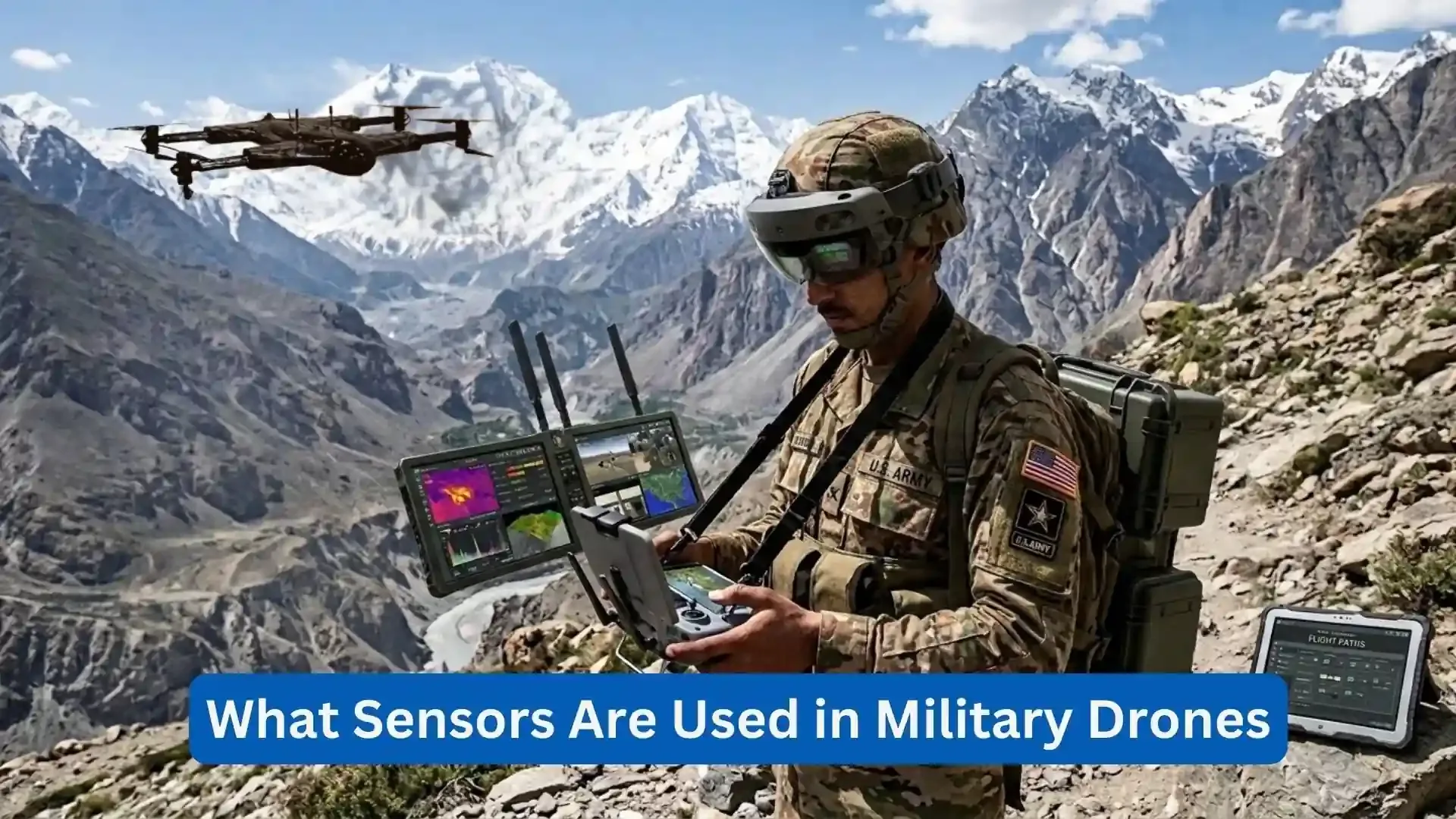
A drone's value is based on the data it can collect. Military drone payloads, including cameras, thermal sensors, LiDAR, radar, as well as multispectral systems, give UAVs different sensing capabilities for different missions.
In terms of supporting tasks, modern military drone sensors are proven to do the job. They support tasks just like mapping, inspection, search and rescue, and monitoring. Military UAV payloads can also combine multiple sensors, cameras, processors, and communications into flexible drone payload systems with UAV sensor payloads configured for specific missions.
This guide’s goal is to introduce you to the main types of payloads, how they work, how payload weight affects UAV performance, and what organizations should consider when selecting and integrating mission equipment.
What Are Military Drone Payloads?
A UAV payload is equipment carried by an unmanned aircraft that performs a specific function beyond the aircraft's basic flight systems. The payload may collect the imagery, measure the distance, detect if there’s heat, map terrain, monitor the environmental conditions, or support communications. In simple terms, the aircraft is the platform, and the payload, on the other hand, is the mission equipment.
Definition of a UAV Payload
A payload can be a single camera or a multi-sensor system, including thermal cameras, LiDAR, radar, and multispectral sensors. Its size depends on the UAV, with smaller platforms carrying a lightweight drone camera payload and larger aircraft supporting multiple sensors.
Payload vs Built-In Drone Systems
Not every UAV component is a payload. It’s important that you consider that mission payloads are added for specific tasks. Additionally, motors, batteries, flight controllers, and navigation systems are part of the aircraft. Think, for example, of an EO/IR camera mounted on a UAV, it can serve as a mission payload for aerial imaging.
How Payloads Expand UAV Capabilities
Payloads let one UAV handle different missions. The camera's role is to capture detailed imagery, thermal sensors detect heat, LiDAR creates 3D data, and radar basically supports the sensing in limited visibility. Flexibility is the one that makes military drone payloads useful for changing missions and varied data needs.
Types of Payloads Used on Military UAVs
Common payload categories include:
EO and IR cameras
Thermal imaging systems
Multispectral sensors
Hyperspectral sensors
LiDAR
Radar and SAR
Communications equipment
Environmental sensors
Mapping and surveying systems
The correct choice depends on the information required rather than simply choosing the most advanced sensor available.
What Sensors Are Used in Military Drones?
The term military UAV sensors covers a wide range of technologies. Each sensor captures a different part of the physical environment.
Electro-Optical (EO) Sensors
Electro-optical sensors function by capturing the visible-light images and video for projects like inspection, mapping, and especially situational awareness. Many include the zoom as well as the stabilization features.
Infrared (IR) Sensors
Infrared sensors are the ones that detect the wavelengths beyond the visible light. Revealing infrared differences is infrared sensors’ role that complements optical cameras since standard cameras cannot see these differences.
Thermal Imaging Cameras
Thermal cameras detect heat rather than visible light. They can identify heat sources, support inspections, and provide useful imagery in low-light conditions.
Multispectral Sensors
Multispectral drone sensors are responsible for capturing information across selected bands of the electromagnetic spectrum. Through this, they can reveal the differences that are not obvious in standard RGB imagery. The applications can include analyzing vegetation, monitoring the environment, assessing the terrain, and infrastructure inspection.
LiDAR Sensors
A LiDAR system uses laser pulses to measure distances and construct detailed three-dimensional representations of an area. A LiDAR drone payload has the capability to support terrain mapping, vegetation analysis, measuring infrastructure, and 3D modeling.
Radar Sensors
Radar uses radio waves to detect and measure objects or surfaces. It can provide useful data in conditions where optical cameras are limited by darkness or clouds
Environmental and Positioning Sensors
These sensors track altitude, position, movement, temperature, and other conditions. They’re helpful to the UAV to navigate and monitor its operating environment.
EO/IR Payloads for Military UAVs
An EO/IR payload combines electro-optical and infrared imaging in one system, giving operators complementary imagery from the same aircraft. An EO IR drone camera supports visible and infrared imaging, making drone sensor systems more flexible for both daytime and low-light operations. Thermal imaging is also helpful in detecting the sources of heat, people, and equipment, making a thermal camera drone payload a useful thing to go along with optical cameras.
A UAV camera payload can encompass high-resolution imaging, optical zoom, and stabilized gimbals for clearer aerial footage. These are considered valuable especially in military drone cameras, where stable imagery is needed during a flight or hovering. Some systems are also support real-time onboard processing, reducing transmitted data and helping operators receive useful information faster.
Thermal Imaging in Drone Payload Systems
Thermal imaging provides information that conventional cameras cannot. Thermal drone cameras are useful because they detect infrared radiation as well as convert the heat differences into images. They are used especially in inspections, searches, and monitoring the environment. Additionally, they operate in low-light and nighttime conditions because they detect heat rather than visible light.
Thermal imaging can be affected by smoke, dust, vegetation, and weather, that’s why combining it with optical imaging can provide a better context. Using both data sources gives the operators a more complete view as well as it shows why drone surveillance sensors are increasingly designed to work together.
Multispectral & Hyperspectral Sensors for Military UAVs
Multispectral and hyperspectral imaging extend aerial sensing beyond conventional RGB photography.
What Is Multispectral Drone Imaging?
Multispectral imaging captures data from several defined spectral bands. Each band can provide information regarding the different properties of surfaces, vegetation, materials, or conditions of an environment.
Multispectral vs Standard RGB Cameras
An RGB camera primarily captures red, green, and blue visible-light information. A multispectral system captures the additional wavelengths. This can make certain differences easier to identify and analyze. UAV imaging sensors can provide information for applications involving terrain, vegetation, environmental conditions, and material differences that standard photographs cannot.
What Is Hyperspectral Imaging?
Hyperspectral imaging is the one that captures data across many narrow spectral bands. It reveals details that the standard cameras may not see. Hyperspectral imaging drones use this technology for a detailed environmental analysis, as well as both agricultural analysis and surface analysis.
Detecting Environmental and Surface Differences
Spectral data can reveal changes in vegetation, moisture, and surface composition, providing more than basic visual information.
Combining Spectral Data with Other UAV Sensors
It’s important to remember that multispectral data can be combined with optical, thermal, or LiDAR sensors in order to provide a more complete view of terrain and environmental conditions.
LiDAR Payloads for Military UAVs
LiDAR provides precise distance measurements using laser pulses.
How Drone LiDAR Works
A LiDAR system sends laser pulses toward the ground or an object as well as measures how long the reflected signals take to return. The resulting measurement can be assembled into point clouds and three-dimensional models.
Creating High-Resolution 3D Terrain Models
A UAV equipped with LiDAR can collect large amounts of elevation at the same time, flying over an area. Then, the information can be processed into terrain models, maps, as well as other 3D representations.
LiDAR for Complex Terrain
LiDAR can be useful for areas where understanding both the elevation and structure is important. Vegetation, slopes, infrastructure, and terrain features can all be represented inside of a three-dimensional dataset.
LiDAR Point Clouds and Mapping Data
The output of LiDAR is often represented as a point cloud. Each point contains spatial information that can be used to build a model of the environment that’s already been surveyed, making LiDAR valuable for both mapping as well as measurement applications.
LiDAR vs Camera-Based Drone Sensors
A camera records visual information. On the other hand, LiDAR primarily measures the distance. A camera may provide more recognizable imagery, while LiDAR can provide highly useful geometric information. These technologies are complementary instead of being direct substitutes.
Radar & SAR Payloads for Military Drones
Radar introduces another sensing method based on radio-frequency energy.
What Is a Radar Drone Payload?
Radar payload both uses radio waves as well as analyzes their reflections just to detect and measure objects or surfaces. IT can range from a compact sensor to a more advanced system that requires greater power and processing based on its design.
Synthetic Aperture Radar (SAR)
Synthetic aperture radar uses the UAV’s movement to create detailed radar imagery. A SAR drone payload can provide imaging capabilities that substantially differ from both optical and thermal cameras.
Imaging Through Clouds and Poor Visibility
One major advantage of radar is that some radar frequencies can operate through conditions that can interfere with optical imaging. This can make radar useful for persistent mapping and monitoring when cloud cover or darkness limits conventional cameras.
Radar vs EO/IR Sensors
EO/IR systems are the general provider of imagery that is easier for humans to interpret visually. Radar provides a different type of information as well as offer advantages in certain weather and visibility conditions. The choice should therefore be based on the requirements of a mission rather than expecting that a single sensor is universally better.
Advantages and Limitations of SAR Payloads
SAR can provide valuable information in challenging visibility conditions, but radar systems can be heavier, more power-intensive, and more complex than conventional cameras. Payload size and aircraft capacity therefore remain important considerations.
Modular Payload Systems for Military Drones
A modular drone payload allows operators to do three things: to attach, to remove, or to replace the equipment without having the need to redesign the aircraft. This is important since it enables the same UAV to use different cameras and sensors, such as optical, thermal, or LiDAR systems, depending on the mission. A modular UAV payload has the ability to improve flexibility while at the same time, reducing the need for multiple specialized UAVs. Multi-payload compatibility can also simplify the logistics, maintenance, training, as well as the upgrades. However, its feasibility is still dependent on the payload capacity, electrical interfaces, software compatibility, mounting, and the performance of a flight.
How Military Drone Payloads Support Different Missions
Payloads should always be selected according to the information a mission requires.
· Terrain and Infrastructure Assessment: For terrain assessment and infrastructure assessment, optical cameras, LiDAR, and multispectral equipment can assist by creating detailed information regarding both the terrain and infrastructure. High-resolution imagery can document structures, while LiDAR can provide measurements and 3D data.
· Search and Rescue Support: In supporting search and rescue, thermal cameras can help in identifying the heat differences as well as support searches across large areas. Additionally, Optical cameras can provide visual confirmation and context.
· Environmental Monitoring: Multispectral and thermal sensors can provide information about vegetation, surface conditions, water, and other environmental characteristics.
· Communications Support: It’s important to remember that UAVs can carry communications equipment designed in order to extend the connectivity or relay information.The payload in this case is not primarily an imaging sensor but a communications system.
· Mapping and 3D Modeling: LiDAR and high-resolution cameras can support mapping workflows. Photogrammetry can use overlapping photographs to construct maps and 3D models, while LiDAR directly measures distances to produce spatial data.
· Post-Mission Data Collection: Not every payload needs to provide information in real time. Some missions prioritize collecting large datasets that can be processed later for detailed analysis. This distinction is important when determining storage, processing, communications, and battery requirements.
Sensor Fusion in Military UAV Payload Systems
Sensor fusion plays an important role by combining data from multiple sensors to provide a more complete picture. UAV sensor payloads have the power to combine optical, thermal, EO/IR, and LiDAR data in order to improve situational awareness. Take these as examples, cameras do provide visual details, thermal sensors are the ones that detect heat, and LiDAR provides the accurate spatial measurements for both mapping and inspection.
AI can help both process and classify any large amounts of multi-sensor data, but output quality still depends on accurate and properly calibrated sensors. Do note that combining different data sources can improve the accuracy by providing complementary information, while at the same time, real-time onboard processing can reduce the transmission requirements and deliver more useful information faster.
AI & Edge Computing for Drone Sensor Payloads
AI and edge computing are improving how UAV sensor data is processed. Computer vision can analyze aerial imagery in order to identify the patterns, classify objects, detect changes, and flag areas for review. Automated recognition of an object reduces the manual image analysis, while AI can process the sensor data in real time in order to support both faster alerts and more efficient workflows.
Edge computing processes data closer to the UAV and its sensors instead of just relying entirely on remote servers. This can reduce the latency, bandwidth use, and the amount of raw data that are transmitted, especially for high-resolution imagery and video. The systems in the future may also make use of AI to adjust sensors that are based on the mission conditions, depending on the platform, software, regulations, as well as the operational needs.
How Payload Weight Affects Military Drone Performance
Payload selection is always a trade-off.
Understanding UAV Payload Capacity
Every aircraft has a maximum payload capacity. This includes the weight of the camera, sensor, gimbal, mounting hardware, cables, and other mission equipment.
Payload Weight vs Flight Time
It’s important to consider that when a payload’s heavier, it puts more strain on the aircraft and it also requires more power in order to retain airborne. When payload weight increases, the flight time can drop, it depends on the propulsion system of a drone as well as its battery capacity.
Payload Weight vs Operational Range
Additional weight can also influence how efficiently an aircraft travels.For long-range operations, payload weight must therefore be considered alongside battery capacity and flight profile.
Power Consumption of Advanced Sensors
Some sensors require considerably more electrical power than basic cameras. Radar, high-performance processing systems, and certain advanced imaging payloads can place additional demands on the aircraft's power system.
Aerodynamic Effects of Payload Systems
The physical shape as well as the placement of a payload can influence the stability of both the airflow and aircraft. Remember that a poorly integrated payload can create drag, affect balance, or interfere with other components.
Balancing Sensor Capability and UAV Performance
In choosing the best choice, you must remember that the most advanced sensor is not automatically the best choice. A smaller sensor that meets the requirements of a mission may be more useful compared to a heavier system that significantly reduces endurance.
Fixed vs Modular Military Drone Payloads
Fixed payload systems are integrated permanently into the UAV. This makes them both simpler to operate and calibrate considering that the aircraft is built around a specific sensor. As a contrast, modular payload systems allow the sensors as well as the cameras to be swapped. This is important since it gives the operators more flexibility when there are changes in mission requirements.
On the other hand, interchangeable drone payloads can support different tasks, just like using one setup for mapping and another for thermal inspection. However, modular systems need compatible mechanical, electrical, and software interfaces; at the same time, fixed systems generally offer simpler integration and maintenance.
How to Choose the Right Sensor Payload for a UAV
Choosing a payload should begin with the mission rather than the technology.
· Define the Mission Requirements: You should identify the information that’s needed in the mission.
· Determine Required Sensor Type: Match the sensor to the task, such as LiDAR, thermal, or multispectral imaging.
· Check Payload Weight and Capacity: You must ensure that the aircraft can carry the full payload safely.
· Consider Flight Time and Range: Account for how payload weight affects endurance.
· Evaluate Resolution and Data Quality: It’s important that you choose the resolution that’s needed for the mission.
· Check Environmental Requirements: Ensure that the payload can handle operating conditions.
· Consider Software and AI Integration: Confirm the compatibility with the onboard systems.
· Assess Payload Interoperability: UAV sensor integration is in need of compatible mounts, connections, software, as well as data formats.
Challenges of Military UAV Payload Integration
Adding a sensor to a UAV involves more than simply mounting hardware.
Payload Weight Limitations: Excess weight can reduce flight performance and endurance.
Power Consumption: Sensors and processors must fit within the aircraft’s power budget.
Sensor Calibration: Proper calibration is essential for accurate and reliable data.
Vibration and Image Stabilization: Vibration can affect image quality and sensor accuracy.
Data Storage and Processing: High-resolution sensors require sufficient storage and processing capacity.
Environmental Conditions: Payloads must withstand the conditions of the mission.
Hardware and Software Compatibility: Drone payload integration requires the payload and aircraft to communicate and operate together properly.
Future Trends in Military Drone Sensors & Payload Technology
Payload technology is moving toward smaller, smarter, and more integrated systems.
· Smaller and Lighter Sensor Payloads: Sensor manufacturers are still continuing to focus on lessening both the size and weight, at the same time, maintaining a useful performance. This is important as it can allow smaller UAVs to carry capabilities that previously required larger aircraft.
· AI-Powered Multi-Sensor Systems: AI can help combine information from multiple sensors and identify relevant patterns.
· Advanced Sensor Fusion: The coming platforms in the future are likely to combine optical, thermal, LiDAR, radar, and spectral information more efficiently.
· Edge AI Processing: Onboard processing of information can lessen the latency as well as limit the amount of the raw data that needs to be transmitted.
· Higher-Resolution EO/IR Systems
· Improvements in optical as well as infrared technology are expected to continue increasing both the image quality and detection capabilities.
· Smart Modular Payloads: Future mission specific drone payloads may become increasingly software-defined and interchangeable, allowing operators to adapt aircraft configurations more efficiently.
· Multi-Mission Autonomous UAV Platforms: Instead of designing one aircraft for one task, organizations can use flexible platforms that support multiple mission configurations.
ZenaDrone 1000: A Multi-Payload UAV Platform for Mission-Specific Operations
The ZenaDrone 1000 is a multi-purpose UAV that’s useful enough to perform inspection, monitoring, scanning, and data collection. It’s reliable because it features AI, autonomous flight, 4K imaging, multispectral sensors, LiDAR, as well as a universal attachment adapter.
Modular Payload Capabilities of the ZenaDrone 1000
Its detachable components support mission specific drone payloads, allowing configurations to match different operational needs.
Camera and Sensor Integration
The platform combines 4K imaging, multispectral sensors, telemetry, 360-degree LiDAR, and stabilized imaging for flexible data collection.
Thermal, Multispectral & LiDAR Payload Compatibility
The ZenaDrone 1000 can be equipped with thermal imaging, LiDAR, and multispectral sensors. Effective UAV payload integration requires the right sensor, capacity, and compatibility.
Autonomous Flight and AI-Assisted Data Collection
AI and machine learning support autonomous flight and pre-planned routes for consistent inspection, monitoring, and scanning.
Payload Capacity, Flight Performance & Mission Flexibility
The performance of military drone payloads depends on balancing sensor capability, weight, power use, and flight endurance. ZenaTech states that the ZenaDrone 1000 can carry up to 40 kg of payload and fly for up to 1 hour, depending on configuration and operating conditions.
Configuring the ZenaDrone 1000 for Different Operational Requirements
Different missions require different sensors. LiDAR suits mapping, while multispectral and thermal sensors can support surveillance, inspection, and environmental assessment.
Conclusion
The right payload helps a UAV in collecting the data that a mission needs. For organizations that are evaluating military UAV payloads, the modular systems can combine cameras, thermal sensors, LiDAR, radar, and the multispectral equipment while at the same time, balancing the weight, power, endurance, and also quality of the data. ZenaDrone 1000 supports configurable capabilities as well as 4K imaging, multispectral sensing, LiDAR, autonomous flight, and the AI-assisted operations.
As UAV technology advances, military drone payloads are becoming more flexible and connected. That’s why choosing the right drone payload systems and UAV sensor payloads starts with the mission first, and then, followed by a proper drone payload integration in order to ensure both the aircraft and sensors are working well together and effectively.
Frequently Asked Questions About Military Drone Payloads
What is a military drone payload?
Mission equipment carried by a UAV, such as cameras, thermal sensors, LiDAR, radar, or multispectral systems.
What payloads are used on military drones?
Common payloads include EO/IR cameras, thermal sensors, LiDAR, radar, multispectral sensors, and communications equipment.
What sensors are commonly used in military UAVs?
Common military drone sensors include EO, IR, thermal, LiDAR, radar, multispectral, and positioning sensors.
What is an EO/IR drone payload?
It combines electro-optical and infrared cameras to provide both visual and infrared imagery.
Can military drones carry thermal cameras?
Yes, if the UAV has enough payload capacity, power, and compatible mounting and software systems.
What is a modular UAV payload?
A payload that can be changed or replaced to suit different mission requirements.
How does payload weight affect drone flight time?
Heavier payloads typically increase power consumption, reducing flight time and potentially range.
What is the difference between LiDAR and radar drone payloads?
LiDAR uses laser pulses for distance and 3D mapping, while radar uses radio waves for sensing and imaging.
How does sensor fusion work on a UAV?
It combines data from multiple sensors, such as optical, thermal, and LiDAR, for a more complete picture.
Can one drone carry multiple sensors?
Yes, provided the UAV has enough payload capacity, power, space, and compatible interfaces.
How are AI systems used with drone payloads?
AI can process sensor data, identify patterns, classify objects, and support faster analysis.
How do you choose the right payload for a UAV?
Match the sensor to the mission, then consider weight, power, resolution, endurance, environment, and compatibility.
Contact Us