


 Deutsch
 Português
Drone Photography Pricing: How Much Does It Cost in 2026?
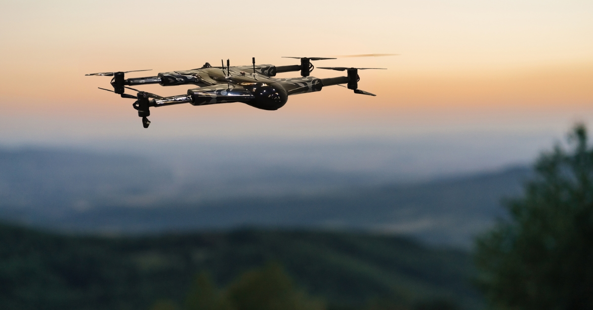
Drone photography pricing in the U.S. can range from a few hundred dollars for a straightforward property shoot to several thousand dollars for complex commercial projects. The final cost depends on the type of project, location, flight requirements, deliverables, editing, equipment, and usage rights.
For standard residential real estate, a drone photography package often falls around $150 to $400 per shoot in 2026. Commercial photography, construction documentation, events, and cinematic productions can cost significantly more because they require additional planning, flight time, equipment, editing, or specialized deliverables.
Understanding these differences makes it easier for clients to compare quotes and helps drone photographers build rates that reflect the actual work involved.
What is Drone Photography Pricing at a Glance?
There is no universal rate for professional aerial photography. However, current U.S. market benchmarks provide a useful starting point:
Drone Photography Service | Typical 2026 Price Range | Common Pricing Method |
Residential real estate | $150–$400 | Per property/shoot |
Commercial/luxury real estate | $400–$1,200+ | Per project |
Construction progress photography | $250–$600+ | Per visit |
Wedding and event coverage | $300–$1,500+ | Package/project |
Commercial and brand photography | $1,000–$3,500+ | Half-day/project |
General commercial day rate | $1,200–$2,500+ | Per day |
Drone photo and video | $500–$1,200+ | Half-day/project |
These figures should be treated as market benchmarks rather than fixed prices. Current 2026 pricing guides show substantial variation based on location, deliverables, experience, equipment, and project complexity.
How Much Does Drone Photography Cost?
The cost of drone photography depends heavily on what the client needs.
A simple residential property shoot may require less than an hour on location and basic image processing. A commercial shoot may involve site planning, multiple flights, advanced editing, additional personnel, specialized equipment, and broader image-usage rights.
This is why two projects that require similar flight times can have very different prices.
Drone photographers generally use one of four pricing methods:
Per project or shoot
Hourly rates
Half-day or full-day rates
Fixed packages
For predictable assignments such as residential real estate, package pricing is common. Larger commercial projects are more likely to receive a custom quote.
Average Drone Photography Cost Per Project
Small drone photography projects commonly start in the low hundreds of dollars. Current 2026 U.S. pricing references place many residential aerial photography shoots between $150 and $400.
Commercial assignments can start around several hundred dollars and move into four figures depending on the scope.
The project price may include:
Pre-flight planning
Travel within a specified area
On-site flight operations
A defined number of aerial photographs
Basic image correction
File processing
Digital delivery
Additional services can increase the total cost.
Average Cost of Drone Photography Per Hour
Some drone photographers charge hourly rates, particularly for events or assignments where the required coverage time is difficult to predict.
Current market references commonly show professional drone photography around $100 to $250 per hour for certain assignments. However, an hourly quote may not include travel, advanced editing, specialized equipment, or licensing.
For this reason, clients should compare complete deliverables rather than hourly rates alone.
Half-Day and Full-Day Drone Rates
Half-day and full-day pricing is more common for commercial productions, large properties, marketing campaigns, and projects requiring extensive coverage.
A half-day photo-only assignment can start at several hundred dollars, while mixed photo-and-video work can exceed $1,000. Broad commercial full-day rates can reach $1,200 to $2,500 or more, depending on the production requirements.
Drone Photography Prices by Services
The purpose of a drone flight has a major impact on price. A residential listing, real estate construction site, wedding venue, and national advertising campaign require very different workflows.
1. Real Estate Drone Photography Pricing
One of the most common businesses involves taking drone shots of commercial properties. Aerial photography isn’t just the best way to showcase properties and their locations. To increase the chances of landing a client, best drones for real estate is a requirement.
According to the US Bureau of Labor Statistics in May 2026, the median hourly wage for photographers was $19.60. The median wage is the point at which half the workers in an occupation earned more than that amount and half earned less. Here’s a breakdown:
Lowest 10%: Earned less than $13.71 per hour
Highest 10%: Earned more than $46.03 per hour
2. Industry-Specific Earnings
For photographers in various industries, here are the median hourly wages: Photographic Services: $17.70 per hour
Here is a sample breakdown you can change as needed:
Up to 2,000 square feet: $150 - $250
2,001 to 4,000 square feet: $251 - $350
4,001 to 6,000 square feet: $351 - 450
Over 6,000 feet: $450 - $600
Work Schedules and Flexibility
Many photographers enjoy the flexibility of part-time work. This flexibility allows them to meet with current and potential clients or visit various work sites. It's important to note that workloads can fluctuate, especially for photographers specializing in seasonal events. For instance:
Wedding Photographers: Typically busiest during the summer and fall
3. Wedding Drone Photography Cost
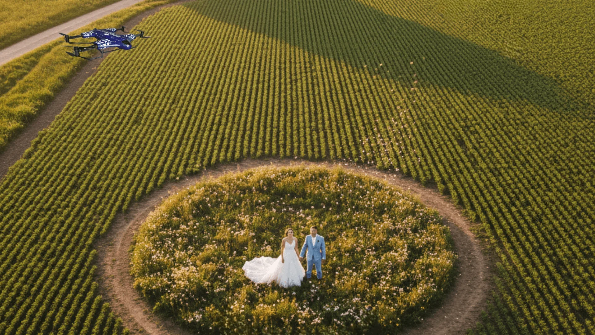
Drones can shoot amazing footage for weddings. Wide shots show off the venue and the bridal gown in ways that standard photography may struggle with.
That said, with wedding photography, you need to be handy with photo and video editing. The good news is these tools are also readily available for novice and experienced pilots.
Here is a sample price breakdown that you can adjust if needed:
Full-day Coverage: $700 - $1,000
Half-day Coverage: $400 - $700
Highlight Video: $200 - $500
4. Construction Progress Drone Photography Pricing
Nowadays, drone photography is considered a norm for the Architecture and construction industry. Showing off photo and video footage of ongoing construction projects is the first part of aerial photography.
Aside from pre-planning and ribbon-cutting, drones can cover more ground during inspections. They can collect and analyze real-time data for managers and stakeholders to access from anywhere in the world.
Here is a sample hourly rate breakdown you can adjust as needed:
Up to 1 hour: $70 - $250
1 hour to 4 hours: $280 - $1000
4 hours to 8 hours: $560 - $2000
5. Agriculture Drone Photography Pricing
Aerial drone photography services in agriculture are well-established. They not only take high-resolution photos and videos but also see use in precision mapping and surveying.
If you’re interested in landing clients from the agriculture sector, here is a sample price breakdown you can adjust:
Basic aerial mapping: Basic aerial mapping, which covers basic visual assessment, can range between $300 to $1,000 per flight.
Advanced aerial mapping: Advanced mapping includes data analysis and specialized data products. This service can range between $1,000 to $1,300 per flight.
Basic crop monitoring: Basic crop monitoring services include capturing images for crop health assessment. This service can range between $500 to $1500 per flight, though it may vary based on the area.
Advanced crop monitoring: Advanced crop monitoring comes with data analysis. Including NDVI mapping and disease detection, the service can range between $1,500 and $5,000 per flight.
What Affects Drone Photography Pricing?
A headline price rarely tells the entire story. Several factors determine the final cost of professional drone photography.
Location
Location costs include fuel and travel time, which can easily add up. As a result, destination weddings, like beach weddings, can be more expensive compared to other locations.
Pricing by Experience
Drone photographers are likely to charge more based on their level of experience. An extensive portfolio helps them convey their expertise in drone photography, videography, and post-production.
Here’s a sample breakdown of hourly and day rate estimates according to professional drone pilots that you can adjust later:
Equipment
Complex projects need more specialized equipment. Equipping gimbals for mounted cameras or special attachments may add to the hourly and daily rate.
On top of that commercial drone photography rates vary depending on the drone. Higher-end drones come with higher-end cameras, which can justify the price tag.
Duration
Costs run higher the longer events take. This has to do with running multiple drone flights, which means extra batteries and most importantly, labor cost
Post-production and Editing
After the initial flights, then comes post-production and editing. For wedding or real estate photography, you may need to be handy with photo and video editing.
However, for industries like agriculture, you may also need to work with specialized software. These can include handling mapping software for 3D mapping to data analysis.
What are the Hidden Costs of Drone Photography?
The drone itself isn’t the only cost to consider when setting up a pricing plan for your drone business. According to drone professional pilots and enthusiasts, here are a few extras you need to factor in:
Software Subscriptions
Editing and post-production software should be a hidden cost worth considering for beginner drone photographers. Beyond basic color correction, many commercial property shoots require professional post-production, where a clipping path service provider can help with background removal, property cutouts, and creating polished marketing materials from aerial images.
For the most part, photo and video editing is readily available and can be rather intuitive. Drone mapping software is also readily available online but can be a little trickier to navigate.
Licensing & Regulations
In each country, certain rules govern when and where to register the drone. In the case of the US, one can register with the FAA official. Moreover, in the case of each drone, you would be charged only $5. However, you can then fly the drone legally for the next few years.
For commercial drone photography, pilots also need to obtain a remote pilot certificate. They also need to follow Part 107 regulations. This means they need to fly within line of sight during daylight hours below 400 feet.
Insurance & Safety
Most of the time, while operating drones, you might face the risk of crashing them and damaging them at the same time. There is always an element of uncertainty regarding accidents, and bad weather can cause the drones to crash at anytime. Staying insured might make you pay more but secures you in the long run.
Repairs & Spare Parts
Drones have good durability, but they will damage after all. In the commercial drone photography business, the job gets really tough here. Here, you have to fly the drone in really harsh weather many times, risking it to pressure and getting damaged.
Here is a list of drone parts that you should have spares for:
Landing Gear: Landing gear keeps the drone upright and prevents the propellers from touching the ground.
Spare Propellers: Damaged propellers can make a drone unstable.
Neutral Density Filters: Neutral filters limit the amount of light from reaching your sensors, which lets you film at slower shutter speeds.
Memory Card: Back-ups matter more than you think! When your data storage is full, you can’t take any more pictures or videos.
Carry Case: Depending on the size of the drone, a durable carry case protects it during transport.
Spare Batteries: Spare batteries can save you plenty of time and help you stay airborne longer.
What to Consider When Taking Drone Photos
Drones are incredibly fast. They are also much cheaper compared to planes and helicopters. Simply having an affordable flying camera not only saves so much on expenses but also allows photographers to explore new opportunities.
When taking drone shots, keep the following in mind to ensure the best results every time:
Familiarize Your Drone
Before you start your aerial photography business, you, of course, need to possess the most important thing of all – your drone and learn all of its intricacies and capabilities.
To begin with, getting the hang of your drone and its functions and features is highly important. You will not be able to capture stunning footage without them. So, thoroughly study the relevant user manual and fly it to test the controls and settings.
Study the Work of Experts
All the best drone pilots learn from the best ones that came before them. So, studying the works of the world’s best professional photographers will be useful for you in the long run.
Use the Best Lighting to Your Advantage
Like with standard photography, lighting can make or break drone photography. Take advantage of sunrises or diffused light, or take advantage of overhead shots on cloudy days. Taking pictures by twilight can also yield great results.
Composition
Patterns and lines in drone photography have the same effect as in standard photography. Engaging patterns and lines can be found everywhere, from rivers to farm fields. When utilized well, they make for captivating shots.
Plan Your Shoots Well
Despite various advances in drone technology, they still have a limited flight time. Planning your flight routes to take advantage of the best shots efficiently is crucial. When it comes to aerial photography, maps are your best friend. They can help you see the shape of the terrain and can provide great ideas for aerial subjects.
Drone Data Files & Formats
If you want to expand aerial drone photography service, drone mapping is a great thing to add to your repertoire. Many industries, such as construction, need drone data to make maps for various project phases.
When it comes to drone mapping, it’s important to know the different industry-standard formats when delivering data. Having the right format ensures that clients can readily use or integrate it with other software tools.
Here are a few of the most popular drone data export formats you should be familiar with:
Point Cloud
Point cloud maps are a collection of points in 3D space, often used for representing external surfaces of buildings. They are great for providing accurate models of real-world geometry.
Point cloud maps have two types of file formats:
xyz: A simple format for recording points in 3D space
las: A file format designed to interchange and archive LiDAR data
Digital Elevation Models (DEM)
Otherwise known as 2D elevation models, digital elevation models are heat maps where different colors represent different elevations. They are great tools for analyzing the Earth’s surface in a two-dimensional format.
These elevation maps often come in the following file formats:
kml: The format used in Google Earth for showing geographic data
tiff: A lossless file format used for storing high-quality image files before editing
Orthomosaics & Thermal Maps
Commercial drone photography also covers taking extensive pictures for creating maps. 2D orthomosaics are simply top-down, scale-corrected maps that provide a birds’-eye view of a site. The same goes for thermal maps.
They typically have two file formats:
kml: The format used in Google Earth for showing geographic data
tiff: A lossless file format used for storing high-quality image files before editing
Scaling Your Drone Photography Business?
Drone photographers, much like event photographers, make money by charging clients to shoot photos and videos. Now that you’ve decided your rates, it’s time to make your business official.
Here’s how you can get your beginner drone photography business airborne:
Create your Business Plan
Now that you’ve decided to start your own business, you need to know what resources you need. You also need to know how you can monetize your business.
When it comes to creating a business plan, consider the following:
Initial Expenses: A Part 107 prep course and drone license will set you back $300 and $160, respectively. Meanwhile, the drone itself will set you back at about $1,500 to $2,000 each.
Regular Expenses: Regular expenses include liability ($600 to $1,000) and hull ($500 to $750) insurance. Editing software (e.g. Adobe Premiere) and flight support software also run at around $15.99 and $300 yearly.
Landing Clients: Drone photographers can’t rely on repeat customers. To increase your chances, you need to pay close attention to marketing. You should also have your portfolio readily available for clients.
Choose a Business Structure
It’s important to start with a name early on when starting a business since names stick. Additionally, most states don’t allow businesses to use names that are already used.
Next, it’s important to choose your drone photography business structure carefully. Your choice between the following can affect many aspects of your b
Sole/General Proprietorship: Sole and general proprietorships are when a business is owned by one or multiple partners. They are fast, cheap, and easy to maintain, but owners are personally liable.
LLC: Limited liability companies are business entities that are considered legally separate from their owners. Owners are not personally liable but often incur more fees and formal requirements.
Whichever structure you pick, an LLC comes with one requirement the others skip. You need a registered agent with a physical address in your state to receive legal notices. Drone operators working from home often use a service to keep their home address off public records. Northwest's address privacy works that way, and the review covers what it costs.
Market & Promote Smartly
Once you’ve filed the necessary paperwork, it’s time to start promoting. You can either hire a professional or use a platform like WordPress or Medium.
You should also maintain a regular presence on social media. Having multiple platforms for your commercial drone photography business increases your visibility to potential clients.
What are the Other Applications for Drone Technology?
Drone photography isn’t the only application for drones. If you want to branch out your drone business, you should be open to expanding to different niches. By doing so, you offer more services and are more likely to land more clients.
Here are a few other applications for drones in industries:
1. Warehouse Drones
Offering warehousing and ineventory is a viable option for a few reasons. One is that drones are great at identifying QR codes on crates quickly without risking injuries. With pre-programmed flight routes, they can even work as security drones.
2. Weather Drones
Weather drones are useful for local weather stations in rural and agricultural areas. Their speed, relative affordability, and onboard sensors make them vital for delivering accurate local weather broadcasts in real-time.
3. Mining Drones
Warehouse drones are excellent at navigating tight spaces. The same can be said for using drones in the mining industry. Drones in mining are often used to monitor specific areas to ensure personnel safety at all times.
The Bottom Line
Drones give plenty of advantages that traditional photography can’t. Whether it’s for weddings, tourism ads, or real estate listings, well-placed drone shots provide that extra edge apart from competitors.In other industries, 3D mapping is also extremely valuable. The ability to collect images quickly in real-time means projects are completed much faster and with more accuracy.
Now is the perfect time to break into the market for drone photography, real estate, weddings, and other industries. By following this guide, you’ll be on your way to becoming a superstar drone pilot.
FAQ’s
How much does drone photography cost?
Professional drone photography in the U.S. often costs approximately $150 to $400 for a standard residential shoot, while commercial, video, construction, and specialized projects can cost substantially more.
How much do drone photographers charge per hour?
Some U.S. drone photographers charge approximately $100 to $250 per hour, although project and package pricing is also common. Editing, travel, specialized equipment, and commercial licensing may be separate.
How much does drone photography cost for real estate?
Standard residential real estate drone photography commonly falls around $150 to $350, with some packages reaching $400 or more. Adding video, twilight photography, larger properties, or additional services increases the total price.
How much should I charge for drone photography?
Calculate the full cost of planning, travel, flight operations, editing, equipment depreciation, insurance, software, marketing, and administration. Then add a sustainable profit margin. Market rates can provide context, but they should not replace your own cost calculation.
What is included in a drone photography package?
Packages commonly include a specified number of aerial photographs, flight operations, basic editing, and digital delivery. Premium packages may include video, advanced retouching, multiple locations, faster delivery, or additional licensing.
Why is commercial drone photography more expensive?
Commercial projects can require more planning, larger locations, specialized equipment, advanced post-production, multiple flights, additional personnel, and broader usage rights. These factors increase both production time and project complexity.
How much does drone videography cost?
Drone videography prices vary widely. Simple video add-ons may cost a few hundred dollars, while professionally edited commercial productions can cost $1,000 or several thousand dollars depending on scope.
Is drone photography profitable?
It can be profitable when pricing covers the complete cost of providing the service. Operators should account for equipment, travel, insurance, software, editing time, marketing, maintenance, and administrative work before setting rates.
Contact Us