


Drone with Thermal Camera Uses Benefits Prices and Services
Thermal drones use sensors that detect infrared radiation instead of visible light. A thermal imaging drone converts heat into clear visuals, revealing temperature differences across land, structures, equipment, or wildlife. With a drone thermal camera, operators see hidden issues that optical cameras miss, such as heat loss, overheating components, or warm-blooded animals under canopy. As drones with thermal imaging become more affordable, organizations across conservation, inspection, and public safety gain faster insights with less risk. That is why thermal drones now play a central role in modern field operations.
A drone with a thermal camera combines a thermal sensor and onboard software that maps infrared energy into a temperature image. Every object emits heat; the sensor reads that radiation and builds a thermal map. The resulting output from a thermal vision drone highlights hot
and cold zones, allowing teams to pinpoint hotspots, moisture intrusion, or living targets in seconds. This capability makes drone thermal vision essential for early problem detection, whether locating a missing person, spotting a hidden fire, or diagnosing energy loss in a facility. This makes drones with thermal imaging invaluable for identifying problems early, whether it’s a hidden fire risk, a missing person, or heat loss in a commercial facility. With the advancement in technology, affordability and accessibility are on the rise and more organizations are able to integrate this tool like the drone thermal camera.
Thermal Drone Sensors and Imaging Systems
A thermal sensor drone uses an infrared detector to translate invisible heat into electrical signals and color-coded images. Hot areas often appear yellow or red, while cooler surfaces render blue or purple. Output quality depends on sensor class. Entry-level thermal sensors for drones reveal general hot-cold patterns. Premium units deliver tighter temperature resolution and finer detail. In hazardous scenes, a drone with infrared camera thermal capabilities gives responders real-time awareness without exposure, making thermal imaging a safer, faster alternative to manual checks.
The result is dependent on the quality of the sensor to a great extent. The expensive sensors can display better detail and give accurate temperature measurements, whereas the entry-level ones can give a general idea of hot or cold areas. The selection of the appropriate option is based on the mission that is, whether it is wildlife tracking, fighting fires, industrial inspection or even the public safety operations. As an example, a drone with infrared camera thermal technology can give real-time feedback of a location that is too dangerous to ground crews, like a burning building or a zone with a chemical spill.
Types of Thermal Sensors
Uncooled Microbolometers
Light, cheap, and common. They are ideal for general inspection, agricultural inspection, and non-critical inspection.
Cooled Infrared Detectors
More costly and provide better resolution and sensitivity. They are preferred in defense, oil and gas and massive emergency operations.
For professionals who need both accuracy and range, the best drone with infrared and thermal surveillance system combines thermal imaging with visible-light cameras. This two-layered solution offers thermal information in addition to contextual images, hence simplifying the interpretation of locations and objects. As an example, a hot spot on a roof could be cross-confirmed with visual footage to determine whether it is a person, an animal, or equipment that is overheating.
Improvements in Imaging Systems
Precision is no longer the prerogative of the sensor. The use of AI-based software has become a part of numerous thermal sensor drones, allowing smarter image processing. Such systems are capable of automatically identifying human heat signatures or even identifying the population of wildlife. In search and rescue, this translates to quicker search of missing people in forests, mountains, or areas of disaster- ultimately saving lives.
With the development of technology, drones are getting smaller with more powerful sensors. The combination of portability, accuracy, and smartness makes thermal sensor drones for search and rescue operations not a fringe product anymore, but a regular asset in various business sectors. From small farms to international energy corporations, the right imaging system makes a drone a life-saving, cost-cutting, and decision-making giant.
Applications and Benefits of Thermal Drones
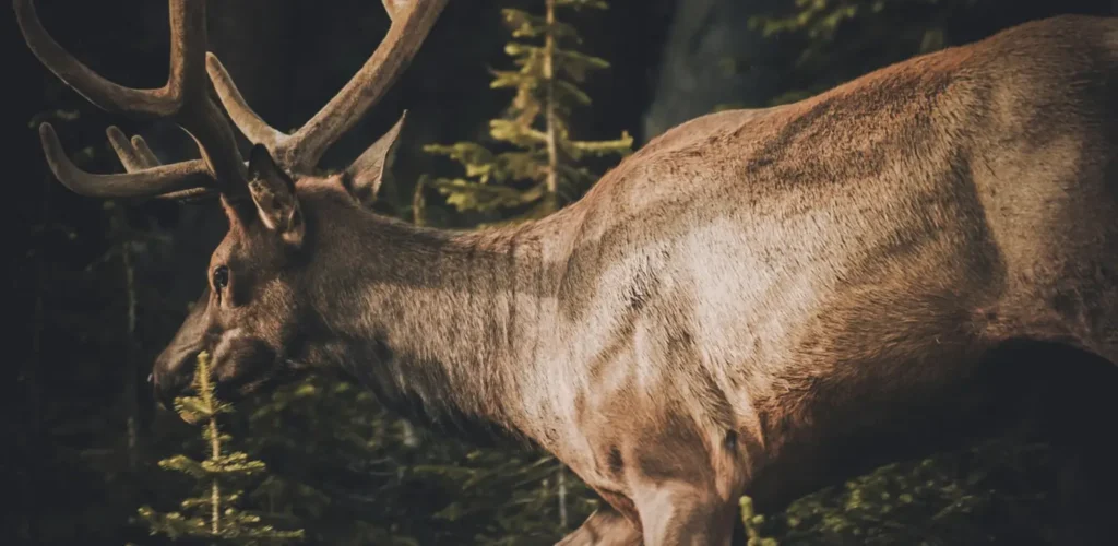
Wildlife & Deer Recovery
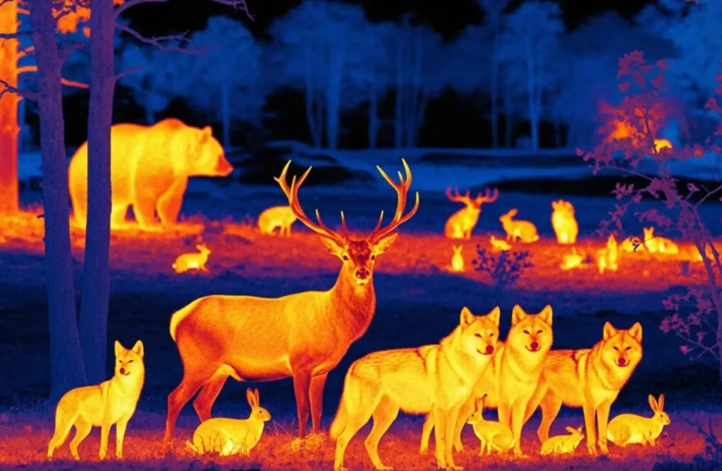
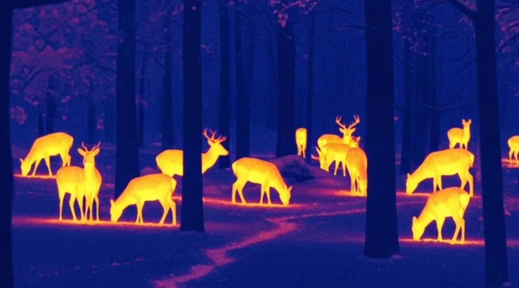
Using a thermal drone for deer recovery has transformed how hunters and wildlife conservationists locate injured or missing animals. Conventional search techniques depend on physical searches that may take several hours and, in most cases, cause disturbance to the environment. With a thermal drone deer recovery approach, operators quickly scan large areas, detecting heat signatures from deer hidden in brush or wooded areas. This lowers the pressure on animals, decreases the human influence on the ecosystems, and can save a lot of time.
Thermal drones are becoming more popular in conservation programs to recover deer populations in order to check the health of the population and minimize the cases of roadkill. Thermal technology assists in the identification of the living deer against the background, even in total darkness or in severe weather conditions. There is also an advantage to land owners, who can use this technology to defend crops against overgrazing. Thermal drones for deer recovery can help avoid missing any deer or animals by providing clear heat maps.
Hunters now seek the best thermal drone for deer recovery, which balances affordability with accuracy. GPS mapping and high-resolution sensors enable the game to be easily tracked and recovered ethically. Thermal drones can also be used to facilitate compliance with local hunting laws as they evolve to ensure efficient recovery without the need to cause disturbance over a long period of time. These drones provide a responsible means of improving deer management and a bridge between technology and tradition for professionals and hobbyists.
Hunting
Integrating a thermal drone for hunting provides a strategic advantage for spotting game that blends into its surroundings. These drones are used to identify the presence of heat, hence hunters can find animals that are hidden in the bushes or are operating at night. Thermal drones used to hunt do not make a lot of noise, so unlike spotlights or noisy ground patrols, they can cover large areas in a short period, which reduces the likelihood of spooking wildlife. The accuracy of thermal sensors also assists hunters in saving time on non-target animals.
In regions with strict hunting regulations, thermal drone hunting can support legal and ethical practices. Hunters can also use drones to find shot wildlife and retrieve it humanely. Drones meet the current standards of responsible hunting by not subjecting animals to long-term suffering. Another advantage is that they mitigate the risk to safety because they can see other hunters or predators around them.
The best thermal drones for hunting combine thermal imaging with GPS features, providing maps of animal movement patterns. Such lessons can guide future hunting efforts and still ensure conservation ambitions are achieved. Nevertheless, thermal drone hunting operations should be conducted responsibly because the laws are different in different places, and misuse may result in punishment. Ethically, thermal drones for hunting are safer, more efficient, and more accurate.
Public Safety and Rescue Operations
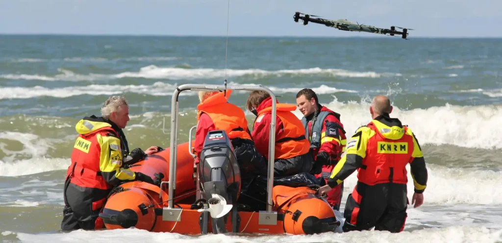
A search and rescue thermal drone is one of the most impactful applications of this technology. Emergency teams employ them to locate lost hikers, accident victims, and survey hazardous conditions following natural disasters. Drones identify people very fast by detecting heat, even in utter darkness, dense smoke, or rubble. This technology saves much time that would be required during rescue missions, and this can save lives.
First responders are adopting thermal drone search and rescue strategies to enhance coordination. An example of this is in the use of drones by firefighters who identify hotspots in burning buildings and direct crews to areas of priority. The police use them to do surveillance in critical events, so that the officers could not be subjected to unnecessary risks. The thermal imaging and the bird-eye view enables the teams to make knowledgeable and quick decisions.
Thermal drones can be used in the flood zones, earthquake areas, and collapsed buildings as well. Portable, lightweight units may be deployed within minutes and can cover an area that would be inaccessible on foot. In addition to immediate rescue, thermal drones can be used to aid the analysis of operations after the operation, and thus enable the teams to respond better in the future. To public safety organizations, the tools are no longer a luxury- they are becoming essential in every mission.
Surveys and Inspections
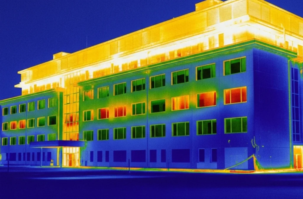
A drone thermal survey is increasingly used in industries like construction, energy, and agriculture. Compared to traditional surveys, thermal imaging exposes hidden structural issues, heat loss or faulty electrical systems. Drones can facilitate inspection of a broad range of locations within a reduced time compared to the time required by the inspector to climb structures and reach hazardous sites. This makes the surveys less expensive, risky, and time consuming to business.
Thermal drone surveys are utilized by environmentalists to monitor the situation on the land and assess ecosystems. As an example, researchers performing a thermal drone survey of wildlife in Texas can follow the activity of species without disrupting any habitat. Scientists possess accurate and noninvasive data since they are able to detect nocturnal creatures or species at risk. Through these lessons, conservation work can be directed, and organizations can be helped to comply with environmental regulations.
Thermal imaging drones detect insulation holes, water, and energy wastage in property management. It is advantageous to land owners and facility managers because it lowers the long-term expenditures and improves sustainability. Drones are able to provide actionable information that cannot be captured by the traditional inspections since they can capture detailed heat maps. Within an urban or rural setting, thermal imaging may be employed to add a second level of intelligence to surveys and it is an invaluable component of modern operations.

New vs Used Thermal Drone Prices, Availability & Services
When exploring thermal drones for sale, buyers will notice significant differences between new and used models.
New Drones
- Come with warranties
- Manufacturer support
- Latest imaging technology.
They are perfect for those businesses or professionals that require reliability and advanced features.
Used Thermal Drone
- Offer cost savings
- Outdated sensors
- Reduced flight time
- Lack of after-sales service.
When buying second-hand equipment, great care must be exercised and the seller must be trusted.
Choosing between new and used thermal drones for sale depends largely on the intended application. New units can be worth the investment where the mission-critical activity, such as search and rescue, is involved. Nonetheless, a second-hand drone can provide good performance as long as it is used in training or when conducting small-scale agricultural surveillance. Buyers must consider operational requirements, budget, and risk tolerance before deciding.
Pricing Breakdown
Understanding the drone with thermal camera price requires looking beyond the sticker cost. Such aspects as sensor resolution, camera range, payload capacity, and brand reputation have a role to play. The buyers are supposed to not only compare the initial costs, but also the long-term value, which includes training, software upgrades, and maintenance. The simplified breakdown of the typical market prices is as follows:
Category | Price Range | Key Features | Best For |
Entry-Level Thermal Drones | $2,000 – $3,000 | Basic thermal sensors, shorter flight time, and limited range | Small farms, hobbyists, and personal property checks |
Mid-Range Models | $5,000 – $10,000 | Higher resolution, dual cameras (RGB + thermal), improved stability | Agriculture, roof inspections, mid-sized businesses |
Advanced/Enterprise Units | $15,000+ | Cooled sensors, long-range transmission, swappable payloads, and advanced software | Oil & gas, firefighting, construction, large-scale operations |
The thermal camera drone price is also shaped by whether the model comes as a complete package. Others offer accessories, training, and long-term support, and others sell the body and camera of the drone individually. In the case of companies, it is important to consider the total cost of ownership, which comprises batteries, repairs, and software licenses. An adequately selected system will be self-paying in terms of time savings, risk minimization, and expanded scope of operations.
Market Availability
Thermal drones have continued to increase in demand, pushing their supply in online markets, drone dealers, and direct producers. Many companies now offer financing options to make these tools more affordable to small businesses. The emergence of specialized resellers has made locating a thermal drone used by a previous owner easier, although it depends on the area. Premium models can be sold out in a short time, particularly when it is the season of agriculture or hunting.
The world’s manufacturers fight each other in terms of bundles, long warranty, and training packages. This kind of competition is good because the consumers have been provided with an opportunity to choose among various price points including options like a used thermal drone. Nevertheless, it is important to select a supplier who is reliable. In addition to the drone, the long-term satisfaction is defined by after-sales support, updates of the firmware, and customer service. In the case of businesses, it is better to be associated with a reputable partner so that it will be easier to integrate and reduce downtime.
Drone Services vs. Ownership
Not every organization needs to purchase a thermal drone outright. Several companies provide thermal drone services, and businesses have access to high-end equipment and trained pilots without significant initial investment. This model is most effective when one has a limited budget or only requires inspection on a few occasions.
What is the reason why services are preferred to ownership?
Affordable
Clients per project instead of paying thousands of dollars to install hardware.
Local Presence
There are numerous thermal drone service providers in my area, and it is easy to schedule them.
Experience
Services are accompanied by trained pilots who do not only fly the drone, but also read thermal data properly.
Flexible Use
This product suits businesses that do not require a high number of inspections or have seasonal demand.
Typical services offered:
- Wildlife surveys
- Inspections of infrastructure and utility.
- Search and rescue support
- Assessment of agricultural land.
Experience is the greatest benefit of outsourcing. With thermal drone services near me, clients don’t just access a machine, they get reliable results, faster insights, and reduced risks compared to building their own drone fleet.
Thermal Drone Services by State
Connecticut
Businesses and landowners searching for drone Connecticut thermal solutions are finding advanced applications for inspections, wildlife surveys, and safety operations. Thermal drones are widespread in this area, as energy companies use them to access infrastructure and identify issues such as overheated equipment. They are also used by farmers to monitor the health of crops and water application so that they can detect possible irrigation problems before they become serious. Connecticut has local drone providers that ensure that organizations can hire services without making any equipment purchase commitment. From urban developments to rural farmland, thermal drones are becoming integral tools for accuracy, safety, and efficiency in state-wide operations.
Florida
The need for thermal drone service in Florida has surged in recent years, especially in agriculture, search and rescue, and environmental monitoring. The various ecosystems of the state, such as wetlands and coastal areas, are also benefiting greatly from heat-mapping technologies. Drones can survey wildlife at risk, monitor invasive species, and measure the health of crops in hot Florida. They are also used by law enforcement and emergency teams during hurricanes and flooding.
For individuals searching online for a thermal drone near Florida, providers are widely available, offering both purchase and rental options. Many local operators offer quick-response services adapted to urgency, and thus, thermal drones are extremely available to residents and businesses across the state.
Kentucky
The rise of thermal cameras drone Kentucky services has created new opportunities in industries such as farming and energy. Farmers are now more and more using drones to detect livestock health problems early, as well as to survey the fields. Thermal imaging offers significant information on soil temperature change, efficiency in irrigation and crop stress, and it provides farmers with competitive advantage.
Another unique application in this region is drone deer recovery in Kentucky. Hunters use drones to locate deer ethically after harvesting to minimize the possibility of leaving wounded animals without recovery. This combination of tradition and technology demonstrates how Kentucky is modifying thermal drones both as a method of farming and as a form of recreation.
Michigan
Wildlife conservationists and hunters often rely on thermal drone deer recovery services in Michigan to locate animals quickly in the state’s dense forests. The high deer population in the state makes recovery an important issue, both morally and ecologically. Even in snowy weather, thermal imaging drones can work, emphasizing heat on cold backgrounds. This keeps deer recovery operations in operation throughout the year.
For those who prefer broader services, drone deer recovery Michigan providers also offer agricultural inspections and infrastructure monitoring. Local operators tend to bundle services to match the seasonal needs of Michigan businesses, whether farming or forestry. This makes thermal drones a flexible tool adapted to the region’s unique landscape and industries.
Pennsylvania
The growing demand for Pennsylvania drone thermal services reflects the state’s wide-ranging industries. Utility companies use drones to survey pipelines, power lines, and equipment to ensure safety. Environmental agencies use drones for wildlife research and forest management, particularly in large rural parts of Pennsylvania. Thermal technology is assisting in reducing risks and enhancing the accuracy of data collection.
Residents also search for drones in PA and Pennsylvania drones for personal or commercial use. Drone service providers are affordable in terms of renting to conduct land surveys, building inspections, and wildlife tracking. With the growth of regulations, Pennsylvania remains a pioneer in adopting drones into the traditional industries, and they become an important resource to both large and small businesses.
Wisconsin
The use of thermal drone deer recovery in Wisconsin is increasingly common among hunters who want efficient and ethical recovery solutions. This application has been quickly accepted, as the state has a long history of hunting. Thermal imaging enables the deer to be traced even in the woods or snow-covered regions, reducing effort waste and encouraging responsible hunting.
For broader needs, drone deer recovery Wisconsin providers also support agricultural inspections, forest monitoring, and land surveys. Drone deer recovery near Wisconsin is another keyword that many residents search for in the area, and it brings them to local operators that provide fast and professional services. This is made accessible so that individuals and organizations can make use of thermal drones without necessarily investing heavily in the hardware.
Always check local and state regulations before using thermal drones for hunting or recovery.
Conclusion
Thermal drones have proven their value across industries–whether for wildlife monitoring, hunting, public safety, inspections, or agriculture. In contrast to typical UAVs, these sophisticated systems can give clear information about the heat distribution, providing the user with an advantage in those cases when speed and accuracy are the most important factors. Since thermal imaging drones are employed in rescue missions and special surveys are done to conserve nature, the technology is still developing, which is more accessible and efficient. Affordability is becoming better. With a range of options available, organizations can now choose between buying new, selecting a used thermal drone, or relying on professional thermal drone services. This flexibility allows businesses, hunters, and landowners to obtain solutions that will fit their own specific needs without excessive spending.
State-specific demand is also on the rise, pointing to the fact that thermal imaging cannot be considered a trend but a necessity. From Kentucky’s deer recovery to Florida’s emergency responses, such tools are shaping the current safety and efficiency strategy.
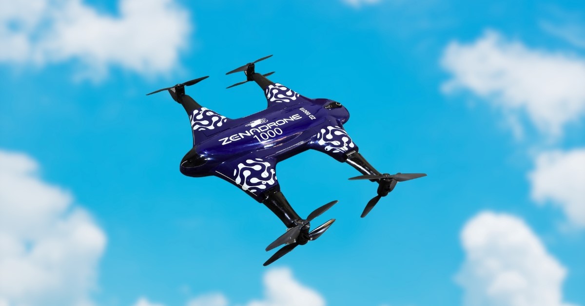
Ready to reap the benefits? With ZenaDrone’s professional services and expert guidance, you can find the right thermal drone for your needs. You might need reliable recovery, inspections, or custom solutions, but in any case, ZenaDrone will provide you with the most appropriate tools to win.
Contact Us
Thank you for your message. It has been sent.